Shadwell is a village and civil parish in north-east Leeds, West Yorkshire, England. The village is 6 miles (9.7 km) to the north east of Leeds city centre.
| Shadwell | |
|---|---|
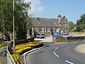
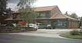
 Main Street: Red Lion and Post Office | |
 Shadwell  Shadwell Location within West Yorkshire | |
| Population | 1,849 (2011 census)[1] |
| Civil parish |
|
| Metropolitan borough | |
| Metropolitan county | |
| Region | |
| Country | England |
| Sovereign state | United Kingdom |
| Post town | LEEDS |
| Postcode district | LS17 |
| Dialling code | 0113 |
| Police | West Yorkshire |
| Fire | West Yorkshire |
| Ambulance | Yorkshire |
| UK Parliament | |
It sits in the Harewood ward of Leeds City Council and Elmet and Rothwell parliamentary constituency. The village is in the LS17 postal code and is served by the Shadwell Parish Council.
Shadwell borders with areas including Alwoodley, Roundhay, Whinmoor and Moortown and is being increasingly referred to simply as an area or suburb of Leeds but retains its many village traditions. It had a population of 1,864 in 2001,[2] reducing to 1,849 at the 2011 Census.[1]
History edit
The first written proof of Shadwell's existence is in 1086 in William the Conqueror's Domesday Book, where it is called Scadewelle, and is part of the Feudal Barony of Pontefract.[3] The origin of the name is not certain, and some 25 variations are found in the historical record, the present one being largely fixed in the 18th century. In the original Anglo-Saxon form, welle could mean a well, spring or boundary, often a boundary stream, such as Shadwell Beck. The scade portion could refer to shade, such as a shady spring, or a name such as Chad or Shad, and different characters with these names have been postulated.[4]
Eight "wells" or ‘springs" situated within Shadwell are shown on an 1851 Ordnance Survey map.[5] One of these, a “Holy Well”,[6] is located in the Shadwell Holywell Triangle, a conservation area. Spring water emerges in a ditch near to the north entrance to Spencer House, a property on Holywell Lane. According to Leeds City Council's Conservation Area Appraisal and Management Plan, it is reputed to have been visited by Bede, and used for the baptism of early Christians.[7] The village pub "The Red Lion" is located between two wells which were originally used to gather water for the brewing process.[8]
In the Middle Ages it was part of the Wapentake of Skyrack. Over the centuries Shadwell was sometimes a separate manor, sometimes part of the Manor of Roundhay until these rights were extinguished in 1935.[3]
In the early part of the 19th century it was still a village with fewer than 200 inhabitants, containing 11 farms, 2 inns and a Methodist chapel but no school or church. However, from the middle of the century buildings began to appear as wealthier people moved out of industrial Leeds, made with stone from the local quarries.[9]
Shadwell was historically a township in the ancient church parish of Thorner in the West Riding of Yorkshire, until the construction of St Paul's Church in 1842 when it became a parish in its own right.[3] Roundhay Grange, originally a grange of Kirkstall Abbey, was a detached part of the township.[10] In 1866 the township became a separate civil parish as part of Wetherby Rural district, but in 1912 the parish was abolished and absorbed into Leeds.[3][11]
In 1974 Shadwell became part of the enlarged City of Leeds in the new county of West Yorkshire. In 2002 the civil parish was reconstituted, with an elected parish council.[12]
Amenities edit

The village has two churches. The Church of England parish church is St Paul's, a Grade II Listed Building from 1842,[13] which replaced a much earlier Chapel of Ease on Gateland Lane which had been disused and had vanished by then, as stones were taken for other buildings.[14] The Shadwell Methodist Chapel dates from 1892, and replaced the smaller building on the opposite side of the road which was the Methodist Chapel from 1814 to 1892 and is also Grade II.[15] This now serves as a library, which has operated independently since 2013.[16] Other buildings include a primary school, The Red Lion pub, the Village Hall, a social club, a tennis club, a golf club and six shops (clothing shop, beauty shop, dry cleaner, fish and chip shop (itself a Grade II listed building dating from 1637),[17] post-office/newsagent and a hairdresser. There is also a cricket club. Shadwell United is a junior football club which trains at the primary school. There are Scouts, Cubs, Beavers, Guides and Ranger groups.
It is also covered by a local newspaper, the Wetherby News.[citation needed]
Slaid Hill edit
Slaid Hill is an area of Leeds which is within the manor or traditional estate of Shadwell, but is about half a mile west of Shadwell village with clear countryside between them, and the Shadwell name sign between. Slaid Hill is within the Alwoodley ward of Leeds City Council, whereas Shadwell village sits within the Harewood ward.[18]
Today, Shadwell Parish excludes most of Slaid Hill, but includes the estate to the south of Shadwell Lane and east of Roundhay Park Lane.[19] The 1881 Census makes it clear that the district of Shadwell extended to the west end of Shadwell Lane and to the Moortown Ring Road in the South.[20] In addition Shadwell Grange is a large house and farm in Slaid Hill, with a view over the Moortown Ring Road. It is a Grade II listed building.[21]
-
 Shadwell Village Hall
 -
 Red Lion
 -
 Shadwell Library
 -
 Methodist Church
 -
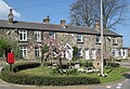 Millennium Wheel and cottages
 -
 Fish and chip shop
 -
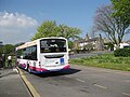 Terminus for the 7S Bus Leeds-Shadwell
 -
 Sign going from Slaid Hill to Shadwell
 -
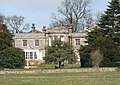 Shadwell Grange viewed from the Leeds Ring Road
 -
 One of the parades of shops in Slaid Hill


Location grid edit
See also edit
References edit
- ^ a b UK Census (2011). "Local Area Report – Shadwell Parish (E04000218)". Nomis. Office for National Statistics. Retrieved 8 May 2021.
- ^ UK Census (2001). "Local Area Report – Shadwell Parish (00DA033)". Nomis. Office for National Statistics. Retrieved 8 May 2021.
- ^ a b c d Howard 1978, pp. 1–2
- ^ Howard 1978, pp. 3–4
- ^ Ordnance Survey, 1st Edition six inches to the mile OS map, sheet 203, surveyed 1847, published 1851, cited in Leeds City Council, Shadwell Holywell Triangle: Conservation Area Appraisal and Management Plan, published 8 November 2019, accessed 28 February 2021
- ^ Marked on Promap site map, see Allsop Property Consultancy, Land & Buildings at Spencer House Holywell Lane Leeds LS17 8EY, accessed 11 April 2021
- ^ Leeds City Council, Shadwell Holywell Triangle: Conservation Area Appraisal and Management Plan, published 8 November 2019, accessed 28 February 2021
- ^ Howard 1978, p. 48
- ^ Howard 1978, pp. 64–7
- ^ "Roundhay Park Conservation Area" (PDF). West Yorkshire Archaeological Advisory Service. 2007. Archived from the original (PDF) on 7 April 2014. Retrieved 6 April 2014.
- ^ Vision of Britain website
- ^ Leeds City Council: Shadwell Parish Council
- ^ Historic England. "Church of St Paul (1375133)". National Heritage List for England. Retrieved 4 May 2019.
- ^ Howard 1978, pp. 15–17
- ^ Historic England. "Shadwell Branch Library (1375128)". National Heritage List for England. Retrieved 4 May 2019.
- ^ Shadwell Library, Arts Centre and Café, accessed 24 January 2017
- ^ Historic England. "125, Main Street (1375129)". National Heritage List for England. Retrieved 4 May 2019.
- ^ Leeds City Council Website accessed 20 April 2009
- ^ Shadwell Parish Council Website Parish Map
- ^ Genuki Shadwell Census 1881
- ^ Historic England. "Shadwell Grange (1256110)". National Heritage List for England. Retrieved 13 October 2013.
Bibliography
- Howard, Iva (1978). Shadwell and its People. Shadwell Women's Institute.
External links edit
- The ancient parish of Thorner: historical and genealogical information at GENUKI (Shadwell was in this parish).
- Shadwell Parish Council Website: local parish council website, including details of village amenities and activities
- Shadwell In Bloom: local volunteer group maintaining Shadwell's floral environment
- Shadwell Bridge Club: local Bridge club meeting on Friday evenings
- Shadwell Tennis Club
- Shadwell Cricket Club
- Shadwell Independent Library: taken over from Leeds Council and run by volunteers