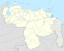
Óscar Machado Zuloaga International Airport
Oscar Machado Zuloaga International Airport (ICAO: SVCS) is a general aviation airport in the Miranda state of Venezuela, serving Caracas, the capital of Venezuela. The airport is named in honor of Oscar Machado Zuloaga, an engineer and civic developer.[3]
Oscar Machado Zuloaga International Airport | |||||||||||
|---|---|---|---|---|---|---|---|---|---|---|---|
| Summary | |||||||||||
| Airport type | Public | ||||||||||
| Serves | Caracas | ||||||||||
| Elevation AMSL | 2,142 ft / 653 m | ||||||||||
| Coordinates | 10°17′12″N 66°49′00″W / 10.28667°N 66.81667°W | ||||||||||
| Website | http://www.aeropuerto-caracas-omz.com/ | ||||||||||
| Map | |||||||||||
 | |||||||||||
| Runways | |||||||||||
| |||||||||||
The airport sits atop a ridge 20 kilometres (12 mi) south of Caracas, near the town of Charallave. Low mountain terrain lies to the north, between the airport and Caracas.
The airport has an ILS approach to Runway 10.[4] The Charallave VOR-DME (Ident: TUY) is 0.6 nautical miles (1.1 km) northeast of the Runway 28 threshold.[5]
Facilities
editCustoms and Immigration are available. The airport has full services, fuel, maintenance, weather, aircraft/avionics repair shops, snack bar, pilots briefing room and two flight schools.[6][7]
See also
editReferences
edit- ^ Airport information for SVCS at Great Circle Mapper.
- ^ Google Maps - Oscar Machado Zuloaga
- ^ Machado Zuloaga biography (Spanish)
- ^ Rwy 10 ILS.
- ^ Charallave VOR
- ^ Airport services Airport services (Spanish)
- ^ Airport information (Spanish)
External links
edit- OpenStreetMap - Oscar Machado Zuloaga
- OurAirports - Oscar Machado Zuloaga
- SkyVector - Oscar Machado Zuloaga
