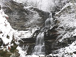
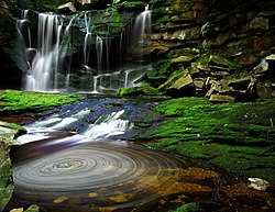
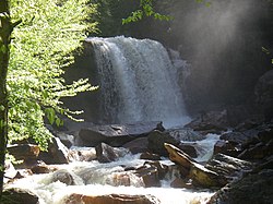
There are about 275 waterfalls in the U.S. state of West Virginia.


Surface waterfalls
editThis section may contain excessive or inappropriate references to self-published sources. (September 2024) |
| Name | Height | Coordinates | USGS Map | GNIS ID |
|---|---|---|---|---|
| Black Fork Falls | 20 ft (6.1 m) | ????? | ????? | ????? |
| Blackwater Falls | 57 to 63 ft (17 to 19 m) | 39°06′50″N 79°29′00″W / 39.113889°N 79.483333°W | Blackwater Falls | 1550380 |
| Brush Creek Falls | 25 ft (7.6 m) | ????? | ????? | ????? |
| Cathedral Falls | 60 ft (18 m) | 38.15444 N 81.1788 W | ????? | ????? |
| Douglas Falls | 35 ft (11 m) | ????? | ????? | ????? |
| Elakala Falls (3rd fall) | 40 ft (12 m) | ????? | ????? | ????? |
| Falling Spring Run Falls | 40 ft (12 m) | ????? | ????? | ????? |
| High Falls of Cheat | 15 to 18 ft (4.6 to 5.5 m) | 38°46′21″N 79°46′38″W / 38.772500°N 79.777222°W | Beverly East | 1551426 |
| Jordan Run Falls | 25 to 30 ft (7.6 to 9.1 m) | 38°59′39″N 79°15′58″W / 38.994131°N 79.266189°W | Hopeville | 1551612 |
| Kanawha Falls | 15 to 21 ft (4.6 to 6.4 m) | 38°09′04″N 81°12′44″W / 38.151111°N 81.212222°W | Gauley Bridge | 1556129 |
| Hills Creek Falls (Lower) | 63 to 65 ft (19 to 20 m) | 38°10′25″N 80°20′06″W / 38.173611°N 80.335000°W | Lobelia | 1551095 |
| Mill Creek Falls | 20 ft (6.1 m) | ????? | ????? | ????? |
| Pendleton Falls | 20 ft (6.1 m) [fall] 150 ft (46 m) [cascade] |
????? | ????? | ????? |
| Pipestem Falls | 15 ft (4.6 m) | ????? | ????? | ????? |
| Sandstone Falls | 15 to 25 ft (4.6 to 7.6 m) | ????? | ????? | ????? |
| Valley Falls | 20 ft (6.1 m) | 39°23′12″N 80°05′16″W / 39.386735°N 80.087832°W | ????? | ????? |
| Wonder Falls | 15 ft (4.6 m) | 39°29′47″N 79°38′40″W / 39.496331°N 79.644476°W | ????? | ????? |
Underground waterfalls
editMany of the state's subterranean waterfalls far exceed the surface falls in height.
| Name | Height | Coordinates | USGS Map | GNIS ID |
|---|---|---|---|---|
| Suicide Falls (Cass Cave)[1][2] | 139 ft (42 m) | ????? | ????? | ????? |
| Monster Falls (Friars Hole Cave)[3] | 103 to 105 ft (31 to 32 m) | ????? | ????? | ????? |
See also
editReferences
editCitations
edit- ^ Dasher, George R., Editor (2000), The Caves of East-Central West Virginia: The Guidebook of the National Speleological Society's 2000 Convention; West Virginia Speleological Survey, Bulletin #14, pg 171.
- ^ Mohr, Charles E. (1964), “Exploring America Underground”, National Geographic Magazine; Vol. 125, No. 6 (June issue), pp 803–837. (Includes photo [2-page spread] of the falls).
- ^ Dasher, Op. cit., pg 169.
Further reading
edit- Adams, Kevin (2002), Waterfalls of Virginia and West Virginia: A Hiking and Photography Guide; Menasha Ridge Press.
- Rehbein, Ed and Randall Sanger (2011), West Virginia Waterfalls: The New River Gorge; Terra Alta, West Virginia: Headline Books, Inc. [Photographs]
- Hartigan, Rick (2017), West Virginia Waterfalls, Nature Trek Publishing, LLC, [Directory with directions, GPS, maps, & photographs]
External links
edit- West Virginia WaterFalls (Map) @ Great Lakes Waterfalls & Beyond
- West Virginia Waterfalls (Map) @ West Virginia Waterfalls website. http://wvwaterfalls.com/
Kanawha Falls on the Kanawha River at Glen Ferris, West Virginia