Tienen (Dutch pronunciation: [ˈtinə(n)] ; French: Tirlemont [tiʁləmɔ̃]) is a city and municipality in the province of Flemish Brabant, in Flanders, Belgium. The municipality comprises Tienen itself and the towns of Bost, Goetsenhoven, Hakendover, Kumtich, Oorbeek, Oplinter, Sint-Margriete-Houtem and Vissenaken.
Tienen | |
|---|---|
City and municipality | |
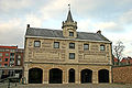
 Collage of Tienen | |
 Flag  Coat of arms | |
Location of Tienen  | |
 Tienen Location in Belgium
Tienen in the Province of Flemish Brabant  | |
| Coordinates: 50°48′N 04°56′E / 50.800°N 4.933°E | |
| Country | |
| Community | Flemish Community |
| Region | Flemish Region |
| Province | Flemish Brabant |
| Arrondissement | Leuven |
| Government | |
| • Mayor | Katrien Partyka (CD&V) |
| • Governing party/ies | CD&V, Open VLD, N-VA, Groen |
| Area | |
| • Total | 72.77 km2 (28.10 sq mi) |
| Population (2018-01-01)[1] | |
| • Total | 34,675 |
| • Density | 480/km2 (1,200/sq mi) |
| Postal codes | 3300 |
| NIS code | 24107 |
| Area codes | 016 |
| Website | www.tienen.be |
On 1 January 2017, Tienen had a total population of 34,365. The total area is 71.77 km2 (27.71 sq mi) which gives a population density of 444 inhabitants per square kilometre (1,150/sq mi).
History
edit
In the early Middle Ages, the town was probably ruled by an old German family Thienen. But it was once a roman settlement and trade center with roads to other important places.
During the 1635 to 1659 Franco-Spanish War, Tienen was part of the Spanish Netherlands and was captured by a combined Franco-Dutch army in May 1635.[2] Its capture resulted in one of the most serious atrocities of the Dutch Revolt; the town was sacked, over 200 civilians killed and many buildings damaged, including Catholic churches and monasteries. This ended Dutch prospects of winning over the predominantly Catholic population of the Southern Netherlands.[3]
After the 1714 Treaty of Utrecht, the town was incorporated into the Austrian Netherlands; in the French Revolutionary Wars, it was used as a base by French Republican General Charles François Dumouriez during the Battle of Neerwinden. On 16 March 1793, the French repulsed an Austrian army commanded by Prince Josias of Coburg.[4]
This was the last victory for the veteran Dumouriez, hero of Valmy and Jemappes; within a week, his army suffered such catastrophic defeats that he defected to the French Royalists.[5]
Economy
editTienen is the centre of sugar production in Belgium; a huge sugar beet processing factory, the Sugar refinery of Tienen (Tiense Suikerraffinaderij - Raffinerie Tirlemontoise), is located at the eastern edge of the town. It is the site of facilities owned by Citrique Belge, that produces citric acid, and Havells Sylvania, a manufacturer of energy saving lamps.[6]
Culture and significant landmarks
editTienen is the location of a summer rock festival known as 'Suikerrock'.[7]
The Sint-Germanus (St. Germain) Church dates from the 12th century and has an altarpiece by the 19th-century painter Gustaaf Wappers.[8] Its belfry has earned that complex a designation on the UNESCO World Heritage Site list of Belfries of Belgium and France.[9]
The principal church, Onze-Lieve-Vrouw-ten-Poel (Our Lady of the Pool), was begun in the 12th and enlarged in the 15th century;[8] it remains unfinished.
-
 Sint-Germanus Church
 -
 Het Toreke museum
 -
 Onze-Lieve-Vrouw-ten-Poel


Transport
editThe town is served by Tienen railway station, the oldest in Belgium still in use.[10] There are also some taxi companies, one of them being Taxi 7 - Tienen.
Notable inhabitants
edit- Beatrijs of Nazareth (1200–1268), Flemish mystic
- André Vandewyer (1909–1992), Belgian footballer and coach
- Matthias Vanden Gheyn (1721–1785), composer, organist, and carillonist
- Linguist Herman Liebaers (1919–2010), was born in Tienen.
- Louis Michel (b. 1947), politician
- Luc van Acker (b. 1961), Belgian musician and producer
- Xandee, Belgian singer who represented Belgium in the Eurovision Song Contest 2004
International relations
editTwin towns—Sister cities
editTienen is twinned with:
References
edit- ^ "Wettelijke Bevolking per gemeente op 1 januari 2018". Statbel. Retrieved 9 March 2019.
- ^ De Périni 1896, p. 179.
- ^ Lasaffer 2006, pp. 3–4.
- ^ Soboul 1975, p. 298.
- ^ Thiers 1838, p. 298.
- ^ www.havells-sylvania.com Archived 2010-06-20 at the Wayback Machine
- ^ www.suikerrock.be
- ^ a b Chisholm 1911.
- ^ "World Heritage List | Belfries of Belgium and France". UNESCO. Retrieved 2021-03-16.
- ^ Timothy (2020-06-10). "Belgium's third oldest railway station: Ronse". Trip By Trip. Retrieved 2023-11-16.
- ^ "Bielsko-Biała - Partner Cities". © 2008 Urzędu Miejskiego w Bielsku-Białej. Retrieved 2008-12-10.
Sources
edit- Chisholm, Hugh, ed. (1911). . Encyclopædia Britannica. Vol. 26 (11th ed.). Cambridge University Press. p. 1010.
- De Périni, Hardÿ (1896). Batailles françaises, Volume III. Ernest Flammarion, Paris.
- Lasaffer, Randall (2006). "Siege Warfare and the Early Modern Laws of War". Tilburg Working Paper Series on Jurisprudence and Legal History. 06 (1).
- Soboul, Albert (1975). The French Revolution, 1787–1799. New York: Vintage. ISBN 0-394-71220-X.
- Thiers, Adolphe (1838). The History of the French Revolution.
External links
edit- Official website - Only available in Dutch
- tienen.info - All news from Tienen, only available in Dutch
- Suikerrock