The original alignment of Kentucky Route 67 (KY 67) was a north–south primary state highway that traversed Edmonson and Warren counties in south central Kentucky. It was one of the original state routes of the state highway system maintained by the Kentucky Transportation Cabinet. It was established in 1929 and was officially decommissioned in 1969. At the time of its removal from the state route system, it was estimated to be 21.491 miles (34.586 km) long as determined by the KYTC's state route logs and county road logs.
Kentucky Route 67 | ||||
|---|---|---|---|---|
| Route information | ||||
| Maintained by KYTC | ||||
| Length | 21.491 mi[1] (34.586 km) | |||
| Existed | 1929–c. 1969 | |||
| Major junctions | ||||
| South end | ||||
| North end | ||||
| Location | ||||
| Country | United States | |||
| State | Kentucky | |||
| Counties | Edmonson, Warren | |||
| Highway system | ||||
| ||||
| ||||

Route description edit
KY 67's original route began at an intersection with U.S. Route 68 (US 68) in downtown Bowling Green. At the time of KY 67's existence, the route's southern terminus was located within a stretch of US 68 and KY 80 where the two concurrently running routes were within a one-way pair, splitting the route between State and College Streets, a few blocks northeast of the campus of Western Kentucky State College (now Western Kentucky University). From the State Street intersection, KY 67 followed Main Street (now Main Avenue) for 0.3 miles (0.48 km) before making a right turn onto Gordon Avenue to exit the city, skirt the east side of the Delafield neighborhood, and cross the Barren River. The highway originally ran through parts of northern Warren County, including the unincorporated community of Anna, but passing just east of Richardsville.[2]
At Glenmore, KY 67 intersected KY 185, which branched into the far eastern part of Butler County. KY 67 then crossed the Green River into Edmonson County via the Bear Creek Ferry, which was a toll ferry situated extremely close to the Butler-Edmonson-Warren County tripoint, and about 1.5 miles (2.4 km) upstream from the then-U.S. Army Corps of Engineers-operated Green River Lock and Dam Number 5. Most traffic from northern and western Edmonson County heading to Bowling Green used this ferry for convenience.[3] The tolls ranged from 10 to 30 cents each time the driver went one way on the ferry during the 1960s.[citation needed] After crossing the ferry, KY 67 went further north-northeastward to the community of Segal, where it had a junction with the original KY 555 (Segal Road, now a part of KY 655).[4] After that, KY 67 followed the present-day KY 655 for the remainder of its current eastward course where it passed through Segal and Asphalt and it finally met its northern terminus at Windyville, where it intersected KY 70.[5][6]
History edit
Road history edit
As one of the state's charter state routes formed in 1929, KY 67 underwent some changes throughout its estimated 38-year-long existence, including some reroutings to straighten out the highway in one spot on the north side of Bowling Green, complete with a new bridge over the Barren River, which opened to traffic in 1957. The Bear Creek Ferry was one of several ferryboats that traversed the Green River during the early days of the state highway system; it was one of the few remaining ferries in the area when a feature article on the area's ferries was published in a September 1956 edition of the Bowling Green Daily News.[7]
Discontinuation of the ferry edit
At one time during the 1955-56 fiscal year, the Bear Creek Ferry was decommissioned. Hence, KY 67 became a two-segment highway[8] as it no longer connected from the Asphalt–Segal area to Warren County.[9] However, the connected KY 67 was still marked with the toll ferry on road maps as late as 1962.[10] The Edmonson County section of KY 67 would eventually be decommissioned sometime prior to 1968.[11] The Warren County section was still signed as KY 67 until sometime in the 1969-70 fiscal year, when the KY 185 alignment in Warren County was rerouted to follow KY 67's course from Bowling Green to KY 185's original southern terminus near Glenmore.[12][13] A portion of the original KY 67 between KY 185 and the Wingfield Road intersection is now part of KY 1749. Ownership of the remainder of the road from KY 1749 in Glenmore to the ferry site on the Warren County side reverted to the Warren County Road Department as Lock 5 Road (a portion became part of the new KY 1201, deleted in 1982), while the road on the Edmonson County side between the ferry site and the Segal community reverted to the Edmonson County Road Department, and became Mouth of Bear Creek Road. By 1968, the remainder of KY 67's designation from Segal to Windyville was reassigned as KY 655.[11]
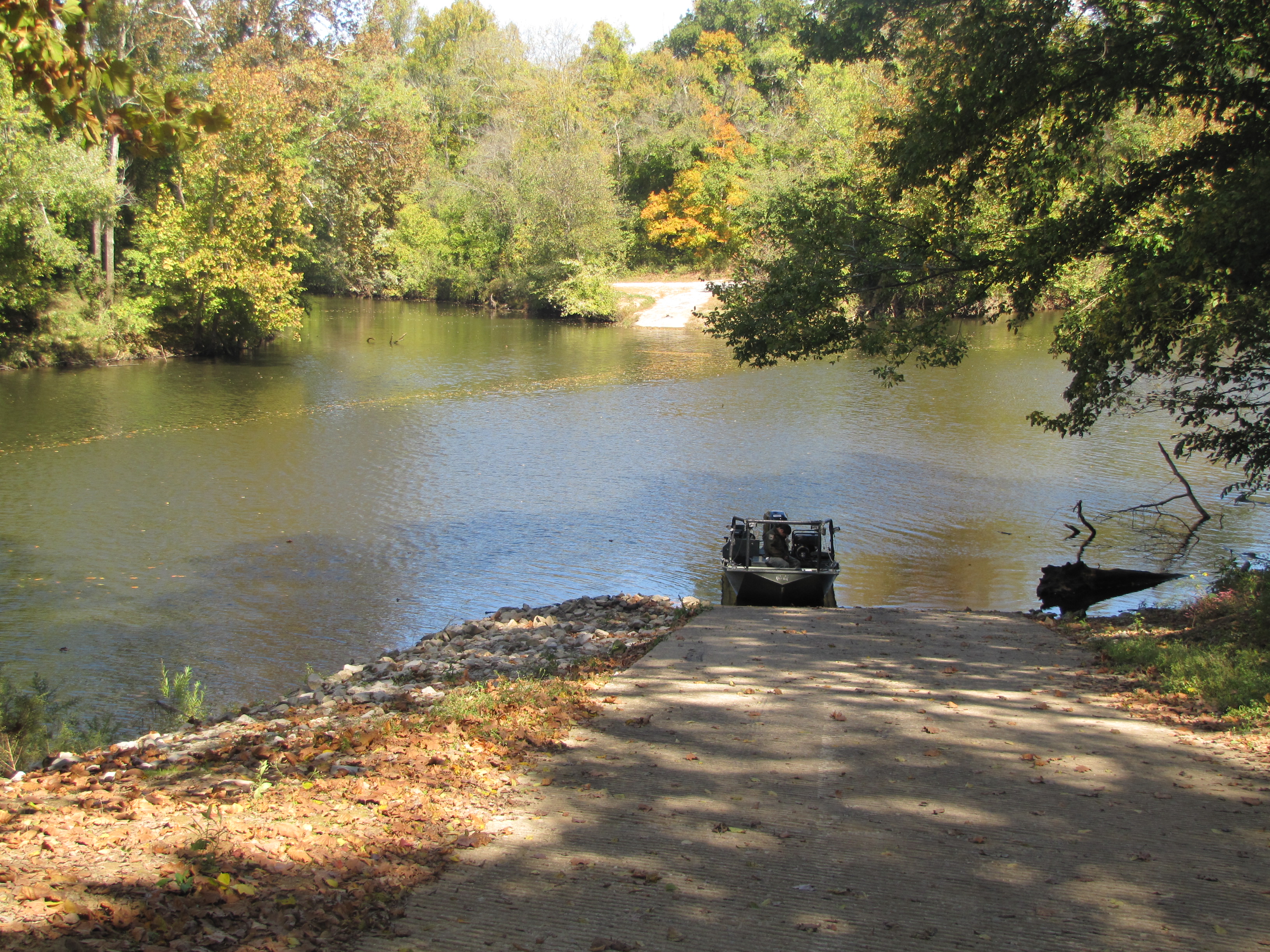
The ferry site is now just a boat ramp,[14] but local residents still use that area for recreational purposes such as boating or fishing.[15][16][17] The boat ramp on the Warren County side was built in 1986.[18]
Change of routes from Edmonson to Warren County edit
The closing of the Bear Creek Ferry put a strain on economic connections between the Bowling Green area and a natural trading area involving the Butler, Edmonson, and nearby Grayson County areas. With the Honaker's Ferry connecting KY 185 becoming the only remaining ferry in this segment of the Green River, a bridge crossing became a top-priority need for the area.[9] The Elmer White Bridge carrying KY 185 between Glenmore and Reedyville would eventually be built and opened to traffic by 1962.[3]
Since the discontinuation of the Bear Creek Ferry, residents of northern Edmonson County were forced to make alternate routes that adds more time to their commute, depending on where they lived in. Option A was for Edmonson County residents to use KY 70 westbound to Roundhill to turn left on KY 185 for their commute to Bowling Green. This option was used for many residents along Edmonson County's western boundary with Butler County. Option B, on the other hand, is to go through Brownsville (the Edmonson County seat) using Kentucky Routes 259 and 101 to enter Warren County, and to make a right turn on U.S. Route 31W. That option is mainly used by people traveling to Bowling Green from the central part Edmonson County (i.e. Brownsville, Lindseyville, Sweeden, and Bee Spring).[19][20]
The return of KY 67 edit
The KY 67 designation returned to the Kentucky state highway system in 2002, when it was assigned to the then-new Industrial Parkway in northeastern Kentucky. KY 67 now follows a route from the exit 179 interchange of Interstate 64 (I-64) in northern Carter County to US 23 near Greenup.
Major intersections edit
This junction list is based on the highway's 1967 alignment.
| County[4][21] | Location | mi | km | Destinations | Notes |
|---|---|---|---|---|---|
| Warren | Bowling Green | 0.00 | 0.00 | Southern terminus | |
| 0.05 | 0.080 | ||||
| 0.30 | 0.48 | The southern terminus of that road is now at a junction with Veterans Memorial Lane (later | |||
| | 5.9 | 9.5 | |||
| Richardsville | 7.1 | 11.4 | |||
| Anna | 9.3 | 15.0 | |||
| Glenmore | 12.6 | 20.3 | |||
| Green River | 13.2 | 21.2 | Northern terminus of Warren County segment and southern terminus of Edmonson County segment (1956–68)[9] | ||
| Edmonson | Segal | 16.9 | 27.2 | Original alignment of KY 70 (1929–35) Now part of present-day | |
| Windyville | 21.5 | 34.6 | Original northern terminus of the continuous route of KY 67 (1936–56); northern terminus of Section B (1956–68); now eastern terminus of KY 655 | ||
| 1.000 mi = 1.609 km; 1.000 km = 0.621 mi | |||||
Related roads edit
Mouth of Bear Creek Road edit
Mouth of Bear Creek Road | |
|---|---|
| Location | Bear Creek Ferry Site at the Green River to Segal |
| Length | 3.0 mi (4.8 km) |
| Existed | 1967–present |
Mouth of Bear Creek Road is a locally maintained road located in Edmonson County, Kentucky. The road was part of an original alignment of the original KY 67 from that state highway's 1929 establishment until its decommissioning in 1967. The road is 3.0 miles (4.8 km) long.
Kentucky Route 655 edit
Kentucky Route 655 (KY 655) is a rural secondary state highway in Edmonson County. The latter 3.569 miles (5.744 km) of KY 655, along with the county-maintained Mouth of Bear Creek Road, was the original course of KY 67 through the area until the 1967 decommissioning of that route, connecting the Windyville-Asphalt-Segal area directly to Warren County. KY 655 is currently a C-shaped route serving as a farm-to-market style road that meanders around the area, both termini are with intersections with KY 70. The total length of the current KY 655 routing is 9.214 miles (14.828 km).
See also edit
References edit
- ^ This is determined by adding mileage of sections of the original highway. See other footnotes.
- ^ Kentucky Transportation Cabinet (1937). Warren County Highway Map (PDF) (Map). 1:62,500. Frankfort: Kentucky Transportation Cabinet. Retrieved December 24, 2015.
- ^ a b "Remembering Ferryboats". SOKY Happenings. August 3, 2021. Archived from the original September 17, 2022. Retrieved September 17, 2022.
- ^ a b Kentucky Transportation Cabinet (1958). Edmonson County Highway Map (PDF) (Map). 1:62,500. Frankfort: Kentucky Transportation Cabinet. Retrieved October 7, 2014.[full citation needed]
- ^ Kentucky Department of State Highways (September 15, 1939). Road Map of Kentucky (PDF) (Map). c. 1:760,320. Frankfort: Kentucky Department of State Highways. Retrieved October 7, 2014.
- ^ Kentucky Transportation Cabinet (1937). Edmonson County Route Planning Map (PDF) (Map). 1:62,500. Frankfort: Kentucky Transportation Cabinet. Retrieved October 7, 2014.
- ^ Thomas, Bill (September 23, 1956). "Ferries Now Rare Sight on Barren, Green Rivers". Park City Daily News. pp. 14, 16. Retrieved November 23, 2023 – via Google Books.
- ^ Kentucky Department of Highways (1965). Kentucky Official Highway Map (PDF) (Map). c. 1:760,320. Frankfort: Kentucky Department of Highways.
- ^ a b c Dickey, Bob (March 19, 1961). "Bridge Needed to Breach Green River 'Curtain' In N. Warren". Bowling Green Daily News. p. 14 – via Google Books.
- ^ Kentucky Department of Highways (1962). Kentucky Official Highway Map (PDF) (Map). c. 1:760,320. Frankfort: Kentucky Department of Highways.
- ^ a b Kentucky Department of Highways (1968). Kentucky Official Highway Map (PDF) (Map). c. 1:760,320. Frankfort: Kentucky Department of Highways.
- ^ "H.B.'s Fun Facts About Kentucky Highways". Archived from the original Archived 2002-08-27 at the Wayback Machine August 27, 2002. Retrieved July 12, 2016.
- ^ Kentucky Department of Highways (1973). Kentucky Official Highway and Parkway Map (PDF) (Map). c. 1:760,320. Frankfort: Kentucky Department of Highways.
- ^ Kentucky Transportation Cabinet (1977). Edmonson County Highway Map (PDF) (Map). 1:125000. Frankfort, KY: Kentucky Transportation Cabinet. Retrieved October 7, 2014.[full citation needed]
- ^ Green River Pool 5 Photo Gallery. Kentucky Department of Fish and Wildlife. Retrieved 12 October 2021.
- ^ "12". Kentucky Department of Fish and Wildlife. Retrieved 12 October 2021.
- ^ "Bear Creek Ramp". Kentucky Department of Fish and Wildlife. Retrieved September 17, 2022.
- ^ "Boat ramp to be built". Park City Daily News. April 4, 1986. p. 2A. Retrieved November 18, 2023 – via Google Books.
- ^ DeLorme (2010). Kentucky Atlas and Gazetteer (Map) (2010 ed.). 1 in=2.4 mi. Yarmouth, Maine: DeLorme. p. 64.
- ^ Rand McNally (2021). "Kentucky" (Map). The 2021 Rand McNally Road Atlas. 1 in=17 mi. Chicago: Rand McNally. p. 42.
- ^ Kentucky Transportation Cabinet (1958). Warren County Official Highway Map (PDF) (Map). Kentucky Transportation Cabinet. Retrieved December 21, 2014.[full citation needed]
- ^ Gulf Refining Company (1935). Road map of Kentucky and Tennessee (Map). 1:1,330,560. Chicago: Rand McNally & Company.
External links edit
- Kentucky Transportation Cabinet
- Bing Maps - reference source for purpose of current highway alignments.