Size of this preview: 800 × 570 pixels. Other resolutions: 320 × 228 pixels | 640 × 456 pixels | 1,024 × 729 pixels | 1,280 × 912 pixels | 2,560 × 1,823 pixels | 2,971 × 2,116 pixels.
Original file (2,971 × 2,116 pixels, file size: 1.22 MB, MIME type: image/jpeg)
| This is a file from the Wikimedia Commons. Information from its description page there is shown below. Commons is a freely licensed media file repository. You can help. |
Summary
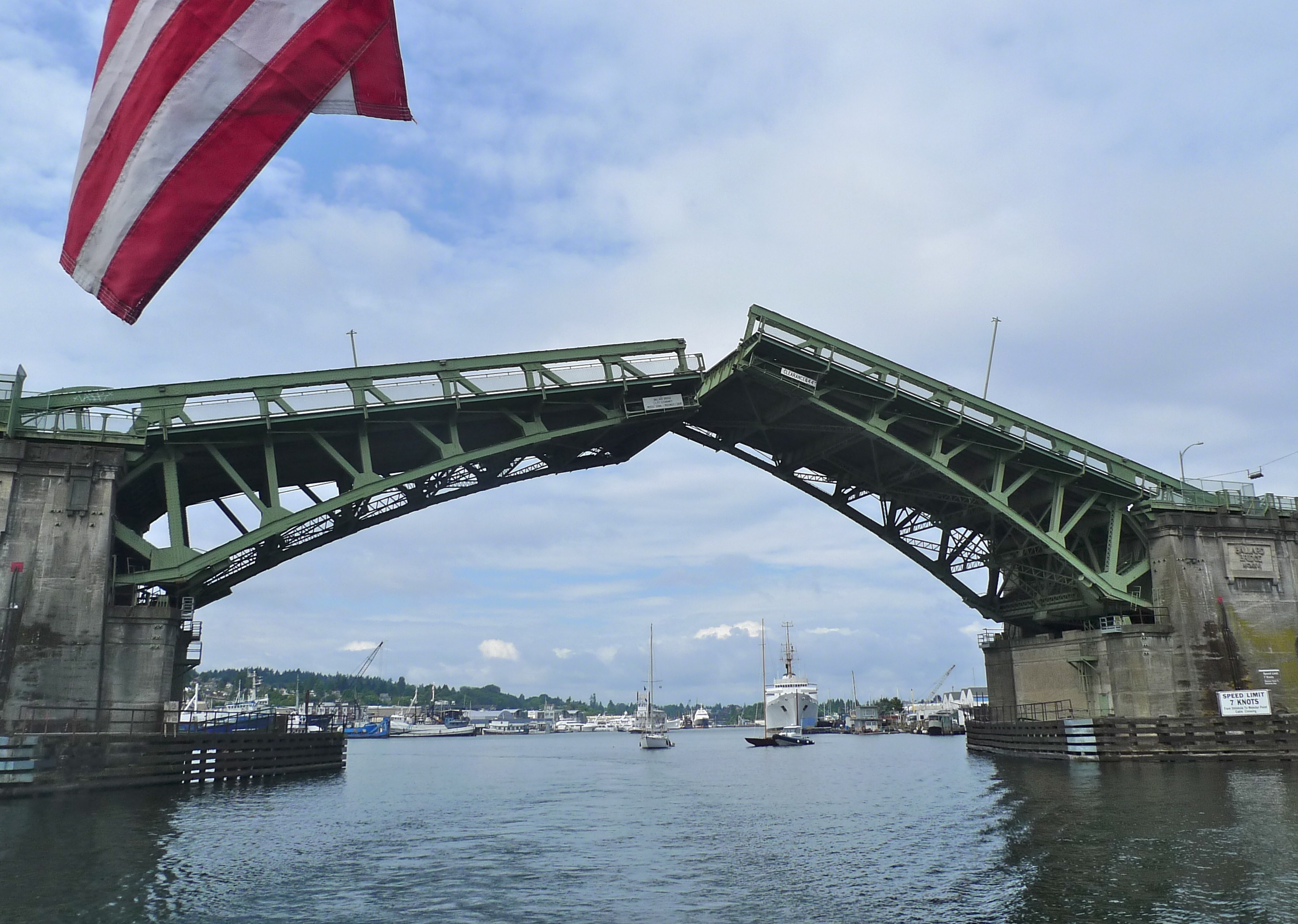
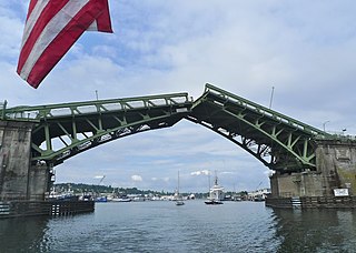
| Description | The Ballard Bridge opening (or closing after having opened) to allow a boat to pass underneath. This photo is looking west and shows the bridge's east side. |
| Date | |
| Source | Ballard Bridge |
| Author | Brian Teutsch |
| Camera location | | View this and other nearby images on: OpenStreetMap |
|---|
Licensing
This file is licensed under the Creative Commons Attribution 2.0 Generic license.
- You are free:
- to share – to copy, distribute and transmit the work
- to remix – to adapt the work
- Under the following conditions:
- attribution – You must give appropriate credit, provide a link to the license, and indicate if changes were made. You may do so in any reasonable manner, but not in any way that suggests the licensor endorses you or your use.
| This image, originally posted to Flickr, was reviewed on 30 May 2013 by the administrator or reviewer Leoboudv, who confirmed that it was available on Flickr under the stated license on that date. |
File history
Click on a date/time to view the file as it appeared at that time.
| Date/Time | Thumbnail | Dimensions | User | Comment | |
|---|---|---|---|---|---|
| current | 09:19, 29 May 2013 | | 2,971 × 2,116 (1.22 MB) | Steve Morgan | {{Information |Description=The Ballard Bridge opening (or closing after having opened) to allow a boat to pass underneath. This photo is looking west and shows the bridge's east side. |Source=[http://www.flickr.com/photos/brianteutsch/6101867579/ Ball... |
File usage
The following pages on the English Wikipedia use this file (pages on other projects are not listed):
Global file usage
The following other wikis use this file: