
Size of this preview: 800 × 532 pixels. Other resolutions: 320 × 213 pixels | 640 × 426 pixels | 1,024 × 681 pixels | 1,280 × 852 pixels | 2,560 × 1,703 pixels | 4,256 × 2,832 pixels.
Original file (4,256 × 2,832 pixels, file size: 4.22 MB, MIME type: image/jpeg)
| This is a file from the Wikimedia Commons. Information from its description page there is shown below. Commons is a freely licensed media file repository. You can help. |
Summary
| Description |
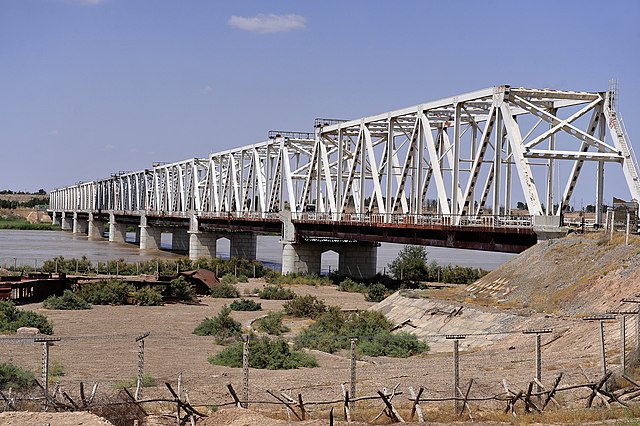
The "Friendship Bridge" runs across the Amu Darya River between Uzbekistan and Afghanistan. The friendship bridge connects Mangusar, Uzbekistan and Hariatan, Afghanistan. (U.S. Air Force Photo By Staff Sgt. Bradley Lail) (released) |
|||
| Date | ||||
| Source |
|
|||
| Author | Bradley Lail via ISAF Headquarters Public Affairs Office from Kabul, Afghanistan |

| Camera location | | View this and other nearby images on: OpenStreetMap |
|---|
Licensing
This file is licensed under the Creative Commons Attribution 2.0 Generic license.
- You are free:
- to share – to copy, distribute and transmit the work
- to remix – to adapt the work
- Under the following conditions:
- attribution – You must give appropriate credit, provide a link to the license, and indicate if changes were made. You may do so in any reasonable manner, but not in any way that suggests the licensor endorses you or your use.
| This image was originally posted to Flickr by isafmedia at https://www.flickr.com/photos/29456680@N06/4820329829. It was reviewed on 21 August 2010 by FlickreviewR and was confirmed to be licensed under the terms of the cc-by-2.0. |
File history
Click on a date/time to view the file as it appeared at that time.
| Date/Time | Thumbnail | Dimensions | User | Comment | |
|---|---|---|---|---|---|
| current | 12:15, 21 August 2010 | | 4,256 × 2,832 (4.22 MB) | FlickreviewR | Replacing image by its original image from Flickr |
| 11:18, 21 August 2010 |  | 240 × 160 (36 KB) | Geo Swan | {{Information |Description=The "Friendship Bridge" runs across the Amu Darya River between Uzbekistan and Afghanistan. The friendship bridge connects Mangusar, Uzbekistan and Hariatan, Afghanistan. (U.S. Air Force Photo By Staff Sgt. Bradley Lail) (rele |
File usage
The following pages on the English Wikipedia use this file (pages on other projects are not listed):
Global file usage
The following other wikis use this file:
- Usage on ba.wikipedia.org
- Usage on bn.wikipedia.org
- Usage on de.wikipedia.org
- Usage on en.wikivoyage.org
- Usage on es.wikivoyage.org
- Usage on fa.wikipedia.org
- Usage on fr.wikipedia.org
- Usage on he.wikipedia.org
- Usage on hi.wikipedia.org
- Usage on it.wikipedia.org
- Usage on ja.wikipedia.org
- Usage on kk.wikipedia.org
- Usage on lt.wikipedia.org
- Usage on lv.wikipedia.org
- Usage on pl.wikipedia.org
- Usage on ru.wikipedia.org
- Usage on sv.wikipedia.org
- Usage on tg.wikipedia.org
- Usage on tr.wikipedia.org
- Usage on uk.wikipedia.org
- Usage on uz.wikipedia.org
- Usage on zh.wikipedia.org