No higher resolution available.
St._Mary's_church_at_Bettws-y-crwyn_-_geograph.org.uk_-_1597620.jpg (640 × 426 pixels, file size: 215 KB, MIME type: image/jpeg)
| This is a file from the Wikimedia Commons. Information from its description page there is shown below. Commons is a freely licensed media file repository. You can help. |
Summary
| Description |
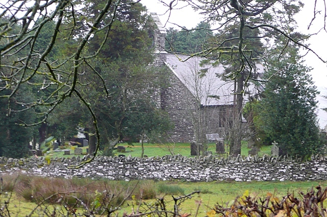
English: St. Mary's church at Bettws-y-crwyn, near to Quabbs, Shropshire, Great Britain.
This is about as remote as you can get for a sizeable church. Bettws-y-crwyn is remote even by Shropshire standards and the church is hidden behind the trees away from the main lane through the hamlet. |
| Date | |
| Source | From geograph.org.uk; transferred by User:svejk74 using geograph_org2commons. |
| Author | Graham Horn |
| Permission (Reusing this file) |
Creative Commons Attribution Share-alike license 2.0 |
| Attribution (required by the license) | Graham Horn / St. Mary's church at Bettws-y-crwyn / |
| Camera location | | View this and other nearby images on: OpenStreetMap |
|---|
| Object location | | View this and other nearby images on: OpenStreetMap |
|---|
_region:GB-EAW_heading:45.00&language=en)
Licensing

|
This image was taken from the Geograph project collection. See this photograph's page on the Geograph website for the photographer's contact details. The copyright on this image is owned by Graham Horn and is licensed for reuse under the Creative Commons Attribution-ShareAlike 2.0 license.
|
This file is licensed under the Creative Commons Attribution-Share Alike 2.0 Generic license.
Attribution: Graham Horn
- You are free:
- to share – to copy, distribute and transmit the work
- to remix – to adapt the work
- Under the following conditions:
- attribution – You must give appropriate credit, provide a link to the license, and indicate if changes were made. You may do so in any reasonable manner, but not in any way that suggests the licensor endorses you or your use.
- share alike – If you remix, transform, or build upon the material, you must distribute your contributions under the same or compatible license as the original.
File history
Click on a date/time to view the file as it appeared at that time.
| Date/Time | Thumbnail | Dimensions | User | Comment | |
|---|---|---|---|---|---|
| current | 16:51, 19 October 2010 | | 640 × 426 (215 KB) | File Upload Bot (Magnus Manske) |
File usage
The following pages on the English Wikipedia use this file (pages on other projects are not listed):
Global file usage
The following other wikis use this file:
- Usage on ceb.wikipedia.org
- Usage on cy.wikipedia.org
- Usage on dag.wikipedia.org
- Usage on fr.wikipedia.org
- Usage on lld.wikipedia.org
- Usage on pl.wikipedia.org
- Usage on www.wikidata.org
- Usage on zh-min-nan.wikipedia.org