
Size of this JPG preview of this PDF file: 776 × 600 pixels. Other resolutions: 311 × 240 pixels | 621 × 480 pixels | 994 × 768 pixels | 1,280 × 989 pixels | 1,650 × 1,275 pixels.
Original file (1,650 × 1,275 pixels, file size: 883 KB, MIME type: application/pdf)
| This is a file from the Wikimedia Commons. Information from its description page there is shown below. Commons is a freely licensed media file repository. You can help. |
Summary
| Description |
English: Soybeans planted area 2020 US map by state |
| Date | |
| Source | https://www.nass.usda.gov/Charts_and_Maps/graphics/soyacm.pdf |
| Author | US Dept Agriculture |
Licensing
This image or file is a work of a United States Department of Agriculture employee, taken or made as part of that person's official duties. As a work of the U.S. federal government, the image is in the public domain.
|
 |
File history
Click on a date/time to view the file as it appeared at that time.
| Date/Time | Thumbnail | Dimensions | User | Comment | |
|---|---|---|---|---|---|
| current | 08:30, 12 May 2020 | 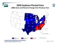 | 1,650 × 1,275 (883 KB) | Rjensen | Uploading a public-domain item using File Upload Wizard |
File usage
No pages on the English Wikipedia use this file (pages on other projects are not listed).