Size of this preview: 749 × 600 pixels. Other resolutions: 300 × 240 pixels | 599 × 480 pixels | 959 × 768 pixels | 1,278 × 1,024 pixels | 1,754 × 1,405 pixels.
Original file (1,754 × 1,405 pixels, file size: 1.2 MB, MIME type: image/jpeg)
| This is a file from the Wikimedia Commons. Information from its description page there is shown below. Commons is a freely licensed media file repository. You can help. |
Summary
| Description |
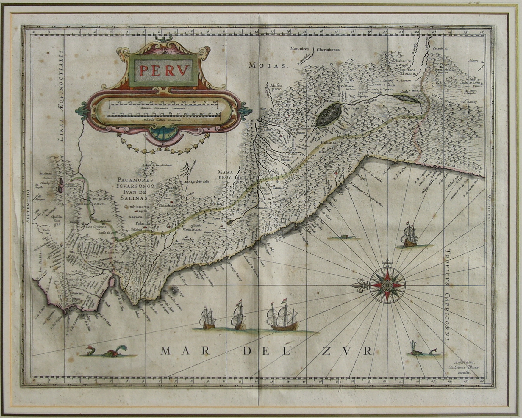
English: Map of Peru.
Español: Mapa «Perv. Mar del Zvr». Cartógrafo : Guiljelmus Blaeuw. (1635). Edición Príncipe. 300 ejemplares |
| Date | |
| Source | Prince edition. 300 pieces. |
| Author | Guiljelmus Blaeuw (cartographer); Manuel González Olaechea y Franco (photographer; Shot date: March 14th, 2004) |
| Other versions |
Licensing
|
This is a faithful photographic reproduction of a two-dimensional, public domain work of art. The work of art itself is in the public domain for the following reason:
The official position taken by the Wikimedia Foundation is that "faithful reproductions of two-dimensional public domain works of art are public domain".
This photographic reproduction is therefore also considered to be in the public domain in the United States. In other jurisdictions, re-use of this content may be restricted; see Reuse of PD-Art photographs for details. | ||||
File history
Click on a date/time to view the file as it appeared at that time.
| Date/Time | Thumbnail | Dimensions | User | Comment | |
|---|---|---|---|---|---|
| current | 20:01, 25 April 2005 | | 1,754 × 1,405 (1.2 MB) | Manuel González Olaechea | Description: Map of Peru by Guiljelmus Blaeuw Date : 1635 Photographer: © Manuel González Olaechea y Franco Shot date : 14.3.2004 {{GFDL}} |
File usage
The following pages on the English Wikipedia use this file (pages on other projects are not listed):
Global file usage
The following other wikis use this file:
- Usage on ast.wikipedia.org
- Usage on de.wikipedia.org
- Usage on es.wikipedia.org
- Anexo:Ciudad de Pisco en los mapas históricos
- Mar del Sur
- Usuario:Manuel González Olaechea y Franco/Galería de imágenes
- Historia territorial del Perú
- Anexo:Perú en los mapas históricos
- Usuario:Yakoo/Origen del término Pisco
- Combate de San Marcos de Arica
- Usuario:Manuel González Olaechea y Franco/Galería de mapas de América
- Usuario Discusión:Mar del Sur/Archivo 5
- Ciencias históricas
- Usage on ru.wikipedia.org