
Size of this JPG preview of this TIF file: 800 × 492 pixels. Other resolutions: 320 × 197 pixels | 640 × 394 pixels | 957 × 589 pixels.
Original file (957 × 589 pixels, file size: 666 KB, MIME type: image/tiff)
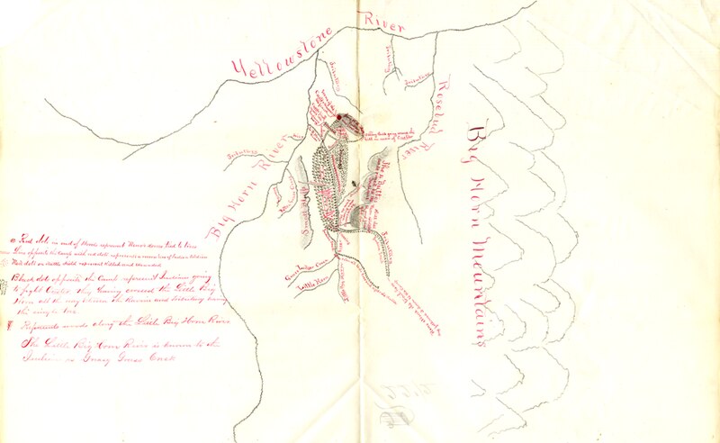
Army map, drawn based on interview with Kill Eagle, 1876. Original in RG393 Records of Continental Commands, Fort Yates, Letters Received. Scanned by Ephriam Dickson. Map in the public domain.
| This file is in the public domain because its copyright has expired in the United States and those countries with a copyright term of no more than the life of the author plus 100 years.
|
 | This file is a candidate to be copied to Wikimedia Commons.
Any user may perform this transfer; refer to Wikipedia:Moving files to Commons for details. If this file has problems with attribution, copyright, or is otherwise ineligible for Commons, then remove this tag and DO NOT transfer it; repeat violators may be blocked from editing. Other Instructions
| ||
| |||
File history
Click on a date/time to view the file as it appeared at that time.
| Date/Time | Thumbnail | Dimensions | User | Comment | |
|---|---|---|---|---|---|
| current | 18:15, 20 December 2011 |  | 957 × 589 (666 KB) | Ephriam3 (talk | contribs) | Army map, drawn based on interview with Kill Eagle, 1876. Original in RG393 Records of Continental Commands, Fort Yates, Letters Received. Scanned by Ephriam Dickson. Map in the public domain. |
You cannot overwrite this file.
File usage
The following pages on the English Wikipedia use this file (pages on other projects are not listed):