
Size of this preview: 800 × 529 pixels. Other resolutions: 320 × 212 pixels | 640 × 423 pixels | 1,037 × 686 pixels.
Original file (1,037 × 686 pixels, file size: 380 KB, MIME type: image/jpeg)
| This is a file from the Wikimedia Commons. Information from its description page there is shown below. Commons is a freely licensed media file repository. You can help. |
Summary
| Description |
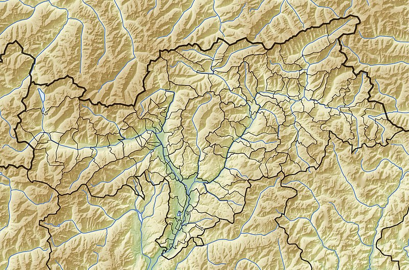
Quadratische Plattkarte, N-S-Streckung 150 %. Geographische Begrenzung der Karte:
Equirectangular projection, N/S stretching 150 %. Geographic limits of the map:
|
||
| Date | 08-05-2009 | ||
| Source |
own work, using
|
||
| Author | NordNordWest, relief by Lencer | ||
| Permission (Reusing this file) |
I, the copyright holder of this work, hereby publish it under the following licenses:
This file is licensed under the Creative Commons Attribution-Share Alike 3.0 Unported license.
You may select the license of your choice. |
||
| Other versions |
|


|
This map has been made or improved in the German Kartenwerkstatt (Map Lab). You can propose maps to improve as well.
|
File history
Click on a date/time to view the file as it appeared at that time.
| Date/Time | Thumbnail | Dimensions | User | Comment | |
|---|---|---|---|---|---|
| current | 17:16, 30 May 2009 | | 1,037 × 686 (380 KB) | NordNordWest | c |
| 18:03, 13 May 2009 |  | 1,037 × 686 (349 KB) | NordNordWest | c | |
| 17:59, 13 May 2009 |  | 1,040 × 687 (358 KB) | NordNordWest | corr | |
| 12:14, 8 May 2009 |  | 2,159 × 1,428 (889 KB) | NordNordWest | {{Information |Description= {{de|Physische Positionskarte von Südtirol, Italien}} Quadratische Plattkarte, N-S-Streckung 150 %. Geographische Begrenzung der Karte: * N: 47.15° N * S: 46.18° N * W: 10.3° O * O: 12.5° |
File usage
The following pages on the English Wikipedia use this file (pages on other projects are not listed):
- 2nd Mountain Artillery Regiment (Italy)
- 5th Mountain Artillery Regiment (Italy)
- Alpine Brigade "Orobica"
- Alpine Brigade "Tridentina"
- Durnholzer See
- Dürrensee
- Grafsee
- Grünsee (Pflersch)
- Haidersee
- Hatzlacke
- Kalterer See
- Karersee
- Lech dl Dragon
- Montiggler Seen
- Neves-Stausee
- Piz da las Trais Linguas
- Pragser Wildsee
- Reschensee
- Stubensee
- Toblacher See
- Vernagt-Stausee
- User:Michael!/Project:Location map templates/Italy
- Module:Location map/data/Italy South Tyrol
- Module:Location map/data/Italy South Tyrol/doc
Global file usage
The following other wikis use this file:
- Usage on als.wikipedia.org
- Usage on ar.wikipedia.org
- Usage on ba.wikipedia.org
- Usage on bn.wikipedia.org
- Usage on ceb.wikipedia.org
- Usage on cs.wikipedia.org
- Usage on de.wikipedia.org
- Schlern
- Vinschgau
- Schloss Juval
- Schloss Sigmundskron
- Eisacktal
- Müllerhütte
- Becherhaus
- Kalterer See
- Kreuzbergpass
- Karerpass
- Vajolet-Türme
- Jaufenpass
- Ultental
- Rosengartenspitze
- Karersee
- Burg Hocheppan
- Burgruine Neuhaus (Terlan)
- Burgruine Walbenstein
- Brunnenburg
- Burg Greifenstein (Südtirol)
- Alpenverein Südtirol
- Burgruine Rafenstein
- Mühlbacher Klause
- Hochgall
- Staller Sattel
- Churburg
- Schloss Schenna
- Schloss Runkelstein
- Birkenkofel
- Schloss Sprechenstein
- Toblacher See
- Dürrenstein (Pragser Dolomiten)
- Haidersee
- Castelfeder
- Peitlerkofel
- Sassongher
- Rittner Horn
- Burg Hauenstein (Seis am Schlern)
- Vigiljoch
- Klammljoch
- Schloss Boymont
View more global usage of this file.