Size of this JPG preview of this PDF file: 800 × 518 pixels. Other resolutions: 320 × 207 pixels | 640 × 414 pixels | 1,024 × 663 pixels | 1,280 × 828 pixels | 2,550 × 1,650 pixels.
Original file (2,550 × 1,650 pixels, file size: 96 KB, MIME type: application/pdf)
| This is a file from the Wikimedia Commons. Information from its description page there is shown below. Commons is a freely licensed media file repository. You can help. |
Summary
| Description |
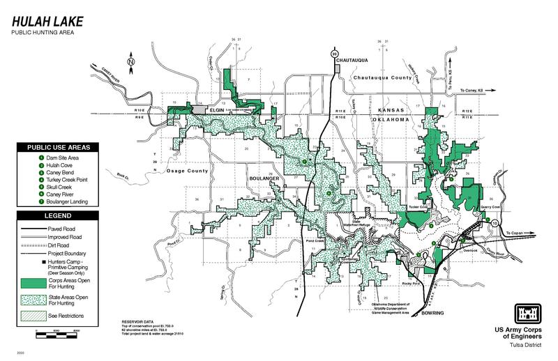
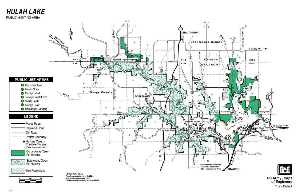
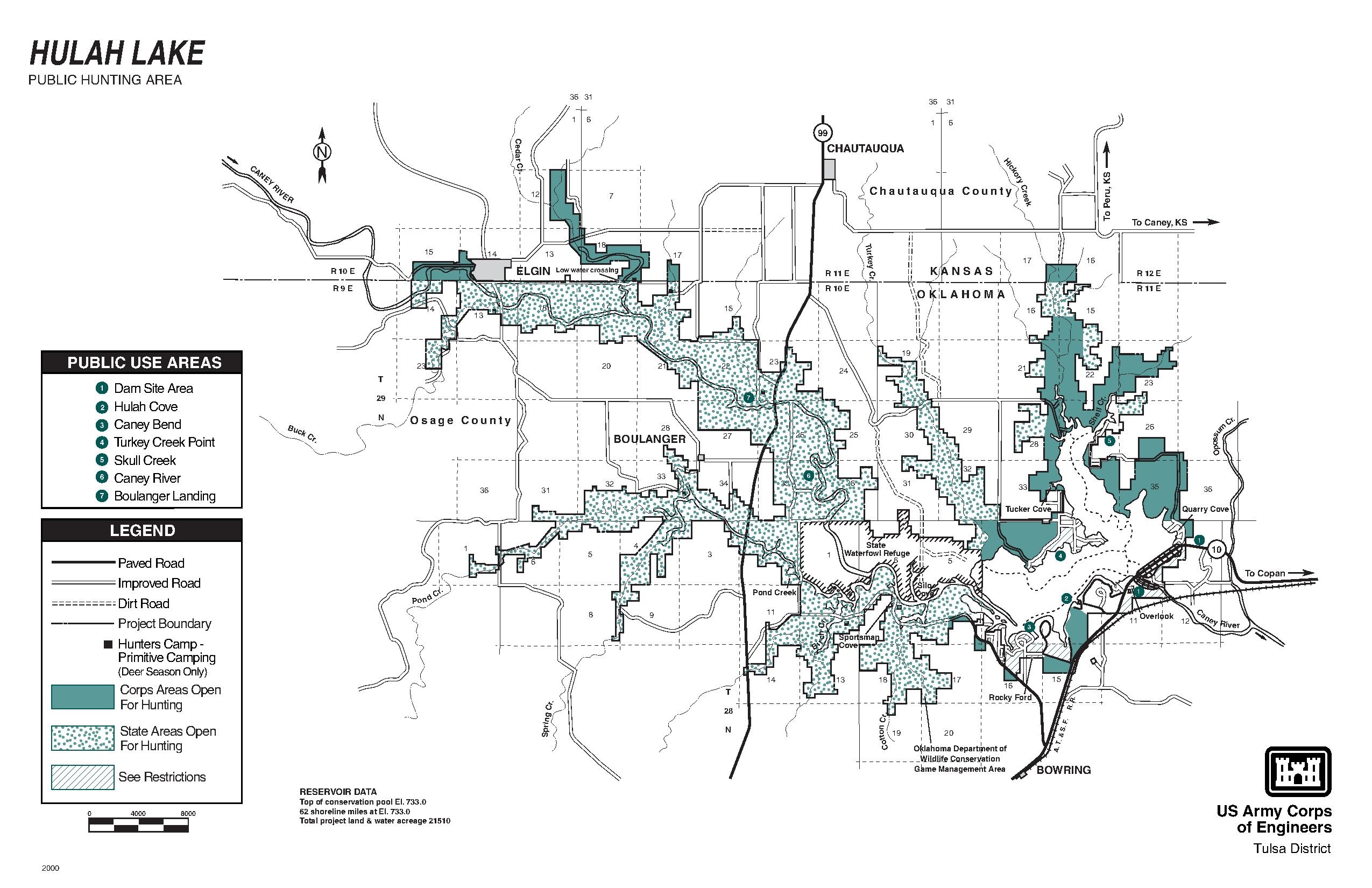
English: Map of the Hulah Lake area in Osage County, Oklahoma |
|||
| Date | Not stated | |||
| Source | Website www.swt.usace.army.mil/LIBRARY/Webhuntingmaps/hulah.pdf | |||
| Author | U.S. Army Corps of Engineers | |||
| Permission (Reusing this file) |
|
Licensing
This file is a work of a U.S. Army soldier or employee, taken or made as part of that person's official duties. As a work of the U.S. federal government, it is in the public domain in the United States.
|
 |
File history
Click on a date/time to view the file as it appeared at that time.
| Date/Time | Thumbnail | Dimensions | User | Comment | |
|---|---|---|---|---|---|
| current | 16:36, 11 April 2012 |  | 2,550 × 1,650 (96 KB) | Bruin2 | {{Information |Description ={{en|1=Map of the Hulah Lake area in Osage County, Oklahoma}} |Source =Website www.swt.usace.army.mil/LIBRARY/Webhuntingmaps/hulah.pdf |Author =U.S. Army Corps of Engineers |Date =Not stated |Per... |
File usage
The following pages on the English Wikipedia use this file (pages on other projects are not listed):