
Size of this PNG preview of this TIF file: 418 × 599 pixels. Other resolutions: 167 × 240 pixels | 335 × 480 pixels | 536 × 768 pixels | 714 × 1,024 pixels | 1,429 × 2,048 pixels | 4,725 × 6,772 pixels.
Original file (4,725 × 6,772 pixels, file size: 9.14 MB, MIME type: image/tiff)
| This is a file from the Wikimedia Commons. Information from its description page there is shown below. Commons is a freely licensed media file repository. You can help. |
Summary
| Description |
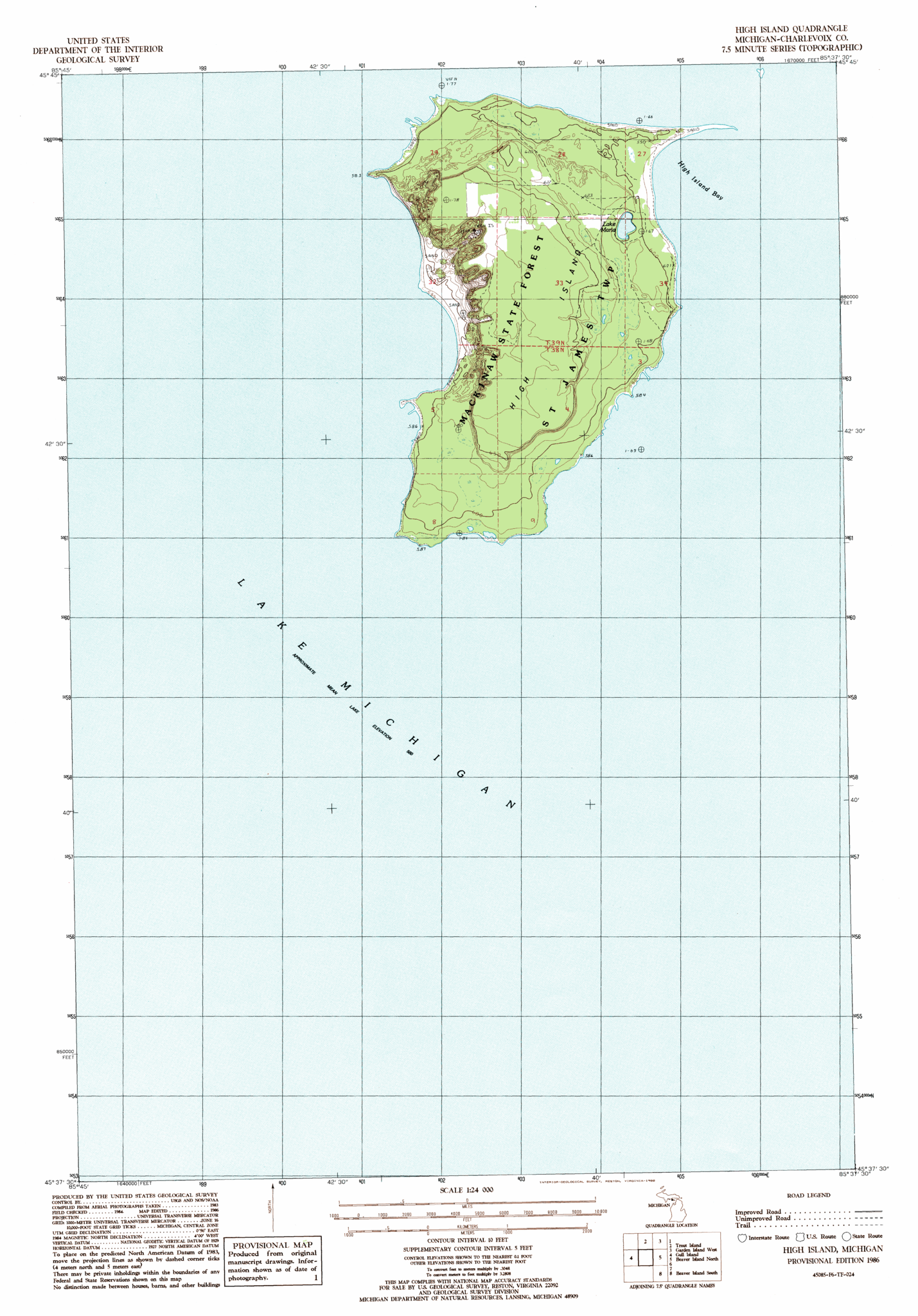
English: map of High Island, Beaver Islands, Lake Michigan, Michigan, USA |
| Date | |
| Source | https://www.topoquest.com/map-detail.php?usgs_cell_id=20361 |
| Author | USGS |
Licensing
| This work is from the Library of Congress. According to the library, there are no known copyright restrictions on the use of this work. |  |
File history
Click on a date/time to view the file as it appeared at that time.
| Date/Time | Thumbnail | Dimensions | User | Comment | |
|---|---|---|---|---|---|
| current | 13:11, 24 October 2016 |  | 4,725 × 6,772 (9.14 MB) | Ratzer | User created page with UploadWizard |
File usage
The following pages on the English Wikipedia use this file (pages on other projects are not listed):
Global file usage
The following other wikis use this file:
- Usage on fr.wikipedia.org