Size of this preview: 800 × 556 pixels. Other resolutions: 320 × 223 pixels | 640 × 445 pixels | 1,024 × 712 pixels | 1,280 × 890 pixels | 2,560 × 1,780 pixels | 3,200 × 2,225 pixels.
Original file (3,200 × 2,225 pixels, file size: 1.57 MB, MIME type: image/jpeg)
| This is a file from the Wikimedia Commons. Information from its description page there is shown below. Commons is a freely licensed media file repository. You can help. |
Summary
| Description |
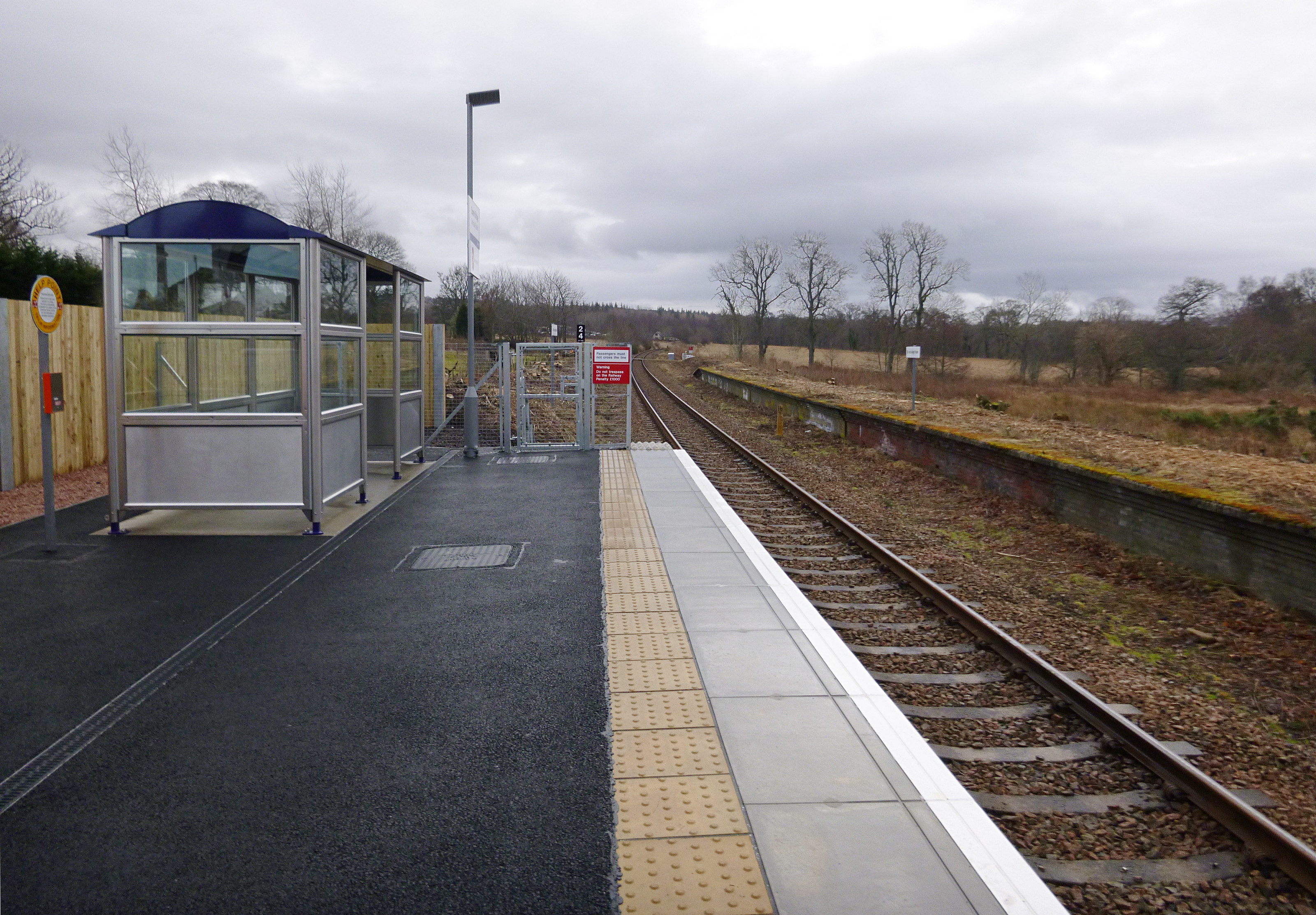
English: Conon Bridge station.
The original station on this site was named "Conon", and closed in 1960. A new station has been constructed, and opened today, 8 February 2013. It is a fairly basic station, similar to the nearby Beauly, which reopened 10 years ago. It has a single platform, a small shelter, a car park and bike parking. One of the original platforms is visible to the right, it now has signs saying "Do not alight here". Near to Conon Bridge, Highland, Great Britain. |
| Date | |
| Source | From geograph.org.uk; transferred by User:Vclaw using geograph_org2commons. |
| Author | Craig Wallace |
| Permission (Reusing this file) |
Creative Commons Attribution Share-alike license 2.0 |
| Attribution (required by the license) | Craig Wallace / Conon Bridge station / |
| Camera location | | View this and other nearby images on: OpenStreetMap |
|---|
| Object location | | View this and other nearby images on: OpenStreetMap |
|---|
_region:GB-GBN_heading:180.00&language=en)
Licensing

|
This image was taken from the Geograph project collection. See this photograph's page on the Geograph website for the photographer's contact details. The copyright on this image is owned by Craig Wallace and is licensed for reuse under the Creative Commons Attribution-ShareAlike 2.0 license.
|
This file is licensed under the Creative Commons Attribution-Share Alike 2.0 Generic license.
Attribution: Craig Wallace
- You are free:
- to share – to copy, distribute and transmit the work
- to remix – to adapt the work
- Under the following conditions:
- attribution – You must give appropriate credit, provide a link to the license, and indicate if changes were made. You may do so in any reasonable manner, but not in any way that suggests the licensor endorses you or your use.
- share alike – If you remix, transform, or build upon the material, you must distribute your contributions under the same or compatible license as the original.
File history
Click on a date/time to view the file as it appeared at that time.
| Date/Time | Thumbnail | Dimensions | User | Comment | |
|---|---|---|---|---|---|
| current | 16:46, 9 February 2013 | | 3,200 × 2,225 (1.57 MB) | File Upload Bot (Magnus Manske) |
File usage
The following pages on the English Wikipedia use this file (pages on other projects are not listed):
Global file usage
The following other wikis use this file:
- Usage on arz.wikipedia.org
- Usage on gd.wikipedia.org
- Usage on www.wikidata.org