Oct2005.jpg)
Oct2005.jpg&action=edit&redlink=1)
No higher resolution available.
ChurchOfStJohnTheEvangelistWorsthorne(AlexanderPKapp)Oct2005.jpg (426 × 600 pixels, file size: 130 KB, MIME type: image/jpeg)
| This is a file from the Wikimedia Commons. Information from its description page there is shown below. Commons is a freely licensed media file repository. You can help. |
Oct2005.jpg)
Summary
| Description |
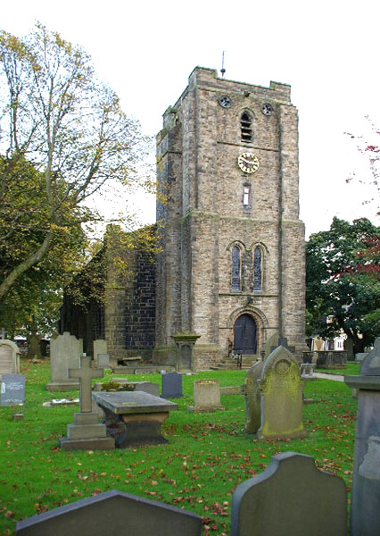
English: St John the Evangelist Church Worsthorne |
| Date | |
| Source |
This file was derived from: St John the Evangelist Church Worsthorne - geograph.org.uk - 84404.jpg |
| Author | Alexander P Kapp |
| Permission (Reusing this file) |
Creative Commons Attribution Share-alike license 2.0 |
| Object location | | View this and other nearby images on: OpenStreetMap |
|---|
Oct2005.jpg¶ms=053.788200_N_-002.189000_E_globe:Earth_class:object_type:object_source:geograph-osgb36(SD876324)_region:GB-GBN_&language=en)
Licensing
This file is licensed under the Creative Commons Attribution-Share Alike 2.0 Generic license.
Attribution: Alexander P Kapp
- You are free:
- to share – to copy, distribute and transmit the work
- to remix – to adapt the work
- Under the following conditions:
- attribution – You must give appropriate credit, provide a link to the license, and indicate if changes were made. You may do so in any reasonable manner, but not in any way that suggests the licensor endorses you or your use.
- share alike – If you remix, transform, or build upon the material, you must distribute your contributions under the same or compatible license as the original.
File history
Click on a date/time to view the file as it appeared at that time.
| Date/Time | Thumbnail | Dimensions | User | Comment | |
|---|---|---|---|---|---|
| current | 10:36, 25 March 2007 | | 426 × 600 (130 KB) | Euchiasmus | St John the Evangelist Church Worsthorne, Lancashire, Great Britain {{geograph|084404|Alexander P Kapp}} |
File usage
The following pages on the English Wikipedia use this file (pages on other projects are not listed):
Global file usage
The following other wikis use this file:
- Usage on arz.wikipedia.org
- Usage on www.wikidata.org
Oct2005.jpg)