Size of this preview: 800 × 600 pixels. Other resolutions: 320 × 240 pixels | 640 × 480 pixels | 1,024 × 768 pixels | 1,280 × 960 pixels | 2,560 × 1,920 pixels | 4,000 × 3,000 pixels.
Original file (4,000 × 3,000 pixels, file size: 4.13 MB, MIME type: image/jpeg)
| This is a file from the Wikimedia Commons. Information from its description page there is shown below. Commons is a freely licensed media file repository. You can help. |
Summary
| Description |
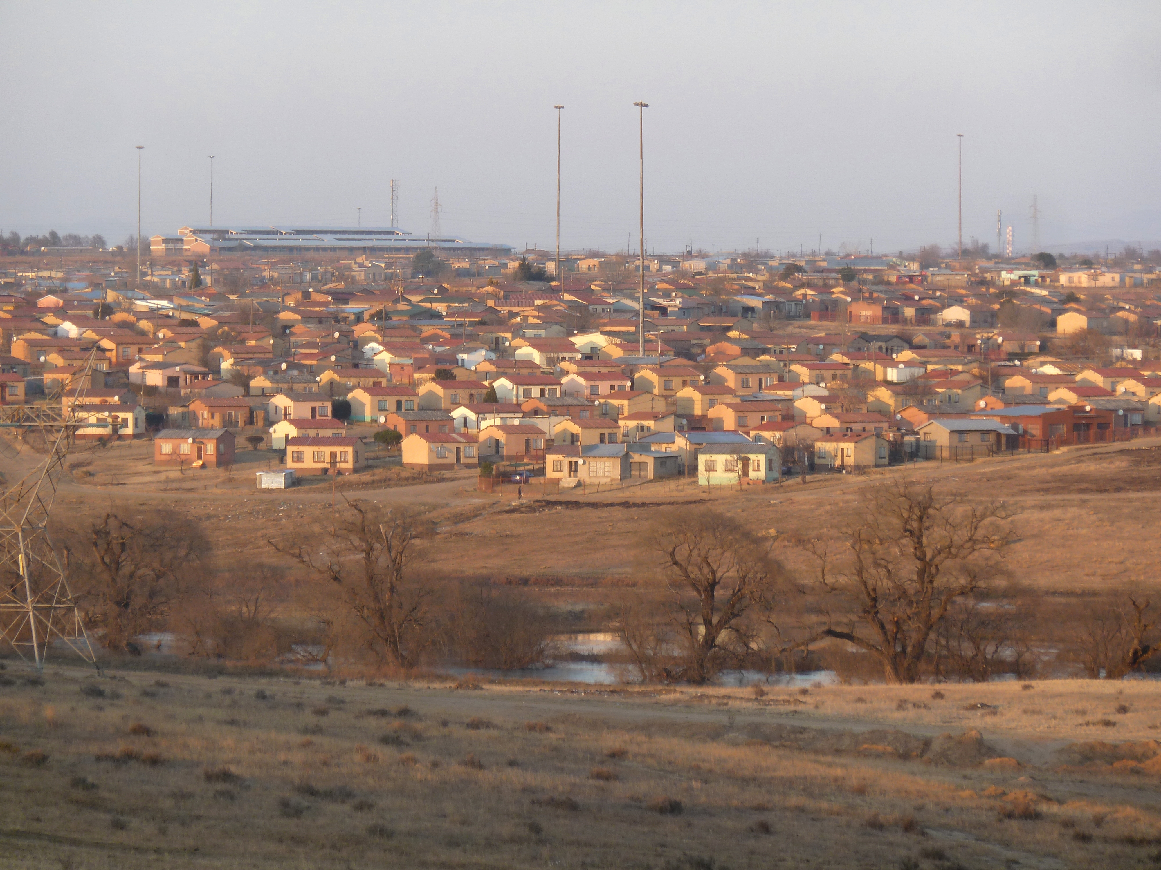
Afrikaans: Oggendson op Bohlokong- en Thorisong-woonbuurte in Bethlehem, Vrystaat, Suid-Afrika. Bethlehem Comprehensive Sekondêre Skool, in Thorisong-woonbuurt is bo links sigbaar. Die Liebenbergsvleirivier, met water van die Lesotho-Hoogland-waterprojek, vloei voor verby.
English: Early morning view on Bohlokong and Thorisong townships in Bethlehem, Free State, South Africa. Bethlehem Comprehensive Secondary School, in Thorisong township, can be seen at top left. The Liebenbergsvlei river is in the foreground (downstream of the Saulspoort dam), a conduit for water from the Lesotho Highlands Water Project. |
| Date | |
| Source | Own work |
| Author | JMK |
| Other versions |
|
| Object location | | View this and other nearby images on: OpenStreetMap |
|---|
Licensing
I, the copyright holder of this work, hereby publish it under the following licenses:

|
Permission is granted to copy, distribute and/or modify this document under the terms of the GNU Free Documentation License, Version 1.2 or any later version published by the Free Software Foundation; with no Invariant Sections, no Front-Cover Texts, and no Back-Cover Texts. A copy of the license is included in the section entitled GNU Free Documentation License. |
This file is licensed under the Creative Commons Attribution-Share Alike 4.0 International license.
- You are free:
- to share – to copy, distribute and transmit the work
- to remix – to adapt the work
- Under the following conditions:
- attribution – You must give appropriate credit, provide a link to the license, and indicate if changes were made. You may do so in any reasonable manner, but not in any way that suggests the licensor endorses you or your use.
- share alike – If you remix, transform, or build upon the material, you must distribute your contributions under the same or compatible license as the original.
You may select the license of your choice.
File history
Click on a date/time to view the file as it appeared at that time.
| Date/Time | Thumbnail | Dimensions | User | Comment | |
|---|---|---|---|---|---|
| current | 07:41, 20 August 2015 | | 4,000 × 3,000 (4.13 MB) | JMK | {{Information |Description ={{en|1=Early morning view on Bohlokong and Thorisong townships in Bethlehem, Free State, South Africa. Bethlehem Comprehensive Secondary School, in Thorisong township, can be seen at top left.}} |Source ={{Own}} |... |
File usage
The following pages on the English Wikipedia use this file (pages on other projects are not listed):
Global file usage
The following other wikis use this file:
- Usage on www.wikidata.org