This article has multiple issues. Please help improve it or discuss these issues on the talk page. (Learn how and when to remove these template messages)
|
Embalam is a panchayat village[1] in Nettapakkam Commune in the Union Territory of Puducherry, India.
Embalam | |
|---|---|
Village | |
 Embalam Location in Puducherry, India  Embalam Embalam (India) | |
| Coordinates: 11°52′16″N 79°42′49″E / 11.871215°N 79.713514°E | |
| Country | |
| State | Puducherry |
| District | Pondicherry |
| Taluk | Bahour |
| Commune | Nettapakkam |
| Languages | |
| • Official | French, Tamil, English |
| Time zone | UTC+5:30 (IST) |
| PIN | 605 106 |
| Telephone code | 0413 |
| Vehicle registration | PY-01 |
| Sex ratio | 50% ♂/♀ |

Geography
editEmbalam is bordered by Nallathur village (Tamil nadu) in the west, Sathamangalam in the north, Sembiapalayam in the east and Manaveli village (Tamil nadu) in the south and south-west.
Transport
editEmbalam is located at 18 km. from Pondicherry. Embalam can be reached directly by any bus running between Pondicherry and Maducarai via. Embalam.
Road Network
editEmbalam is connected to Pondicherry by Thavalakuppam-Embalam (RC-20) State Highway. Also Mangalam-Maducarai State Highway (RC-19) passes through Embalam
Politics
editEmbalam is a part of Embalam (Union Territory Assembly constituency) which comes under Puducherry (Lok Sabha constituency)
Gallery
edit-
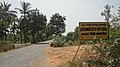
 Way to Embalam
 -
 Embalam Village Panchayat


References
edit- ^ "Archived copy" (PDF). Archived from the original (PDF) on 27 September 2013. Retrieved 5 March 2013.
{{cite web}}: CS1 maint: archived copy as title (link)
External links
edit