Images composed of simple shapes, lines, and letters such as those below should be recreated using vector graphics as an SVG file. These have a number of advantages, such as making it easier for subsequent editors to edit them, enabling arbitrary scaling at high quality, and sharp high-resolution renderings for print versions.
If an SVG version of any of these images becomes available, please tag the deprecated image with {{Vector version available|NewImage.svg}}.
This category is a subcategory of Category:Images that should be in SVG format. You can add images to this category using the template {{Should be SVG|map}}. For more information, see Template:Should be SVG.
See also edit
Media in category "Map images that should be in SVG format"
The following 53 files are in this category, out of 53 total.
-
 Bleakhillmap.png 220 × 220; 91 KB
-
 CamdenCountyBlankmap.png 425 × 523; 34 KB
-
 Carte france recrutement en.gif 300 × 300; 23 KB
-
 Charleroi metro network 2009.png 620 × 270; 69 KB
-
 ChinaRailwaysNetwork.png 1,744 × 1,315; 537 KB
-
 Clash of Civilizations map2.png 1,350 × 625; 56 KB
-
 Denmarkcounties.png 400 × 469; 12 KB
-
 Detroitpeoplemovermap.gif 380 × 414; 27 KB
-
 Electoral divisions, Queensland, Australia.gif 958 × 609; 20 KB
-
 Electoral divisions, Victoria, Australia.gif 934 × 667; 20 KB
-
 Enderby Land, Antarctica Geology.jpg 513 × 281; 40 KB
-
 GianonewplanQueluz.JPG 869 × 953; 96 KB
-
 GMTerminusMap.png 937 × 776; 162 KB
-
 GSCLocationsLarge.png 922 × 736; 167 KB
-
 Hrmcapitaldistrict.png 260 × 461; 28 KB
-
 Hrmurbansuburbanruraldets.png 1,024 × 768; 58 KB
-
 Italian empire 1942.PNG 344 × 241; 8 KB
-
 Italian Invasion British Somaliland.JPG 388 × 313; 28 KB
-
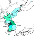 Koreandialects.PNG 422 × 441; 18 KB
-
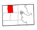 Long Rapids Twp., MI.png 573 × 474; 79 KB
-
 Lutherelysmithsquaremap.png 930 × 748; 194 KB
-
 LUX-FRA-GER-BEL.png 444 × 441; 13 KB
-
 LymingtonTrackPlan.PNG 954 × 538; 39 KB
-
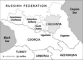 Map chechnyasmall.png 283 × 206; 11 KB
-
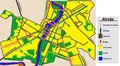 Map of Ahvaz.png 1,843 × 1,020; 846 KB
-
 Map of PA Coal Region.png 295 × 172; 29 KB
-
 Map of the Empire of Japan after 1932.png 1,357 × 628; 46 KB
-
 Map of the major tonal dialects of Norwegian and Swedish.png 252 × 394; 89 KB
-
 Maple Ridge Twp., MI.png 573 × 474; 77 KB
-
 Meades ranch.png 422 × 273; 5 KB
-
 Metrotransitferry.png 750 × 585; 43 KB
-
 North American Rail.gif 557 × 525; 64 KB
-
 Numbered-cardiff-ward-map.jpg 800 × 548; 61 KB
-
 Provinces of North Korea Txt.PNG 581 × 534; 36 KB
-
 Railways Morecambe 1994.jpg 1,024 × 528; 107 KB
-
 Red-fox-range-A.PNG 1,357 × 628; 30 KB
-
 Rhone alpes elevation.gif 720 × 786; 48 KB
-
 Scmap.jpg 179 × 258; 11 KB
-
 SDP BiH logo.png 531 × 187; 35 KB
-
 SE-USshoreline.jpg 500 × 409; 50 KB
-
 ShippingZones2.JPG 687 × 996; 130 KB
-
 SixFlagsLocations.png 2,253 × 1,992; 375 KB
-
 SkyTrain Future V2.png 987 × 492; 33 KB
-
 SkyTrain Future V3.png 1,224 × 516; 85 KB
-
 Somerset Cross Country Line.jpg 860 × 646; 80 KB
-
 Swiss cantons brown flags.png 1,366 × 866; 169 KB
-
 Taunton ma old highlight.png 788 × 466; 128 KB
-
 Triopsrange.PNG 2,759 × 1,404; 136 KB
-
 United Kingdom+Territories EEZs.png 2,410 × 1,178; 185 KB
-
 Urban spread within the Federal District.png 2,172 × 2,911; 270 KB
-
 USBL USA states.png 841 × 622; 75 KB
-
 UserDaanschrCornelius49BCprob.png 431 × 287; 13 KB
-
 UserDaanschrPaullus50BC.png 431 × 287; 13 KB


