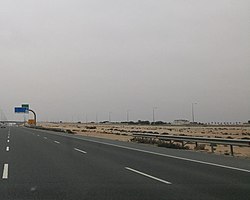
Ain Sinan (Arabic: عين سنان, romanized: ‘Ayn Sinān) is a village on the northern coast of Qatar, located in the municipality of Al Shamal.[2][3] Historically, the village has been mainly inhabited by the Al-Rashed tribe.[4]
Ain Sinan
عين سنان | |
|---|---|
Village | |
 View of Ain Sinan off Al Shamal Road | |
| Coordinates: 26°01′00″N 51°20′00″E / 26.01667°N 51.33333°E | |
| Country | |
| Municipality | Al Shamal |
| Zone | Zone 77 |
| District no. | 366 |
| Area | |
| • Total | 3.5 km2 (1.4 sq mi) |
Etymology
editAin Sinan gets its name from a man named Sinan, who built a well and farm in the area.[5]
History
editIn J.G. Lorimer's Gazetteer of the Persian Gulf, Ain Sinan was described as a village 4 miles southwest of Fuwayrit which contained a fort with a 35 feet deep masonry well. The fort was said to have been built by the Al-Maadeed tribe. After the Al Maadeed abandoned the area, the fort was held by the Bu Kuwara tribe of Fuwayrit as a means to secure its water supply.[6]
The village was demarcated in 1992.[7]
Infrastructure
editThe nearest health center is 15 km away in Madinat Al Kaaban.[4] There is no secondary school in the village; high school students typically commute to Madinat ash Shamal, 25 km away.[8]
Ain Sinan Park was opened in 2013, and covers an area of 5152 meters. It has a children's play area, a cafeteria, and features 15 different species of trees and shrubs.[9]
Built in 1940, Ain Sinan Mosque is considered a local historic landmark and has undergone renovation by Qatar Museums.[10]
Geography
editAin Sinan is situated near the north-eastern tip of Qatar, about 70 km away from capital Doha.[4] The village of Al Zarqaa is nearby.[11]
In the past, villages situated directly on the coast such as Al Ghariyah and Fuwayrit experienced water shortages because seawater prevented direct access to the groundwater. Additionally, the water that could be obtained was of poor quality.[12] Therefore, Ain Sinan would establish a trade relationship with these villages in which it would receive sea goods such as fish and pearls in exchange for its potable water.[13]
References
edit- ^ "District Area Map". Ministry of Development Planning and Statistics. Retrieved 20 May 2019.
- ^ "2013 population census" (PDF). Qatar Statistics Authority. Archived from the original (PDF) on 2 April 2015. Retrieved 28 July 2015.
- ^ "District map". The Centre for Geographic Information Systems of Qatar. Archived from the original on 24 November 2020. Retrieved 28 July 2015.
- ^ a b c "عين سنان بدون خدمات" (in Arabic). Al Raya. 14 September 2008. Retrieved 8 August 2017.
- ^ "GIS Portal". Ministry of Municipality and Environment. Archived from the original on 22 October 2020. Retrieved 10 August 2017.
- ^ "'Gazetteer of the Persian Gulf. Vol. II. Geographical and Statistical. J G Lorimer. 1908' [1527] (1642/2084)". Qatar Digital Library. Retrieved 28 July 2015.
- ^ "قانون رقم (19) لسنة 1992 بتعيين حدود قرية عين سنان" (in Arabic). Qatar Legal Portal. 28 December 1992. Retrieved 8 August 2017.
- ^ Amir Salem (17 May 2016). "سكان "عين سنان" للمسؤولين: نحتاج لمجمع مدارس ومركز صحي وتطوير الشوارع" (in Arabic). Al Arab. Retrieved 8 August 2017.
- ^ "حديقة عين سنان" (in Arabic). Ministry of Municipality and Environment. Retrieved 8 August 2017.
- ^ "'Mosques in Qatar: Then and Now' Exhibition Opens at Museum of Islamic Art". Qatar Museums. 22 June 2023. Retrieved 11 October 2023.
- ^ "Qatar Socio-Economic Atlas". Ministry of Development Planning and Statistics. Archived from the original on 8 August 2017. Retrieved 8 August 2017.
- ^ Phillip G Macumber (2012). "An examination of the impact of environmental disparity on the occupation of Qatar". University of Copenhagen. p. 24. Retrieved 5 July 2018.
- ^ Phillip G. Macumber (2015). "Water Heritage in Qatar" (PDF). Cultural Heritages of Water: Thematic Study on The Cultural Heritages of Water in the Middle East and Maghreb. UNESCO World Heritage Convention. UNESCO. p. 226. Retrieved 5 July 2018.
External links
edit
