The Tropical Cyclones Portal
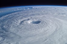
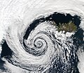
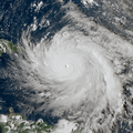
A tropical cyclone is a storm system characterized by a large low-pressure center, a closed low-level circulation and a spiral arrangement of numerous thunderstorms that produce strong winds and heavy rainfall. Tropical cyclones feed on the heat released when moist air rises, resulting in condensation of water vapor contained in the moist air. They are fueled by a different heat mechanism than other cyclonic windstorms such as Nor'easters, European windstorms and polar lows, leading to their classification as "warm core" storm systems. Most tropical cyclones originate in the doldrums, approximately ten degrees from the Equator.
The term "tropical" refers to both the geographic origin of these systems, which form almost exclusively in tropical regions of the globe, as well as to their formation in maritime tropical air masses. The term "cyclone" refers to such storms' cyclonic nature, with anticlockwise rotation in the Northern Hemisphere and clockwise rotation in the Southern Hemisphere. Depending on its location and intensity, a tropical cyclone may be referred to by names such as "hurricane", "typhoon", "tropical storm", "cyclonic storm", "tropical depression" or simply "cyclone".
Types of cyclone: 1. A "Typhoon" is a tropical cyclone located in the North-west Pacific Ocean which has the most cyclonic activity and storms occur year-round. 2. A "Hurricane" is also a tropical cyclone located at the North Atlantic Ocean or North-east Pacific Ocean which have an average storm activity and storms typically form between May 15 and November 30. 3. A "Cyclone" is a tropical cyclone that occurs in the South Pacific and Indian Oceans.
Selected named cyclone -
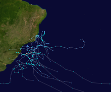
Hurricane Catarina, or Cyclone Catarina (Portuguese pronunciation: [kataˈɾinɐ]) was an extraordinarily rare South Atlantic tropical cyclone, the only hurricane-strength storm on record in the South Atlantic Ocean. Catarina made landfall on Southern Brazil at peak intensity, with the equivalent of Category 2 hurricane-force sustained winds, on 28 March 2004.
The storm developed out of a stationary cold-core upper-level trough on 12 March. Almost a week later, on 19 March, a disturbance developed along the trough and traveled towards the west-southwest until 22 March when a ridge stopped the forward motion of the disturbance. The disturbance was in an unusually favorable environment with a slightly below-average wind shear and above-average sea surface temperatures. The combination of the two led to a slow transition from an extratropical cyclone to a subtropical cyclone by 24 March. The storm continued to obtain tropical characteristics and became a tropical storm the next day while the winds steadily increased. The storm attained wind speeds of 121 km/h (75 mph)—equivalent to a low-end Category 1 hurricane on the Saffir–Simpson scale—on 26 March. At that time, it was unofficially named Catarina and was also the first hurricane-strength tropical cyclone ever recorded in the Southern Atlantic Ocean. Abnormally favorable conditions persisted, resulting in Catarina intensifying further, and it would peak with 1-minute sustained winds of 160 km/h (100 mph) on 28 March. The center of the storm made landfall between the cities of Passo de Torres and Balneário Gaivota, Santa Catarina soon after. Catarina rapidly weakened upon landfall and dissipated later that day. (Full article...)Selected article -
Selected image -

Selected season -

The 2015–16 Australian region cyclone season was the least active Australian region cyclone season since reliable records started during 1969, with only three named tropical cyclones developing in the region. Reasons for the low activity during the year included a positive Indian Ocean Dipole occurring and the 2014–16 El Niño event. Ahead of the season starting; the Australian Bureau of Meteorology predicted that there was a 91% chance that the season would be below average. As the 2015–16 tropical cyclone year opened on 1 July 2015, the newly named Tropical Cyclone Raquel moved south-westward into the Australian region. Over the next couple of days, the system meandered around 160°E and moved through the Solomon Islands, before it was last noted on 5 July. The basin subsequently remained quiet with only several weak tropical lows developing, before the first named tropical cyclone of the season was named Stan during 29 January 2016.
Stan subsequently made landfall on Western Australia and impacted various commodities including oil, natural gas and iron ore. However, impacts were limited due to the low population of the region. The precursor tropical low to Tropical Cyclone Uriah developed over the Indian Ocean, within a monsoon trough of low pressure during 9 February. The system subsequently developed further and was named Uriah during 13 February, before it moved out of the region during the following day. Tropical Cyclone Tatiana developed into a tropical cyclone, during 11 February while it was located over the Coral Sea. Over the next few days, the system remained over water and dissipated during 15 February after it had produced some powerful, long period swells along Queensland beaches. After Tatiana dissipated four tropical lows occurred in the region, before the season ended on 30 April, including the remnant tropical low of Severe Tropical Cyclone Winston. (Full article...)Related portals
Currently active tropical cyclones

Italicized basins are unofficial.
- North Atlantic (2024)
- No active systems
- East and Central Pacific (2024)
- No active systems
- West Pacific (2024)
- No active systems
- North Indian Ocean (2024)
- No active systems
- Mediterranean (2023–24)
- No active systems
- South-West Indian Ocean (2023–24)
- No active systems
- Australian region (2023–24)
- No active systems
- South Pacific (2023–24)
- No active systems
- South Atlantic (2023–24)
- No active systems
Last updated: 21:50, 2 June 2024 (UTC)
Tropical cyclone anniversaries

June 6
- 1994 - Tropical Storm Russ moved across Hainan Island and southern China, killing 72 people and leaving US$727.5&bsp;million in damage.
- 1999 - Typhoon Maggie made landfall in China, and along its path the storm killed nine people.
- 2012 - Tropical Storm Kuena (pictured) became a rare June tropical storm in the South-West Indian Ocean.

June 7,
- 1973 - Hurricane Ava reached its peak intensity as a Category 5 hurricane, becoming the only Pacific hurricane to attain that intensity in the month of June.
- 2003 - Cyclone Gina (pictured) reaches its peak intensity as a Category 3 severe tropical cyclone after affecting the Solomon Islands with only minimal damages.

June 8
- 1960 - Typhoon Mary struck Hong Kong, killing 1,649 people across southeastern China.
- 1966 - Hurricane Alma made landfall in western Cuba causing severe flooding. The storm killed a total of 90 people and caused over $200 million of damage.
Did you know…


- …that the Joint Typhoon Warning Center considers that Typhoon Vera (pictured) of 1986 is actually two distinct systems, formed from two separated low-level circulations?
- …that Hurricane Agatha (pictured) was the strongest Pacific hurricane to make landfall in Mexico in May since records began in 1949?
- …that Cyclone Raquel (track pictured) travelled between the Australian and South Pacific basins between the 2014–15 and 2015–16 seasons, spanning both seasons in both basins?
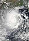
- …that Cyclone Amphan (pictured) in 2020 was the first storm to be classified as a Super Cyclonic Storm in the Bay of Bengal since 1999?
General images -

The 2003–04 South Pacific cyclone season was a below-average season with only three tropical cyclones occurring within the South Pacific to the east of 160°E. The season officially ran from November 1, 2003 to April 30, 2004 with the first disturbance of the season forming on December 4 and the last disturbance dissipating on April 23. This is the period of the year when most tropical cyclones form within the South Pacific Ocean.
During the season at least 16 deaths resulted from tropical disturbances whilst overall damage was estimated at $218 million (2004 USD; $352 million 2024 USD). The most damaging tropical disturbance was Cyclone Heta which caused at least $211 million (2004 USD; $340 million 2024 USD) in damage to six different countries and left three dead. The deadliest tropical disturbance of the season was Tropical Depression 10F, which was responsible for eleven deaths and caused $2.74 million (2004 USD; $4.42 million 2024 USD) in damage. Cyclone Ivy also caused 2 deaths and caused $4.17 million (2004 USD; $6.73 million 2024 USD) worth of damage to Vanuatu. As a result of the impacts caused by Heta and Ivy, the names were retired from the tropical cyclone naming lists. (Full article...)Topics
Subcategories
Related WikiProjects
WikiProject Tropical cyclones is the central point of coordination for Wikipedia's coverage of tropical cyclones. Feel free to help!
WikiProject Weather is the main center point of coordination for Wikipedia's coverage of meteorology in general, and the parent project of WikiProject Tropical cyclones. Three other branches of WikiProject Weather in particular share significant overlaps with WikiProject Tropical cyclones:
- The Non-tropical storms task force coordinates most of Wikipedia's coverage on extratropical cyclones, which tropical cyclones often transition into near the end of their lifespan.
- The Floods task force takes on the scope of flooding events all over the world, with rainfall from tropical cyclones a significant factor in many of them.
- WikiProject Severe weather documents the effects of extreme weather such as tornadoes, which landfalling tropical cyclones can produce.
Things you can do
 |
Here are some tasks awaiting attention:
|
Wikimedia
The following Wikimedia Foundation sister projects provide more on this subject:
-
Commons
Free media repository -
Wikibooks
Free textbooks and manuals -
Wikidata
Free knowledge base -
Wikinews
Free-content news -
Wikiquote
Collection of quotations -
Wikisource
Free-content library -
Wikiversity
Free learning tools -
Wikivoyage
Free travel guide -
Wiktionary
Dictionary and thesaurus


