Route 236 is a two-lane east/west highway on the south shore of the Saint Lawrence River in the Montérégie region of Quebec, Canada. Its western terminus is in Saint-Stanislas-de-Kostka at the junction of Route 132 and the eastern terminus is at the junction of Route 132 again, in Beauharnois.
Route 236 | ||||
|---|---|---|---|---|
 | ||||
| Route information | ||||
| Maintained by Transports Québec | ||||
| Length | 29.4 km[1] (18.3 mi) | |||
| Major junctions | ||||
| West end | ||||
| East end | ||||
| Location | ||||
| Country | Canada | |||
| Province | Quebec | |||
| Highway system | ||||
| ||||

Up until the 1980s, Route 236 also used to extend further west, with an additional stretch between Sainte-Barbe and the hamlet of Cazaville, part of Saint-Anicet.
Municipalities along Route 236 edit
-
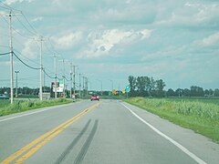 Junction of Routes 236 and 132, near the western end.
 -
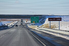 Autoroute 30 interchange with Route 236.
.jpg)
.jpg)
See also edit
References edit
- ^ Ministère des transports, "Distances routières", page 87, Les Publications du Québec, 2005
External links edit
- Official Transport Quebec Road Map (Courtesy of the Quebec Ministry of Transportation)
- Route 236 on Google Maps
45°14′24″N 73°54′43″W / 45.2401°N 73.9119°W
This Quebec road, road transport or highway-related article is a stub. You can help Wikipedia by expanding it. |