
Size of this PNG preview of this SVG file: 596 × 599 pixels. Other resolutions: 239 × 240 pixels | 477 × 480 pixels | 764 × 768 pixels | 1,018 × 1,024 pixels | 2,037 × 2,048 pixels | 717 × 721 pixels.
Original file (SVG file, nominally 717 × 721 pixels, file size: 60 KB)
| This is a file from the Wikimedia Commons. Information from its description page there is shown below. Commons is a freely licensed media file repository. You can help. |
Summary
| Description |
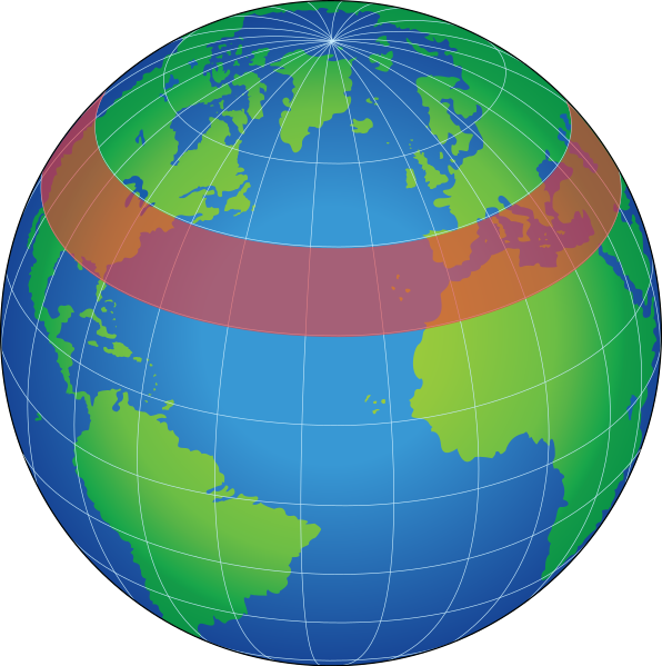
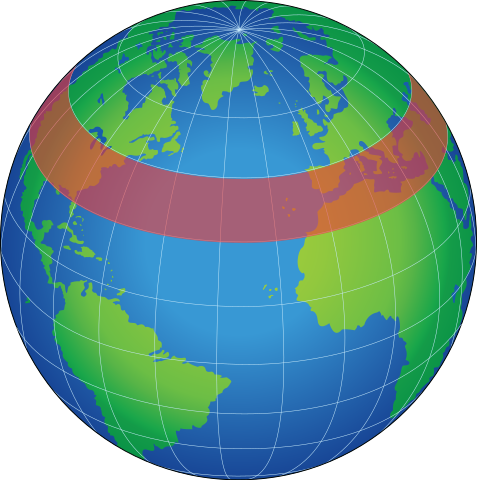
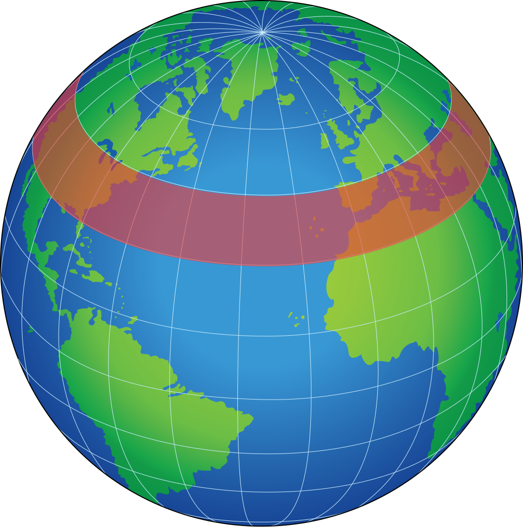
English: zonal band, a latitudinal circle (east-west direction) having any width in degrees latitude, used for the representation of data for an area of Earth's surface or atmosphere |
| Date | (UTC) |
| Source |
This file was derived from: |
| Author |
|


| This is a retouched picture, which means that it has been digitally altered from its original version. Modifications: Vectorized. The original can be viewed here: Globe Atlantic.svg:
|
Licensing
This image is a work of a U.S. military or Department of Defense employee, taken or made as part of that person's official duties. As a work of the U.S. federal government, the image is in the public domain in the United States.
|
 |
Original upload log
This image is a derivative work of the following images:
- File:Zonal_band.gif licensed with PD-USGov-NASA
- 2006-06-25T04:31:49Z Pflatau 485x485 (11219 Bytes) http://mynasadata.larc.nasa.gov/glossary.php?&word=ALL zonal band: a latitudinal circle (east-west direction) having any width in degrees latitude, used for the representation of data for an area of Earth's surface or atmos
- File:Globe_Atlantic.svg licensed with PD-USGov-Military
- 2008-10-18T20:04:36Z Clindberg 717x721 (60406 Bytes) {{Information |Description={{en|1=Globe graphic, centered on the northern Atlantic Ocean.}} |Source=Extracted from PDF version of the [http://www.disam.dsca.mil/pubs/archives.htm Vol 26-4 2004 DISAM Journal] (direct PDF URL [
Uploaded with derivativeFX
File history
Click on a date/time to view the file as it appeared at that time.
| Date/Time | Thumbnail | Dimensions | User | Comment | |
|---|---|---|---|---|---|
| current | 00:08, 23 January 2012 | | 717 × 721 (60 KB) | Rehua | == {{int:filedesc}} == {{Information |Description={{en|1=zonal band, a latitudinal circle (east-west direction) having any width in degrees latitude, used for the representation of data for an area of Earth's surface or atmosphere}} |Source={{Derived from |
File usage
The following pages on the English Wikipedia use this file (pages on other projects are not listed):
Global file usage
The following other wikis use this file:
- Usage on ca.wikipedia.org
- Usage on de.wikipedia.org
- Usage on hi.wikipedia.org
- Usage on hu.wikipedia.org
- Usage on pl.wikipedia.org
- Usage on www.wikidata.org