Size of this preview: 769 × 599 pixels. Other resolutions: 308 × 240 pixels | 616 × 480 pixels | 986 × 768 pixels | 1,214 × 946 pixels.
Original file (1,214 × 946 pixels, file size: 281 KB, MIME type: image/png)
File history
Click on a date/time to view the file as it appeared at that time.
| Date/Time | Thumbnail | Dimensions | User | Comment | |
|---|---|---|---|---|---|
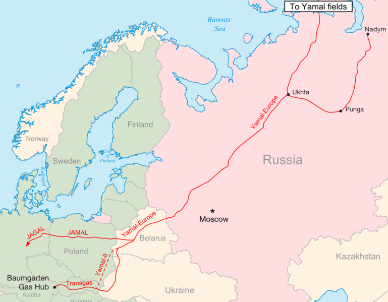
| current | 22:28, 15 November 2009 |  | 1,214 × 946 (281 KB) | Confuciou | {{Information |Description={{en|1=Map of the Yamal-Europe pipeline}} |Source={{own}} |Author=Samuel Bailey (sam.bailus@gmail.com) |Date=2009-11-15 |Permission= |other_versions= }} Category:Pipeline maps in Europe |
File usage
The following 3 pages use this file:
Global file usage
The following other wikis use this file:
- Usage on be-tarask.wikipedia.org
- Usage on be.wikipedia.org
- Usage on cs.wikipedia.org
- Usage on de.wikipedia.org
- Usage on fa.wikipedia.org
- Usage on fi.wikipedia.org
- Usage on fr.wikipedia.org
- Usage on it.wikipedia.org
- Usage on lt.wikipedia.org
- Usage on pl.wikipedia.org
- Usage on uk.wikipedia.org
- Usage on zh.wikipedia.org