
Size of this preview: 600 × 600 pixels. Other resolutions: 240 × 240 pixels | 480 × 480 pixels | 768 × 768 pixels | 1,024 × 1,024 pixels | 2,000 × 2,000 pixels.
Original file (2,000 × 2,000 pixels, file size: 3.11 MB, MIME type: image/jpeg)
| This is a file from the Wikimedia Commons. Information from its description page there is shown below. Commons is a freely licensed media file repository. You can help. |
Summary
| Description |
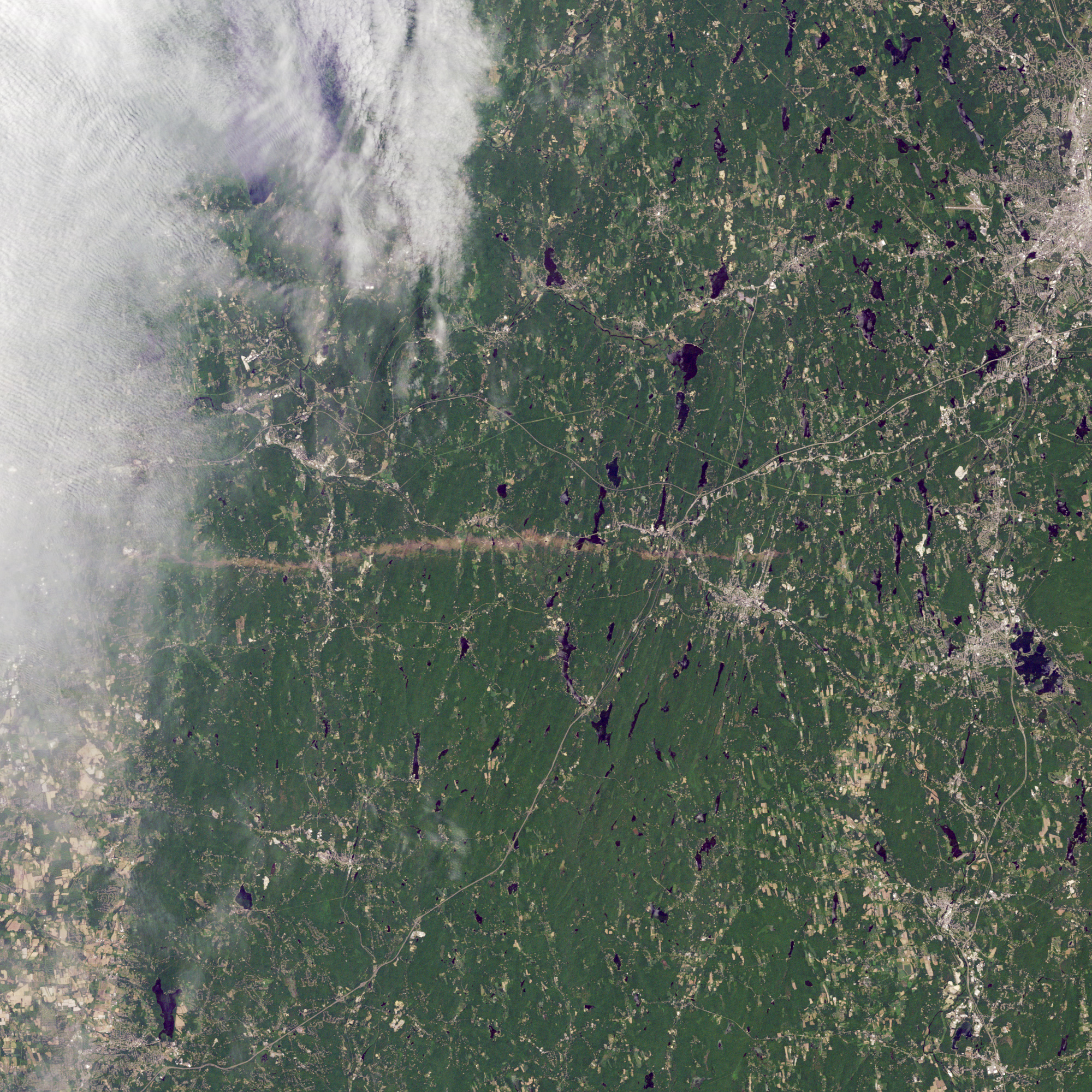
English: A view of a tornado path on June 5th, 2011. The tornado, which originated in Westfield, Massachusetts travelled thirty-nine miles east to Charlton, Massachusetts. The tornado itself occured on the afternoon of June 1st. The city of Worcester is to the northeast of the image. The path of the tornado crosses through rural towns before meeting up with U.S. Route 20 and paralleling the route for a few miles. It eventually crosses through Interstate 84 before ending in Charlton. |
| Date | |
| Source | http://eoimages.gsfc.nasa.gov/images/imagerecords/50000/50854/masstornado_tm5_2011156_lrg.jpg |
| Author | Landsat 5 |
Licensing
| This file is in the public domain in the United States because it was solely created by NASA. NASA copyright policy states that "NASA material is not protected by copyright unless noted". (See Template:PD-USGov, NASA copyright policy page or JPL Image Use Policy.) | ||
 |
Warnings:
|
File history
Click on a date/time to view the file as it appeared at that time.
| Date/Time | Thumbnail | Dimensions | User | Comment | |
|---|---|---|---|---|---|
| current | 22:58, 6 June 2011 | | 2,000 × 2,000 (3.11 MB) | Ktr101 |
File usage
The following pages on the English Wikipedia use this file (pages on other projects are not listed):