
Size of this PNG preview of this SVG file: 800 × 475 pixels. Other resolutions: 320 × 190 pixels | 640 × 380 pixels | 1,024 × 608 pixels | 1,280 × 760 pixels | 2,560 × 1,520 pixels | 1,152 × 684 pixels.
Original file (SVG file, nominally 1,152 × 684 pixels, file size: 58 KB)
| This is a file from the Wikimedia Commons. Information from its description page there is shown below. Commons is a freely licensed media file repository. You can help. |
Summary
| Description |
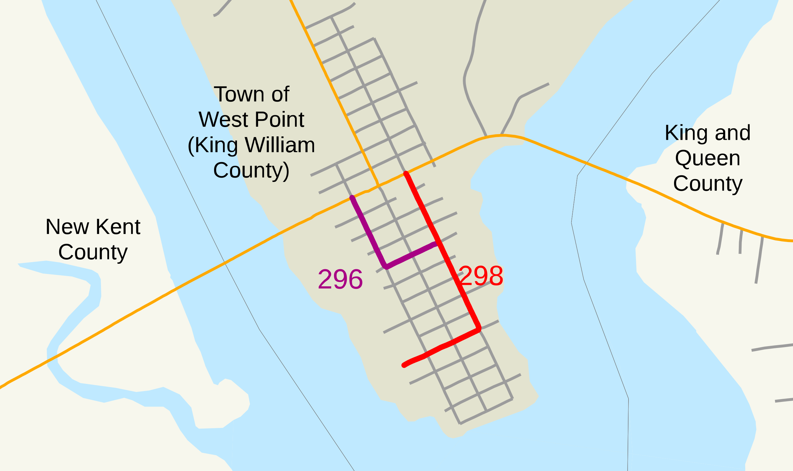
This is a map of Virginia's State Routes 296 and 298, generated from GIS data. The following data has been used: |
| Date | 8 October 2006 (original upload date) |
| Source | No machine-readable source provided. Own work assumed (based on copyright claims). |
| Author | No machine-readable author provided. NE2 assumed (based on copyright claims). |
Licensing
| I, the copyright holder of this work, release this work into the public domain. This applies worldwide. In some countries this may not be legally possible; if so: I grant anyone the right to use this work for any purpose, without any conditions, unless such conditions are required by law. |
File history
Click on a date/time to view the file as it appeared at that time.
| Date/Time | Thumbnail | Dimensions | User | Comment | |
|---|---|---|---|---|---|
| current | 14:32, 9 October 2006 | | 1,152 × 684 (58 KB) | NE2 | Added water. |
| 06:45, 8 October 2006 |  | 1,152 × 684 (51 KB) | NE2 | Reverted to earlier revision | |
| 06:45, 8 October 2006 |  | 1,152 × 684 (51 KB) | NE2 | Reverted to earlier revision | |
| 06:45, 8 October 2006 |  | 1,152 × 684 (51 KB) | NE2 | It looks like the old one was fine (though it's annoying that the text isn't actually placed where ArcMap shows it); it just took a little while to refresh. | |
| 06:43, 8 October 2006 |  | 1,152 × 684 (51 KB) | NE2 | I don't understand this. | |
| 06:41, 8 October 2006 |  | 1,152 × 684 (51 KB) | NE2 | Text positioning was screwed up. | |
| 06:40, 8 October 2006 |  | 1,152 × 684 (51 KB) | NE2 | Removed the border and enlarged the map. | |
| 06:31, 8 October 2006 |  | 290 × 172 (50 KB) | NE2 | This is my first test of an SVG exported from ArcMap. |
File usage
The following pages on the English Wikipedia use this file (pages on other projects are not listed):