Size of this preview: 747 × 600 pixels. Other resolutions: 299 × 240 pixels | 598 × 480 pixels | 956 × 768 pixels | 1,275 × 1,024 pixels | 1,433 × 1,151 pixels.
Original file (1,433 × 1,151 pixels, file size: 891 KB, MIME type: image/jpeg)
| This is a file from the Wikimedia Commons. Information from its description page there is shown below. Commons is a freely licensed media file repository. You can help. |
Summary
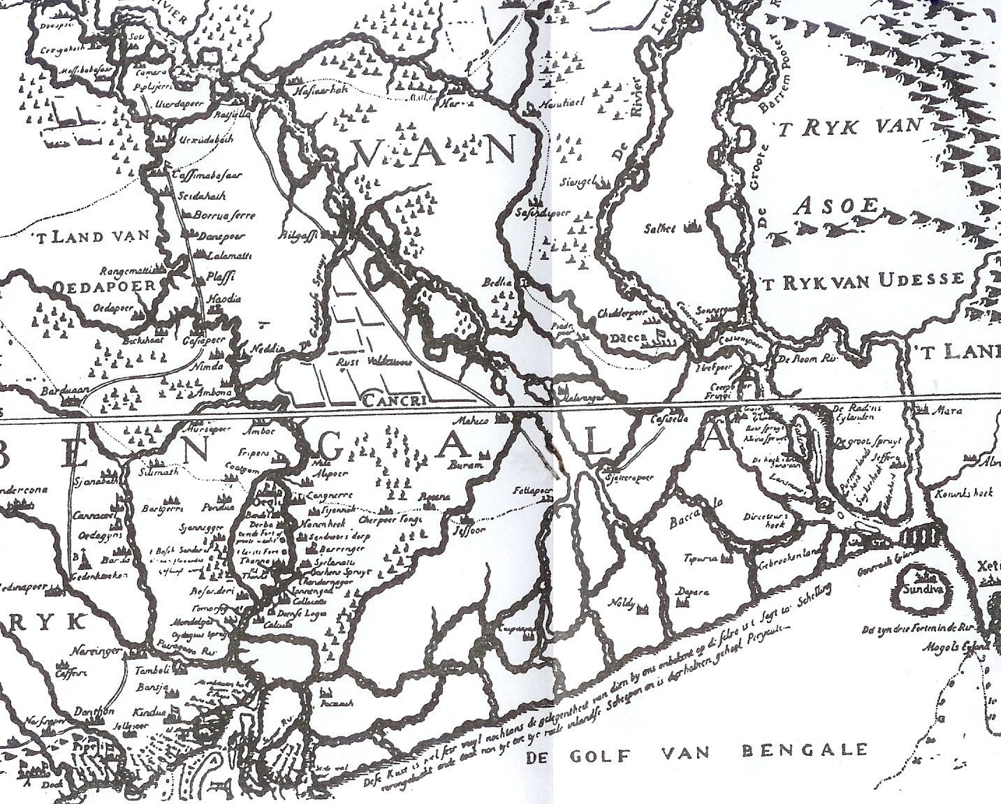
| Description | This is one of the earliest published maps of Bengal. This early map is, however, an inaccurate depiction. The map was published in 1660. |
| Date | |
| Source | Bangalir Itihas by Niharranjan Roy, Bengali, first published 1972, reprint 2005, Dey’s Publishing, 13 Bankim Chatterjee Street, Kolkata, ISBN 81-7079-270-3 |
| Author | Van den Brouck |
Licensing
|
This work is in the public domain in its country of origin and other countries and areas where the copyright term is the author's life plus 100 years or fewer. | |
| This file has been identified as being free of known restrictions under copyright law, including all related and neighboring rights. | |
Original upload log
The original description page was here. All following user names refer to en.wikipedia.
- 2007-11-21 06:54 P.K.Niyogi 1433×1151× (968840 bytes) Source: ''Bangalir Itihas'' by Niharranjan Roy {{Bn icon}}. The map was published in 1660
File history
Click on a date/time to view the file as it appeared at that time.
| Date/Time | Thumbnail | Dimensions | User | Comment | |
|---|---|---|---|---|---|
| current | 07:51, 23 October 2015 | | 1,433 × 1,151 (891 KB) | Opencooper | Remove bug from center of image |
| 20:51, 20 October 2011 |  | 1,433 × 1,151 (946 KB) | OgreBot | (BOT): Uploading old version of file from en.wikipedia; originally uploaded on 2007-11-21 06:54:33 by P.K.Niyogi | |
| 06:34, 24 November 2007 |  | 747 × 600 (165 KB) | Tarif | {{Information |Description= |Source= |Date= |Author= |Permission={{PD-old}} |other_versions= }} |
File usage
The following pages on the English Wikipedia use this file (pages on other projects are not listed):
Global file usage
The following other wikis use this file:
- Usage on as.wikipedia.org
- Usage on bh.wikipedia.org
- Usage on bn.wikipedia.org
- Usage on de.wikipedia.org
- Usage on es.wikipedia.org
- Usage on sat.wikipedia.org
- Usage on sl.wikipedia.org
- Usage on ta.wikipedia.org