
Original file (1,280 × 960 pixels, file size: 164 KB, MIME type: image/jpeg)
| This is a file from the Wikimedia Commons. Information from its description page there is shown below. Commons is a freely licensed media file repository. You can help. |
Summary
| Description |
La Grande is a city in Union County, Oregon, United States.The population was 13,082 at the 2010 census. It is the county seat of Union County. La Grande lies east of the Blue Mountains and southeast of Pendleton. The Grande Ronde Valley had long been a waypoint along the Oregon Trail. The first permanent settler in the La Grande area was Benjamin Brown in 1861. La Grande was incorporated as a city in 1865, and platted in 1868. La Grande grew rapidly during the late 1860s and early 1870s, partially because of the many gold mines in the region and the valley's agricultural capabilities. The early business establishments centered on C Avenue between present day Fourth Street and the hillside on the west end. La Grande's Eastern Oregon University, formerly known as Eastern Oregon State College, began in 1929 as Eastern Oregon Normal School, a teachers college. La Grande had a factory for processing sugar beets into raw sugar. The sugar beets came from the nearby Mormon town of Nibley, Oregon, and both were owned by the Oregon Sugar Company. en.wikipedia.org/wiki/La_Grande,_Oregon en.wikipedia.org/wiki/Wikipedia:Text_of_Creative_Commons_... |
| Date | |
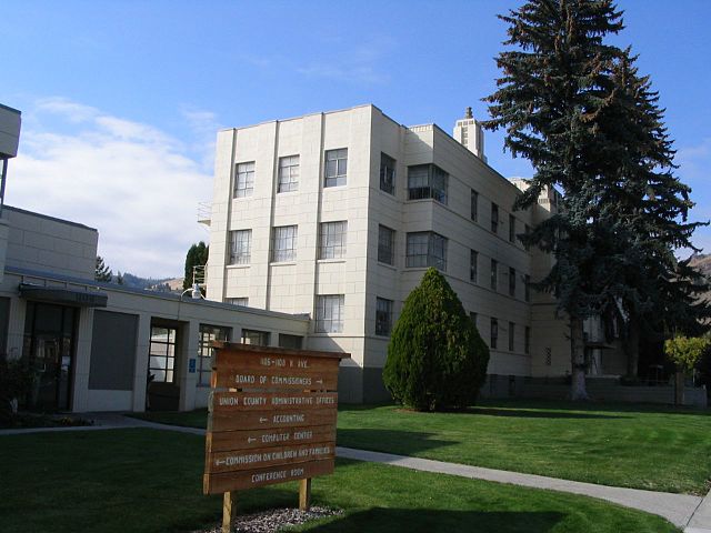
| Source | Union County Courthouse, La Grande, Oregon |
| Author | Ken Lund from Reno, Nevada, USA |
| Camera location | | View this and other nearby images on: OpenStreetMap |
|---|
Licensing
- You are free:
- to share – to copy, distribute and transmit the work
- to remix – to adapt the work
- Under the following conditions:
- attribution – You must give appropriate credit, provide a link to the license, and indicate if changes were made. You may do so in any reasonable manner, but not in any way that suggests the licensor endorses you or your use.
- share alike – If you remix, transform, or build upon the material, you must distribute your contributions under the same or compatible license as the original.
| This image was originally posted to Flickr by Ken Lund at https://flickr.com/photos/75683070@N00/265581433. It was reviewed on 23 January 2016 by FlickreviewR and was confirmed to be licensed under the terms of the cc-by-sa-2.0. |
File history
Click on a date/time to view the file as it appeared at that time.
| Date/Time | Thumbnail | Dimensions | User | Comment | |
|---|---|---|---|---|---|
| current | 04:23, 23 January 2016 | | 1,280 × 960 (164 KB) | Kingofthedead | Transferred from Flickr via Flickr2Commons |
File usage
Global file usage
The following other wikis use this file:
- Usage on ar.wikipedia.org
- Usage on ceb.wikipedia.org
- Usage on ce.wikipedia.org
- Usage on cy.wikipedia.org
- Usage on eo.wikipedia.org
- Usage on es.wikipedia.org
- Usage on fr.wikipedia.org
- Usage on hu.wikipedia.org
- Usage on hy.wikipedia.org
- Usage on it.wikipedia.org
- Usage on ko.wikipedia.org
- Usage on no.wikipedia.org
- Usage on pl.wikipedia.org
- Usage on ru.wikipedia.org
- Usage on sr.wikipedia.org
- Usage on tr.wikipedia.org
- Usage on tt.wikipedia.org
- Usage on ur.wikipedia.org
- Usage on www.wikidata.org