
Size of this preview: 794 × 600 pixels. Other resolutions: 318 × 240 pixels | 636 × 480 pixels | 829 × 626 pixels.
Original file (829 × 626 pixels, file size: 90 KB, MIME type: image/jpeg)
| This is a file from the Wikimedia Commons. Information from its description page there is shown below. Commons is a freely licensed media file repository. You can help. |
Summary
| Description |
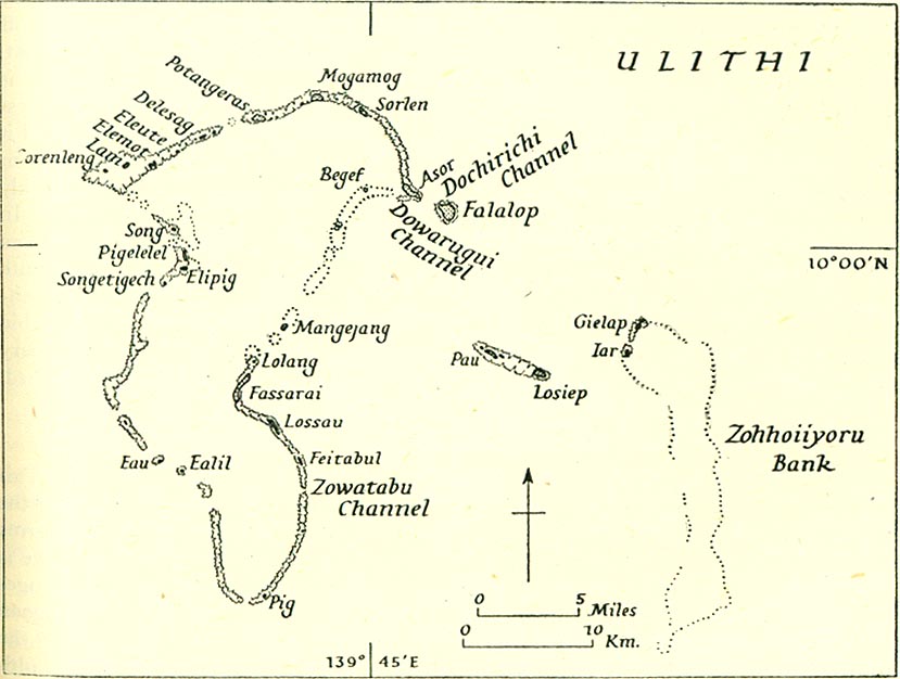
English: map of Ulithi Atoll, Yap State, Federated States of Micronesia (Pacific Ocean) |
| Date | before 1945 |
| Source | http://lib.utexas.edu/maps/historical/pacific_islands_1943_1945/ulithi.jpg |
| Author | Unknown author |
| Permission (Reusing this file) |
http://lib.utexas.edu/maps/faq.html |
Licensing
This file is a work of a sailor or employee of the U.S. Navy, taken or made as part of that person's official duties. As a work of the U.S. federal government, it is in the public domain in the United States.
|
 | |
| This file has been identified as being free of known restrictions under copyright law, including all related and neighboring rights. | ||
File history
Click on a date/time to view the file as it appeared at that time.
| Date/Time | Thumbnail | Dimensions | User | Comment | |
|---|---|---|---|---|---|
| current | 21:50, 16 December 2009 | | 829 × 626 (90 KB) | Ratzer | {{Information |Description={{en|1=map of Ulithi Atoll, Yap State, Federated States of Micronesia (Pacific Ocean)}} |Source=http://lib.utexas.edu/maps/historical/pacific_islands_1943_1945/ulithi.jpg |Author=unidentified |Date=pre-1945 |Permission=http://li |
File usage
The following pages on the English Wikipedia use this file (pages on other projects are not listed):
Global file usage
The following other wikis use this file:
- Usage on ast.wikipedia.org
- Usage on ceb.wikipedia.org
- Usage on de.wikipedia.org
- Usage on eo.wikipedia.org
- Usage on fa.wikipedia.org
- Usage on fr.wikipedia.org
- Usage on he.wikipedia.org
- Usage on ja.wikipedia.org
- Usage on pt.wikipedia.org
- Usage on tr.wikipedia.org
- Usage on www.wikidata.org