
Size of this preview: 800 × 557 pixels. Other resolutions: 320 × 223 pixels | 640 × 446 pixels | 1,024 × 713 pixels | 1,280 × 892 pixels | 1,470 × 1,024 pixels.
Original file (1,470 × 1,024 pixels, file size: 239 KB, MIME type: image/jpeg)
| This is a file from the Wikimedia Commons. Information from its description page there is shown below. Commons is a freely licensed media file repository. You can help. |
Summary
| Description |
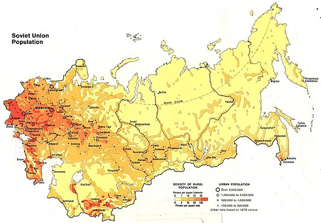
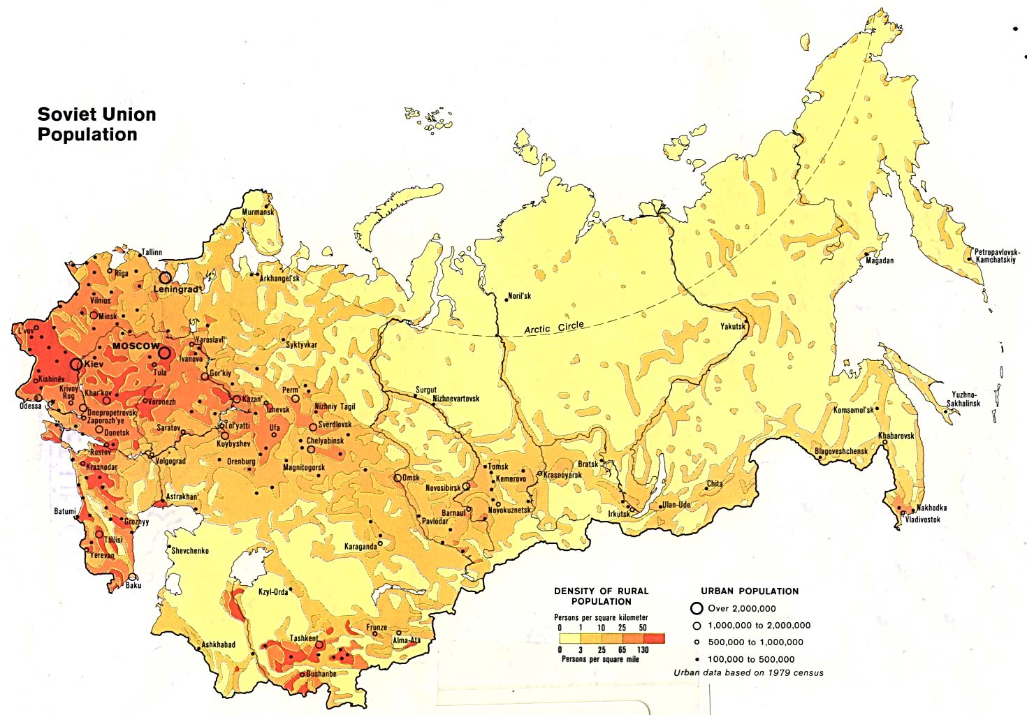
English: Soviet Union population density map 1982.(based on USSR 1979 census data)
Українська: Карта густоти населення Радянського союзу 1982 року. (По даним перепису населення СРСР 1979 року)
Русский: Карта плотности населения СССР 1982 года (на основе переписи населения 1979 года) |
| Date | |
| Source |
http://www.lib.utexas.edu/maps/commonwealth/soviet_pop_82.jpg This map provided courtesy of the University of Texas Libraries, The University of Texas at Austin. |
| Author | The University of Texas at Austin |
Licensing
| This work has been released into the public domain by its copyright holder, The University of Texas at Austin. This applies worldwide. In some countries this may not be legally possible; if so: The University of Texas at Austin grants anyone the right to use this work for any purpose, without any conditions, unless such conditions are required by law.
|
File history
Click on a date/time to view the file as it appeared at that time.
| Date/Time | Thumbnail | Dimensions | User | Comment | |
|---|---|---|---|---|---|
| current | 22:14, 20 August 2010 | | 1,470 × 1,024 (239 KB) | RonRodex | {{Information |Description={{en|1=Soviet Union population density map 1982.(based on USSR 1979 census data)}} {{uk|1=Карта густоти населення Радянського союзу 1982 року. (По даним перепису насел |
File usage
The following pages on the English Wikipedia use this file (pages on other projects are not listed):
Global file usage
The following other wikis use this file:
- Usage on el.wikipedia.org
- Usage on lt.wikipedia.org
- Usage on pt.wikipedia.org
- Usage on ru.wikipedia.org
- Usage on sv.wikipedia.org
- Usage on tr.wikipedia.org
- Usage on uk.wikipedia.org
- Usage on vi.wikipedia.org
- Usage on zh.wikipedia.org