
Size of this preview: 800 × 534 pixels. Other resolutions: 320 × 214 pixels | 640 × 427 pixels | 1,024 × 683 pixels | 1,500 × 1,001 pixels.
Original file (1,500 × 1,001 pixels, file size: 510 KB, MIME type: image/jpeg)
| This is a file from the Wikimedia Commons. Information from its description page there is shown below. Commons is a freely licensed media file repository. You can help. |
| Description |
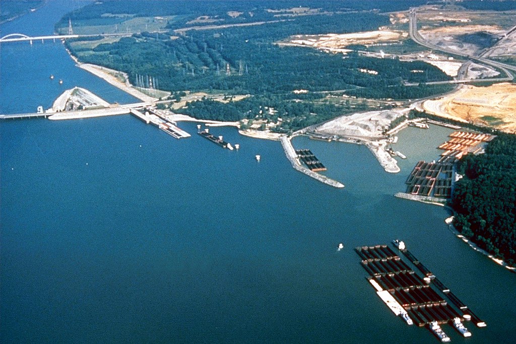
English: Kentucky Lock and Dam at the lower end of Kentucky Lake near Grand Rivers, Kentucky, USA. The lock and dam impound the 184-mile (296 km) Kentucky Lake and provide flood control, river navigation, hydroelectric power production, and recreation. The lock is operated and maintained by the U.S. Army Corps of Engineers. |
|||
| Date | not specified or unknown | |||
| Source |
U.S. Army Corps of Engineers Digital Visual Library Image page Image description page Digital Visual Library home page |
|||
| Author | George Green, U.S. Army Corps of Engineers | |||
| Permission (Reusing this file) |
|
| Camera location | | View this and other nearby images on: OpenStreetMap |
|---|
File history
Click on a date/time to view the file as it appeared at that time.
| Date/Time | Thumbnail | Dimensions | User | Comment | |
|---|---|---|---|---|---|
| current | 03:39, 27 March 2007 | | 1,500 × 1,001 (510 KB) | DanMS | {{Information | Description = {{en|Kentucky Lock and Dam at the lower end of Kentucky Lake near Grand Rivers, Kentucky, USA. The lock and dam impound the 184-mile (296 km) Kentucky Lake and provide flood control, river navigation, hydroelectric power |
File usage
The following pages on the English Wikipedia use this file (pages on other projects are not listed):
Global file usage
The following other wikis use this file:
- Usage on hu.wikipedia.org
- Usage on ja.wikipedia.org