No higher resolution available.
Trig_point_within_Bartine_Castle,_Bartinney_Downs_-_geograph.org.uk_-_40934.jpg (640 × 480 pixels, file size: 178 KB, MIME type: image/jpeg)
| This is a file from the Wikimedia Commons. Information from its description page there is shown below. Commons is a freely licensed media file repository. You can help. |
Summary
| Description |
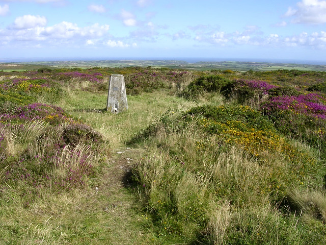
English: Trig point within Bartine Castle, Bartinney Downs. The castle is in fact an iron age inclosure, whose circular earthen bank still remains on top of this broad hill. Much of the hill is covered with gorse and heather, with the remains of prehistoric settlement below. |
| Date | |
| Source | From geograph.org.uk |
| Author | Jim Champion |
| Attribution (required by the license) | Jim Champion / Trig point within Bartine Castle, Bartinney Downs / |
| Object location | | View this and other nearby images on: OpenStreetMap |
|---|
_&language=en)
Licensing

|
This image was taken from the Geograph project collection. See this photograph's page on the Geograph website for the photographer's contact details. The copyright on this image is owned by Jim Champion and is licensed for reuse under the Creative Commons Attribution-ShareAlike 2.0 license.
|
This file is licensed under the Creative Commons Attribution-Share Alike 2.0 Generic license.
Attribution: Jim Champion
- You are free:
- to share – to copy, distribute and transmit the work
- to remix – to adapt the work
- Under the following conditions:
- attribution – You must give appropriate credit, provide a link to the license, and indicate if changes were made. You may do so in any reasonable manner, but not in any way that suggests the licensor endorses you or your use.
- share alike – If you remix, transform, or build upon the material, you must distribute your contributions under the same or compatible license as the original.
File history
Click on a date/time to view the file as it appeared at that time.
| Date/Time | Thumbnail | Dimensions | User | Comment | |
|---|---|---|---|---|---|
| current | 19:54, 30 January 2010 | | 640 × 480 (178 KB) | GeographBot | == {{int:filedesc}} == {{Information |description={{en|1=Trig point within Bartine Castle, Bartinney Downs. The castle is in fact an iron age inclosure, whose circular earthen bank still remains on top of this broad hill. Much of the hill is covered with |
File usage
The following pages on the English Wikipedia use this file (pages on other projects are not listed):