Size of this preview: 739 × 599 pixels. Other resolutions: 296 × 240 pixels | 592 × 480 pixels | 947 × 768 pixels | 1,263 × 1,024 pixels | 1,599 × 1,297 pixels.
Original file (1,599 × 1,297 pixels, file size: 113 KB, MIME type: image/gif)
| This is a file from the Wikimedia Commons. Information from its description page there is shown below. Commons is a freely licensed media file repository. You can help. |
Summary
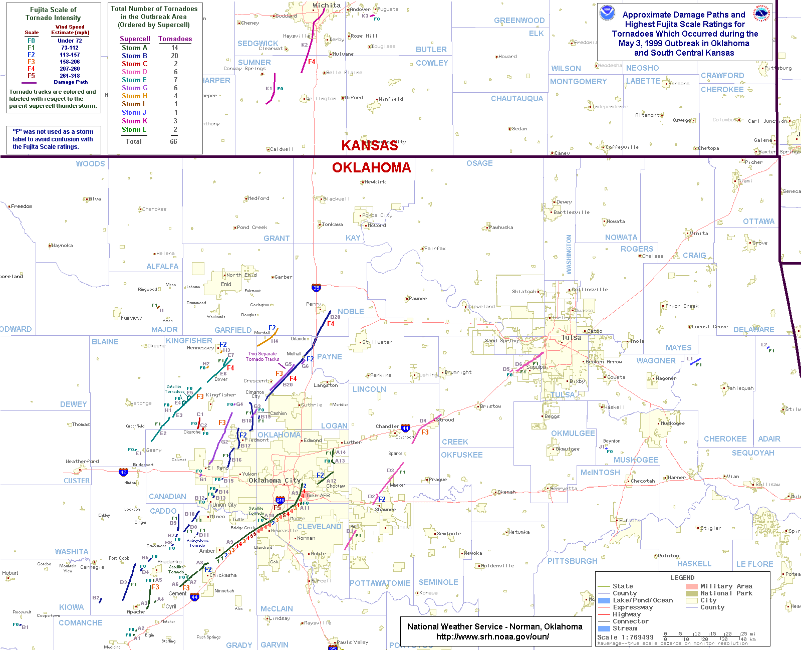
| Description | Map of all tornadoes in Oklahoma and Kansas and their tracks in the 1999 Oklahoma tornado outbreak |
| Date | |
| Source | http://www.srh.noaa.gov/images/oun/wxevents/19990503/maps/bigmap.gif |
| Author | National Weather Service Norman, Oklahoma |
| Other versions | The File:1999-05-03 bigoutbreak.png is showing only the Oklahoma State tornadoes. |
Licensing
This image is in the public domain because it contains materials that originally came from the U.S. National Oceanic and Atmospheric Administration, taken or made as part of an employee's official duties.
|
File history
Click on a date/time to view the file as it appeared at that time.
| Date/Time | Thumbnail | Dimensions | User | Comment | |
|---|---|---|---|---|---|
| current | 04:19, 11 April 2010 | | 1,599 × 1,297 (113 KB) | Ks0stm | Map of all tornadoes and their tracks in the w:1999 Oklahoma tornado outbreakCategory:Tornado track maps Category:Tornadoes of 1999 |
File usage
The following pages on the English Wikipedia use this file (pages on other projects are not listed):