No higher resolution available.
The_former_military_railway_station_at_Trawsfynydd_-_geograph.org.uk_-_510965.jpg (640 × 480 pixels, file size: 141 KB, MIME type: image/jpeg)
| This is a file from the Wikimedia Commons. Information from its description page there is shown below. Commons is a freely licensed media file repository. You can help. |
Summary
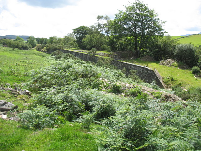
| Description |
English: The former military railway station at Trawsfynydd. This was located a little way to the north of Trawfynydd station and was used by the army to handle men, horses and artillery. The artillery range closed in the late 1950s and the station was than abandoned. The section of the line between Bala and Llandudno Junction south of the Trawsfynydd Nuclear Power Station was dismantled in the early 1960s. The platform of the military station is well preserved. |
| Date | |
| Source | From geograph.org.uk |
| Author | Eric Jones |
| Attribution (required by the license) | Eric Jones / The former military railway station at Trawsfynydd / |
| Camera location | | View this and other nearby images on: OpenStreetMap |
|---|
_heading:180.00&language=en)
| Object location | | View this and other nearby images on: OpenStreetMap |
|---|
_heading:180.00&language=en)
Licensing

|
This image was taken from the Geograph project collection. See this photograph's page on the Geograph website for the photographer's contact details. The copyright on this image is owned by Eric Jones and is licensed for reuse under the Creative Commons Attribution-ShareAlike 2.0 license.
|
This file is licensed under the Creative Commons Attribution-Share Alike 2.0 Generic license.
Attribution: Eric Jones
- You are free:
- to share – to copy, distribute and transmit the work
- to remix – to adapt the work
- Under the following conditions:
- attribution – You must give appropriate credit, provide a link to the license, and indicate if changes were made. You may do so in any reasonable manner, but not in any way that suggests the licensor endorses you or your use.
- share alike – If you remix, transform, or build upon the material, you must distribute your contributions under the same or compatible license as the original.
File history
Click on a date/time to view the file as it appeared at that time.
| Date/Time | Thumbnail | Dimensions | User | Comment | |
|---|---|---|---|---|---|
| current | 14:15, 5 February 2011 | | 640 × 480 (141 KB) | GeographBot | == {{int:filedesc}} == {{Information |description={{en|1=The former military railway station at Trawsfynydd This was located a little way to the north of Trawfynydd station and was used by the army to handle men, horses and artillery. The artillery range |
File usage
The following pages on the English Wikipedia use this file (pages on other projects are not listed):