No higher resolution available.
The_A686_below_Hartside_-_geograph.org.uk_-_1073084.jpg (640 × 480 pixels, file size: 147 KB, MIME type: image/jpeg)
| This is a file from the Wikimedia Commons. Information from its description page there is shown below. Commons is a freely licensed media file repository. You can help. |
Summary
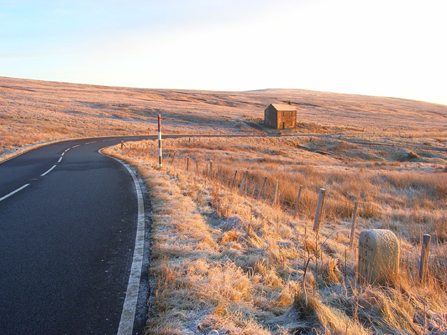
| Description |
English: The A686 below Hartside The road here is on a long gradual descent into the South Tyne valley. The road, which connects Penrith and Haydon Bridge, is beloved of bikers and was named one of the greatest drives in the country by the AA. Cumbria County Council are responsible for keeping the Cumbrian part free of snow and ice but do not grit the section between Melmerby and Alston after sunset due to safety concerns. |
| Date | |
| Source | From geograph.org.uk |
| Author | Andrew Smith |
| Attribution (required by the license) | Andrew Smith / The A686 below Hartside / |
| Camera location | | View this and other nearby images on: OpenStreetMap |
|---|
_heading:45.00&language=en)
| Object location | | View this and other nearby images on: OpenStreetMap |
|---|
_heading:45.00&language=en)
Licensing

|
This image was taken from the Geograph project collection. See this photograph's page on the Geograph website for the photographer's contact details. The copyright on this image is owned by Andrew Smith and is licensed for reuse under the Creative Commons Attribution-ShareAlike 2.0 license.
|
This file is licensed under the Creative Commons Attribution-Share Alike 2.0 Generic license.
Attribution: Andrew Smith
- You are free:
- to share – to copy, distribute and transmit the work
- to remix – to adapt the work
- Under the following conditions:
- attribution – You must give appropriate credit, provide a link to the license, and indicate if changes were made. You may do so in any reasonable manner, but not in any way that suggests the licensor endorses you or your use.
- share alike – If you remix, transform, or build upon the material, you must distribute your contributions under the same or compatible license as the original.
File history
Click on a date/time to view the file as it appeared at that time.
| Date/Time | Thumbnail | Dimensions | User | Comment | |
|---|---|---|---|---|---|
| current | 08:36, 24 February 2011 | | 640 × 480 (147 KB) | GeographBot | == {{int:filedesc}} == {{Information |description={{en|1=The A686 below Hartside The road here is on a long gradual descent into the South Tyne valley. The road, which connects Penrith and Haydon Bridge, is beloved of bikers and was named one of the great |
File usage
The following pages on the English Wikipedia use this file (pages on other projects are not listed):
Global file usage
The following other wikis use this file:
- Usage on www.wikidata.org