.jpg)
.jpg&action=edit&redlink=1)
Size of this preview: 800 × 587 pixels. Other resolutions: 320 × 235 pixels | 640 × 469 pixels | 1,024 × 751 pixels | 1,280 × 938 pixels | 2,560 × 1,877 pixels | 3,339 × 2,448 pixels.
Original file (3,339 × 2,448 pixels, file size: 1.66 MB, MIME type: image/jpeg)
| This is a file from the Wikimedia Commons. Information from its description page there is shown below. Commons is a freely licensed media file repository. You can help. |
.jpg)
Summary
| Description |
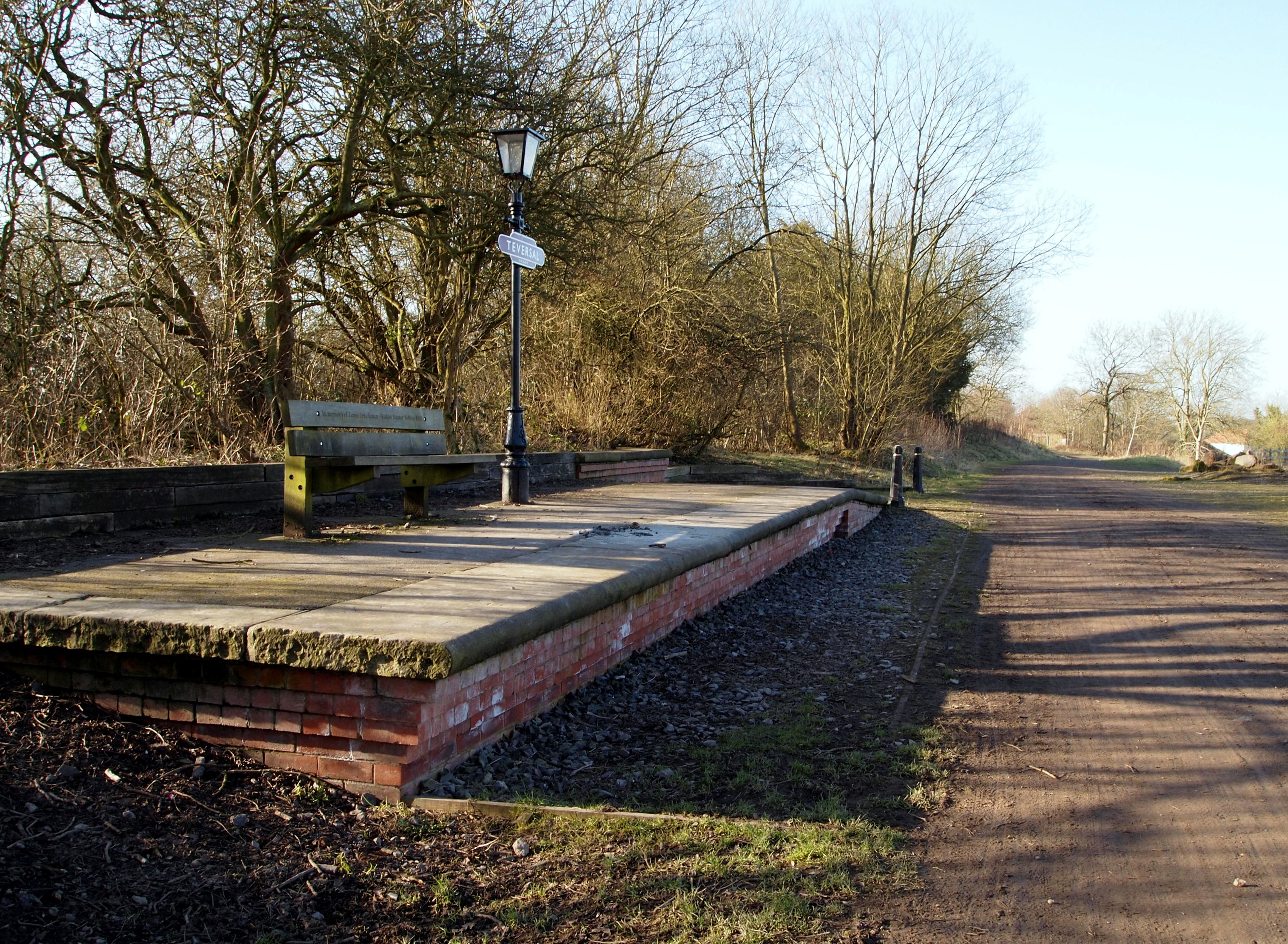
English: Teversal Manor Station, Fackley NG17, Notts Teversal Manor Station functioned between 1866-1963 when it finally ceased to function - for passengers at least - as a result of the Beeching British Railways rationalisation programme. The line linked with Pleasley. This (replica ?) platform on what is now a cycling and rambling trail is approximately 5 minutes walk from The Carnarvon Arms pub in Fackley - alongside the B6014 road - and it can be accessed ahead through the gate and footpath on the right. The bench commemorates the service of Louis Zelickman, the final Station Master, who worked here between 1946-64. When station closed, and following his retirement, he continued to live at the nearby Station Master's House until his death in 2008. |
| Date | |
| Source | From geograph.org.uk |
| Author | David Hallam-Jones |
| Permission (Reusing this file) |
Creative Commons Attribution Share-alike license 2.0 |
| Attribution (required by the license) | David Hallam-Jones / Teversal Manor Station, Fackley NG17, Notts. / |
| Camera location | | View this and other nearby images on: OpenStreetMap |
|---|
.jpg¶ms=053.147608_N_-001.287369_E_globe:Earth_type:camera_source:geograph-osgb36(SK47766140)_heading:225.00&language=en)
| Object location | | View this and other nearby images on: OpenStreetMap |
|---|
.jpg¶ms=053.147430_N_-001.287520_E_globe:Earth_class:object_type:object_source:geograph-osgb36(SK47756138)_heading:225.00&language=en)
Licensing

|
This image was taken from the Geograph project collection. See this photograph's page on the Geograph website for the photographer's contact details. The copyright on this image is owned by David Hallam-Jones and is licensed for reuse under the Creative Commons Attribution-ShareAlike 2.0 license.
|
This file is licensed under the Creative Commons Attribution-Share Alike 2.0 Generic license.
Attribution: David Hallam-Jones
- You are free:
- to share – to copy, distribute and transmit the work
- to remix – to adapt the work
- Under the following conditions:
- attribution – You must give appropriate credit, provide a link to the license, and indicate if changes were made. You may do so in any reasonable manner, but not in any way that suggests the licensor endorses you or your use.
- share alike – If you remix, transform, or build upon the material, you must distribute your contributions under the same or compatible license as the original.
File history
Click on a date/time to view the file as it appeared at that time.
| Date/Time | Thumbnail | Dimensions | User | Comment | |
|---|---|---|---|---|---|
| current | 09:56, 6 December 2020 | | 3,339 × 2,448 (1.66 MB) | Lamberhurst | Transferred from geograph.co.uk using [https://tools.wmflabs.org/geograph2commons/ geograph2commons] |
File usage
The following pages on the English Wikipedia use this file (pages on other projects are not listed):
.jpg)