No higher resolution available.
Tetley_Bitter_Advert_on_Bradford_Trolleybus_Cropped.jpg (333 × 236 pixels, file size: 79 KB, MIME type: image/jpeg)
| This is a file from the Wikimedia Commons. Information from its description page there is shown below. Commons is a freely licensed media file repository. You can help. |
| Description |
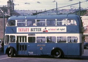
English: Bradford Trolleybus turning at Thackley Corner. BUT Trolleybus 831 (LHN 781) is turning at Thackley Corner where the A657 (Leeds Road) meets with Town Lane. Route 41 turned round here, although this vehicle was on a private tour. |
| Date | |
| Source |
This file was derived from: Bradford Trolleybus turning at Thackley Corner - geograph.org.uk - 1299446.jpg |
| Author |
|
| Other versions |
 Bradford Trolleybus turning at Thackley Corner - geograph.org.uk - 1299446.jpg (original) Bradford Trolleybus turning at Thackley Corner - geograph.org.uk - 1299446.jpg (original) |
| Camera location | | View this and other nearby images on: OpenStreetMap |
|---|
_region:GB-ENG_heading:337.00&language=en)
| Object location | | View this and other nearby images on: OpenStreetMap |
|---|
_region:GB-ENG_heading:337.00&language=en)
| This is a retouched picture, which means that it has been digitally altered from its original version. Modifications: Cropped for use in particular article (focusing on point of interest given limited space). The original can be viewed here: Bradford Trolleybus turning at Thackley Corner - geograph.org.uk - 1299446.jpg:
|
This file is licensed under the Creative Commons Attribution-Share Alike 2.0 Generic license.
Attribution: David Hillas]
- You are free:
- to share – to copy, distribute and transmit the work
- to remix – to adapt the work
- Under the following conditions:
- attribution – You must give appropriate credit, provide a link to the license, and indicate if changes were made. You may do so in any reasonable manner, but not in any way that suggests the licensor endorses you or your use.
- share alike – If you remix, transform, or build upon the material, you must distribute your contributions under the same or compatible license as the original.
Original upload log
This image is a derivative work of the following images:
- File:Bradford_Trolleybus_turning_at_Thackley_Corner_-_geograph.org.uk_-_1299446.jpg licensed with Cc-by-sa-2.0, Geograph
- 2009-05-18T20:37:47Z File Upload Bot (Magnus Manske) 640x456 (61058 Bytes) == Summary == {{Information |Description=Bradford Trolleybus turning at Thackley Corner |Source=From [http://www.geograph.org.uk/photo/1299446 geograph.org.uk]; transferred by [[User:oxyman]] using [http://toolserver.org/~magn
Uploaded with derivativeFX
File history
Click on a date/time to view the file as it appeared at that time.
| Date/Time | Thumbnail | Dimensions | User | Comment | |
|---|---|---|---|---|---|
| current | 17:41, 15 September 2023 | | 333 × 236 (79 KB) | VulpesVulpes42 | Reverted to version as of 21:13, 23 August 2011 (UTC) Undid unrealistic artificial AI upscaling. |
| 06:31, 20 March 2023 |  | 666 × 472 (116 KB) | Schvaxet | Updated the image with a newer AI upscale | |
| 18:43, 16 February 2021 |  | 2,664 × 1,878 (1.55 MB) | Vkem | improved | |
| 21:13, 23 August 2011 |  | 333 × 236 (79 KB) | Ubcule | {{Information |Description=Bradford Trolleybus turning at Thackley Corner |Source=*File:Bradford_Trolleybus_turning_at_Thackley_Corner_-_geograph.org.uk_-_1299446.jpg |Date=2011-08-23 21:12 (UTC) |Author=*[[:File:Bradford_Trolleybus_turning_at_Thack |
File usage
The following pages on the English Wikipedia use this file (pages on other projects are not listed):
Global file usage
The following other wikis use this file:
- Usage on ca.wikipedia.org
- Usage on de.wikipedia.org