
Original file (3,264 × 2,448 pixels, file size: 4.2 MB, MIME type: image/png)
| This is a file from the Wikimedia Commons. Information from its description page there is shown below. Commons is a freely licensed media file repository. You can help. |
| Description |
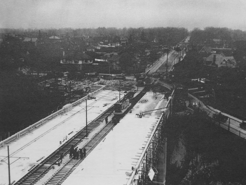
English: Construction of the bridge that carries St Clair Avenue East over David A. Balfour ravine in 1924. View is facing east towards what would later become the Mount Pleasant Extension. Toronto, Ontario, Canada. |
|||||
| Date | ||||||
| Source |
|
|||||
| Author | Unknown author | |||||
| Permission (Reusing this file) |
|
|||||
| Other versions | Derivative works of this file: St Clair Bridge, 1924.jpg |

File history
Click on a date/time to view the file as it appeared at that time.
| Date/Time | Thumbnail | Dimensions | User | Comment | |
|---|---|---|---|---|---|
| current | 18:38, 26 July 2010 | | 3,264 × 2,448 (4.2 MB) | Liandrei | Converted to true Black & White. Removed thumb from upper left corner, reduced dust and scratches, clean up. |
| 04:18, 26 July 2010 |  | 3,264 × 2,448 (22.9 MB) | Floydian | {{Information |Description=Construction of the bridge that carries St Clair Avenue East over David A. Balfour ravine in 1924. View is facing east towards what would later become the Mount Pleasant Extension |Source=City of Toronto Archives, Fonds 1231 Ite |
File usage
Global file usage
The following other wikis use this file:
- Usage on www.wikidata.org