Size of this preview: 800 × 600 pixels. Other resolutions: 320 × 240 pixels | 640 × 480 pixels | 1,024 × 768 pixels | 1,280 × 960 pixels | 2,560 × 1,920 pixels | 3,072 × 2,304 pixels.
Original file (3,072 × 2,304 pixels, file size: 1.6 MB, MIME type: image/jpeg)
| This is a file from the Wikimedia Commons. Information from its description page there is shown below. Commons is a freely licensed media file repository. You can help. |
Summary
| Description |
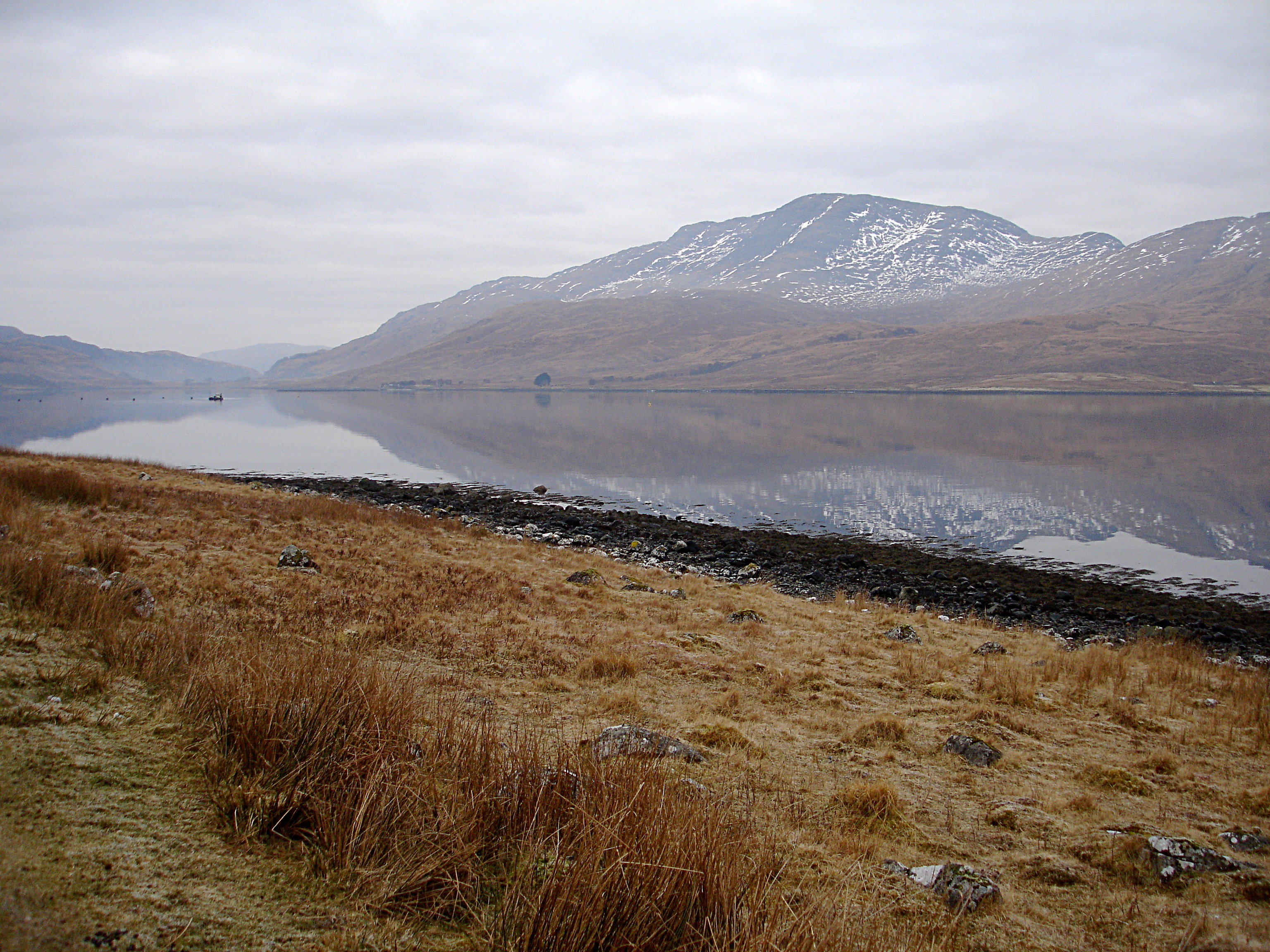
English: South shore of Loch Spelve The narrow road to Croggan runs close by the shore of Loch Spelve, which forms a sheltered place for fish farms. The way out by road to the rest of Mull lies past the head of the loch (far left) and back along the opposite shore, below the slopes of Creach-Beinn, and on to Strathcoil. |
| Date | |
| Source | From geograph.org.uk |
| Author | Andy Waddington |
| Attribution (required by the license) | Andy Waddington / South shore of Loch Spelve / |
| Camera location | | View this and other nearby images on: OpenStreetMap |
|---|
_heading:270.00&language=en)
| Object location | | View this and other nearby images on: OpenStreetMap |
|---|
_heading:270.00&language=en)
Licensing

|
This image was taken from the Geograph project collection. See this photograph's page on the Geograph website for the photographer's contact details. The copyright on this image is owned by Andy Waddington and is licensed for reuse under the Creative Commons Attribution-ShareAlike 2.0 license.
|
This file is licensed under the Creative Commons Attribution-Share Alike 2.0 Generic license.
Attribution: Andy Waddington
- You are free:
- to share – to copy, distribute and transmit the work
- to remix – to adapt the work
- Under the following conditions:
- attribution – You must give appropriate credit, provide a link to the license, and indicate if changes were made. You may do so in any reasonable manner, but not in any way that suggests the licensor endorses you or your use.
- share alike – If you remix, transform, or build upon the material, you must distribute your contributions under the same or compatible license as the original.
File history
Click on a date/time to view the file as it appeared at that time.
| Date/Time | Thumbnail | Dimensions | User | Comment | |
|---|---|---|---|---|---|
| current | 00:26, 6 March 2011 | | 3,072 × 2,304 (1.6 MB) | GeographBot | == {{int:filedesc}} == {{Information |description={{en|1=South shore of Loch Spelve The narrow road to Croggan runs close by the shore of Loch Spelve, which forms a sheltered place for fish farms. The way out by road to the rest of Mull lies past the head |
File usage
The following pages on the English Wikipedia use this file (pages on other projects are not listed):
Global file usage
The following other wikis use this file:
- Usage on ceb.wikipedia.org
- Usage on cy.wikipedia.org
- Usage on lld.wikipedia.org
- Usage on sv.wikipedia.org
- Usage on www.wikidata.org