_01_-_Bus_Loop.jpg)
_01_-_Bus_Loop.jpg&action=edit&redlink=1)

Size of this preview: 800 × 533 pixels. Other resolutions: 320 × 213 pixels | 640 × 427 pixels | 1,024 × 683 pixels | 1,280 × 853 pixels | 2,560 × 1,707 pixels | 5,472 × 3,648 pixels.
Original file (5,472 × 3,648 pixels, file size: 4.28 MB, MIME type: image/jpeg)
| This is a file from the Wikimedia Commons. Information from its description page there is shown below. Commons is a freely licensed media file repository. You can help. |
_01_-_Bus_Loop.jpg)
Summary
| Description |
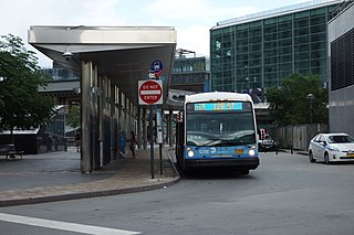
English: An East Harlem–125th Street-bound M15 SBS bus entering service at the South Ferry Bus Loop at the west end of Peter Minuit Plaza in South Ferry, at State Street / Water Street and Whitehall Street in the Financial District, Manhattan. |
| Date | Taken on 2 August 2018, 15:14:53 |
| Source | Own work |
| Author | Tdorante10 |
| Camera location | | View this and other nearby images on: OpenStreetMap |
|---|
_01_-_Bus_Loop.jpg¶ms=040.702146_N_-074.013706_E_globe:Earth_type:camera__&language=en)
Licensing
I, the copyright holder of this work, hereby publish it under the following license:
This file is licensed under the Creative Commons Attribution-Share Alike 4.0 International license.
- You are free:
- to share – to copy, distribute and transmit the work
- to remix – to adapt the work
- Under the following conditions:
- attribution – You must give appropriate credit, provide a link to the license, and indicate if changes were made. You may do so in any reasonable manner, but not in any way that suggests the licensor endorses you or your use.
- share alike – If you remix, transform, or build upon the material, you must distribute your contributions under the same or compatible license as the original.
File history
Click on a date/time to view the file as it appeared at that time.
| Date/Time | Thumbnail | Dimensions | User | Comment | |
|---|---|---|---|---|---|
| current | 16:50, 26 March 2020 | | 5,472 × 3,648 (4.28 MB) | Tdorante10 | Uploaded own work with UploadWizard |
File usage
The following pages on the English Wikipedia use this file (pages on other projects are not listed):
_01_-_Bus_Loop.jpg)