
Size of this PNG preview of this SVG file: 800 × 562 pixels. Other resolutions: 320 × 225 pixels | 640 × 449 pixels | 1,024 × 719 pixels | 1,280 × 899 pixels | 2,560 × 1,797 pixels | 990 × 695 pixels.
Original file (SVG file, nominally 990 × 695 pixels, file size: 541 KB)
| This is a file from the Wikimedia Commons. Information from its description page there is shown below. Commons is a freely licensed media file repository. You can help. |
Summary
| Description |
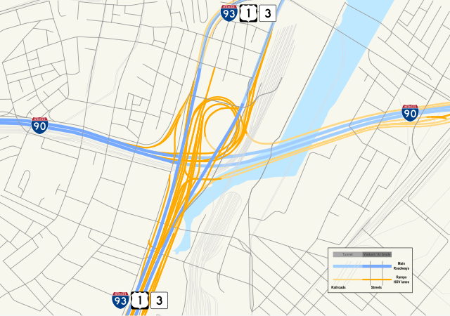
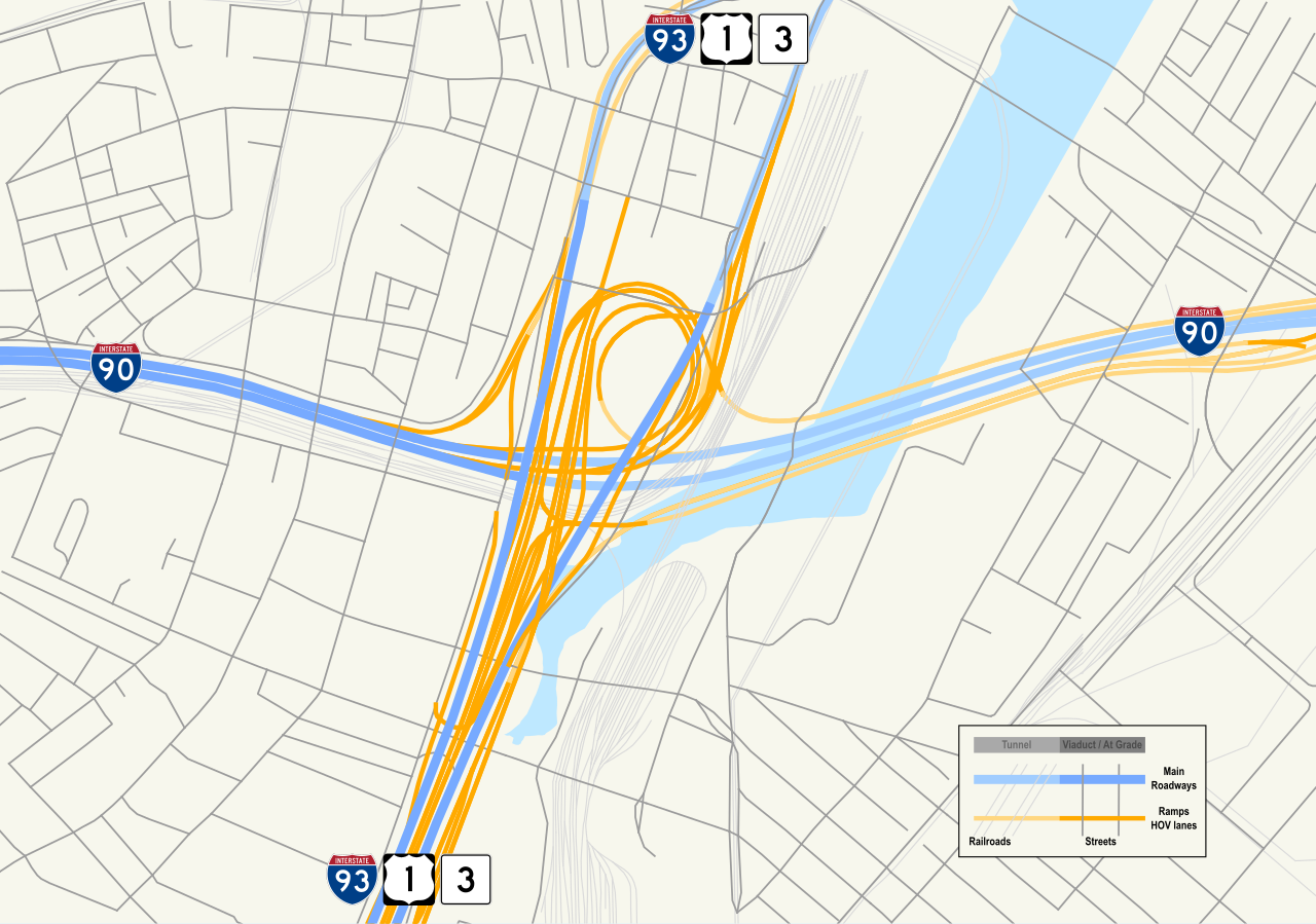
English: Map of South Bay Interchange, the junction of Interstate 90/Massachusetts Turnpike with Interstate 93/U.S. Route 1/Massachusetts Route 3, showing ramps to and from routes and local streets with tunnels and railroad locations indicated. |
| Date | |
| Source | Own work by uploader, using Quantum GIS and Inkscape based on public data from Office of Geographic and Environmental Information (MassGIS), Commonwealth of Massachusetts Executive Office of Environmental Affairs - http://www.mass.gov/mgis/dd-over.htm |
| Author | Sswonk |
| Camera location | | View this and other nearby images on: OpenStreetMap |
|---|
Licensing
| I, the copyright holder of this work, release this work into the public domain. This applies worldwide. In some countries this may not be legally possible; if so: I grant anyone the right to use this work for any purpose, without any conditions, unless such conditions are required by law. |
File history
Click on a date/time to view the file as it appeared at that time.
| Date/Time | Thumbnail | Dimensions | User | Comment | |
|---|---|---|---|---|---|
| current | 03:14, 17 May 2009 | | 990 × 695 (541 KB) | Sswonk | {{Information |Description={{en|1=Map of South Bay Interchange, the junction of Interstate 90/Massachusetts Turnpike with Interstate 93/U.S. Route 1/Massachusetts Route 3, |
File usage
The following pages on the English Wikipedia use this file (pages on other projects are not listed):