
Original file (2,502 × 3,135 pixels, file size: 1.38 MB, MIME type: image/png)
| This is a file from the Wikimedia Commons. Information from its description page there is shown below. Commons is a freely licensed media file repository. You can help. |

|
This map image could be re-created using vector graphics as an SVG file. This has several advantages; see Commons:Media for cleanup for more information. If an SVG form of this image is available, please upload it and afterwards replace this template with
{{vector version available|new image name}}.
It is recommended to name the SVG file “Serbia Map including with de facto regime.svg”—then the template Vector version available (or Vva) does not need the new image name parameter. |
| Description |
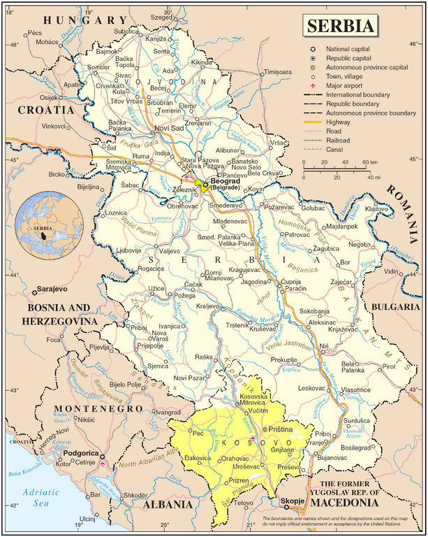
English: Map of Serbia with Kosovo included, changed, de facto regime inner Serbia |
|||
| Date | ||||
| Source | The Cartographic Section of the United Nations (CSUN) http://www.un.org/Depts/Cartographic/map/profile/serbia.pdf | |||
| Author | Cartographer of the United Nations | |||
| Permission (Reusing this file) |
|

File history
Click on a date/time to view the file as it appeared at that time.
| Date/Time | Thumbnail | Dimensions | User | Comment | |
|---|---|---|---|---|---|
| current | 13:51, 24 February 2008 | | 2,502 × 3,135 (1.38 MB) | Cp6 | {{protected|of edit-warring}} {{Information |Description=Map of Serbia with Kosovo included, changed, de facto regime inner Serbia |Source=The Cartographic Section of the United Nations (CSUN) http://www.un.org/Depts/Cartographic/map/profile/serbia.pdf |
File usage
Global file usage
The following other wikis use this file:
- Usage on ar.wikipedia.org
- Usage on bs.wikipedia.org
- Usage on ca.wikipedia.org
- Usage on ckb.wikipedia.org
- Usage on de.wikipedia.org
- Usage on es.wikipedia.org
- Usage on fa.wikipedia.org
- Usage on id.wikipedia.org
- Usage on ka.wikipedia.org
- Usage on mzn.wikipedia.org
- Usage on nl.wikipedia.org
- Usage on ro.wikipedia.org
- Usage on ru.wikipedia.org
- Usage on sr.wikinews.org
- Usage on tr.wikipedia.org
- Usage on www.wikidata.org
- Usage on zh.wikipedia.org