_Loch_Linnhe.png)
_Loch_Linnhe.png&action=edit&redlink=1)
No higher resolution available.
Scotland_Map_(Firth_of_Lorn_Detail)_Loch_Linnhe.png (250 × 158 pixels, file size: 14 KB, MIME type: image/png)
| This is a file from the Wikimedia Commons. Information from its description page there is shown below. Commons is a freely licensed media file repository. You can help. |
_Loch_Linnhe.png)
Summary
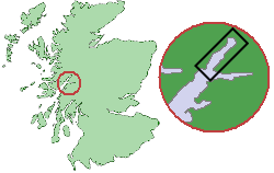
From en.wikipedia. Original comment was: " Map showing the location of Loch Linnhe within Scotland
| This work is ineligible for copyright and therefore in the public domain because it consists entirely of information that is common property and contains no original authorship. |
Original work of submitter.
Source of map outline was Image:Scotland_Map.png, template was Image:Scotland_Map_(Firth_of_Lorn_Detail).png "
.png&action=edit&redlink=1)
File history
Click on a date/time to view the file as it appeared at that time.
| Date/Time | Thumbnail | Dimensions | User | Comment | |
|---|---|---|---|---|---|
| current | 11:50, 10 September 2005 | | 250 × 158 (14 KB) | Tbc | From en.wikipedia. Original comment was: " Map showing the location of Loch Linnhe within Scotland {{PD}} Original work of submitter. Source of map outline was Image:Scotland_Map.png, template was Image:Scotland_Map_(Firth_of_Lorn_Detail).png |
.png&action=edit&redlink=1)
File usage
No pages on the English Wikipedia use this file (pages on other projects are not listed).
Global file usage
The following other wikis use this file:
- Usage on nl.wikipedia.org
- Usage on no.wikipedia.org
- Usage on sh.wikipedia.org
_Loch_Linnhe.png)