_Loch_Long.png)
_Loch_Long.png&action=edit&redlink=1)
No higher resolution available.
Scotland_Map_(Firth_of_Clyde_Detail)_Loch_Long.png (250 × 158 pixels, file size: 17 KB, MIME type: image/png)
| This is a file from the Wikimedia Commons. Information from its description page there is shown below. Commons is a freely licensed media file repository. You can help. |
_Loch_Long.png)
Summary
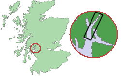
| Description |
English: Map showing the location of Loch Long within Scotland. |
| Date | |
| Source | Source of map outline was :Image:Scotland_Map.png, template was :Image:Scotland_Map_(Firth_of_Clyde_Detail).pngTransferred from en.wikipedia to Commons by Frokor using CommonsHelper. |
| Author | Topbanana at English Wikipedia |
| Other versions |
This file was derived from: |
.png)
.png)
Licensing
| This work has been released into the public domain by its author, Topbanana at English Wikipedia. This applies worldwide. In some countries this may not be legally possible; if so: Topbanana grants anyone the right to use this work for any purpose, without any conditions, unless such conditions are required by law. |
Original upload log
The original description page was here. All following user names refer to en.wikipedia.
- 2004-04-29 11:11 Topbanana 250×158× (17394 bytes) Map showing the location of Loch Long within Scotland
File history
Click on a date/time to view the file as it appeared at that time.
| Date/Time | Thumbnail | Dimensions | User | Comment | |
|---|---|---|---|---|---|
| current | 14:17, 16 January 2010 | | 250 × 158 (17 KB) | File Upload Bot (Magnus Manske) | {{BotMoveToCommons|en.wikipedia|year={{subst:CURRENTYEAR}}|month={{subst:CURRENTMONTHNAME}}|day={{subst:CURRENTDAY}}}} {{Information |Description={{en|Map showing the location of Loch Long within Scotland Original work of submitter. Source of map outl |
File usage
No pages on the English Wikipedia use this file (pages on other projects are not listed).
Global file usage
The following other wikis use this file:
- Usage on de.wikipedia.org
- Usage on eu.wikipedia.org
- Usage on ga.wikipedia.org
- Usage on ms.wikipedia.org
- Usage on nn.wikipedia.org
- Usage on www.wikidata.org
_Loch_Long.png)