
Size of this PNG preview of this SVG file: 343 × 342 pixels. Other resolutions: 241 × 240 pixels | 481 × 480 pixels | 770 × 768 pixels | 1,027 × 1,024 pixels | 2,054 × 2,048 pixels.
Original file (SVG file, nominally 343 × 342 pixels, file size: 165 KB)
| This is a file from the Wikimedia Commons. Information from its description page there is shown below. Commons is a freely licensed media file repository. You can help. |
Summary
This map was created with Adobe Illustrator,
and with Inkscape.
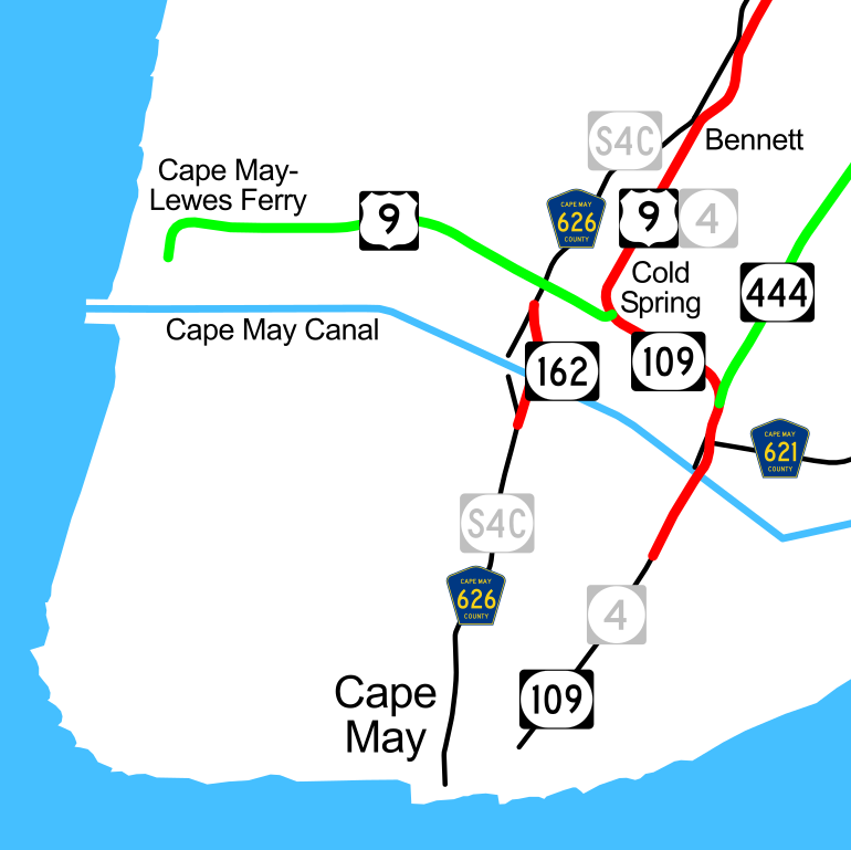
English: Map of the state routes and a few other major roads near Cape May, New Jersey.
- State-maintained roads are red; authority-maintained roads are green. Gray shields are old designations (S4C was likely never signed).
- See also NJ 162 old bridge.jpg.
| This work has been released into the public domain by its author, Ltljltlj. This applies worldwide. In some countries this may not be legally possible; if so: Ltljltlj grants anyone the right to use this work for any purpose, without any conditions, unless such conditions are required by law. |
File history
Click on a date/time to view the file as it appeared at that time.
| Date/Time | Thumbnail | Dimensions | User | Comment | |
|---|---|---|---|---|---|
| current | 04:33, 29 September 2007 | | 343 × 342 (165 KB) | Ltljltlj | |
| 04:06, 3 August 2006 |  | 343 × 342 (125 KB) | SPUI~commonswiki | Reverted to earlier revision | |
| 13:01, 27 June 2006 |  | 343 × 342 (165 KB) | Ltljltlj | ||
| 00:12, 4 December 2005 |  | 343 × 342 (125 KB) | SPUI~commonswiki | {{spuimap}} Map of the state routes and a few other major roads near Cape May, New Jersey. State-maintained roads are red; authority-maintained roads are green. Gray shields are old designations (S4C was likely never signed). Category:road maps [[Cate |
File usage
The following pages on the English Wikipedia use this file (pages on other projects are not listed):