Size of this preview: 800 × 567 pixels. Other resolutions: 320 × 227 pixels | 640 × 454 pixels | 1,024 × 726 pixels | 1,280 × 907 pixels | 2,139 × 1,516 pixels.
Original file (2,139 × 1,516 pixels, file size: 146 KB, MIME type: image/jpeg)
| This is a file from the Wikimedia Commons. Information from its description page there is shown below. Commons is a freely licensed media file repository. You can help. |
Summary
| Description |
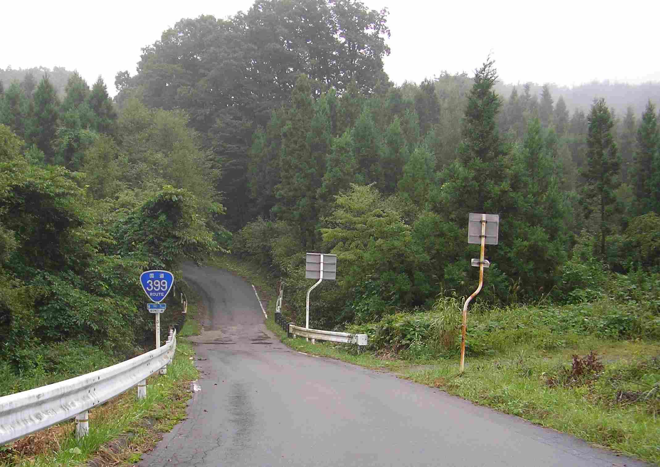
日本語: 国道399号、福島県浪江町にて。阿武隈高地を縦断するルートでは、このような狭隘路が延々と続く。道が狭いため、大型の国道標がひどく大きく見える。2007年9月 |
| Date | |
| Source |
Own work by the original uploader (Original text: 投稿者撮影) |
| Author | NEXT-EXIT at Japanese Wikipedia |
Licensing
| This file is licensed under the Creative Commons Attribution-Share Alike 3.0 Unported license. Subject to disclaimers. | ||
| ||
| This licensing tag was added to this file as part of the GFDL licensing update. |

|
Permission is granted to copy, distribute and/or modify this document under the terms of the GNU Free Documentation License, Version 1.2 or any later version published by the Free Software Foundation; with no Invariant Sections, no Front-Cover Texts, and no Back-Cover Texts. A copy of the license is included in the section entitled GNU Free Documentation License. Subject to disclaimers. |
Original upload log
| This file was moved from Japanese Wikipedia.
See below for original file information. | ||||||||||||||||||||||||
| ||||||||||||||||||||||||
|
| ||||||||||||||||||||||||
File history
Click on a date/time to view the file as it appeared at that time.
| Date/Time | Thumbnail | Dimensions | User | Comment | |
|---|---|---|---|---|---|
| current | 10:13, 8 June 2010 | | 2,139 × 1,516 (146 KB) | LERK | {{User:LERK/Information-other-user-photo |language-code=ja |language-name=Japanese |wikimedia-project=Wikipedia |des={{ja|国道399号、福島県浪江町にて。阿武隈高地を縦断するルートでは、このような狭隘� |
File usage
The following pages on the English Wikipedia use this file (pages on other projects are not listed):
Global file usage
The following other wikis use this file: