Size of this preview: 800 × 494 pixels. Other resolutions: 320 × 198 pixels | 640 × 396 pixels | 1,024 × 633 pixels | 1,280 × 791 pixels | 2,560 × 1,582 pixels | 4,000 × 2,472 pixels.
Original file (4,000 × 2,472 pixels, file size: 8.77 MB, MIME type: image/png)
| This is a file from the Wikimedia Commons. Information from its description page there is shown below. Commons is a freely licensed media file repository. You can help. |
| Description |
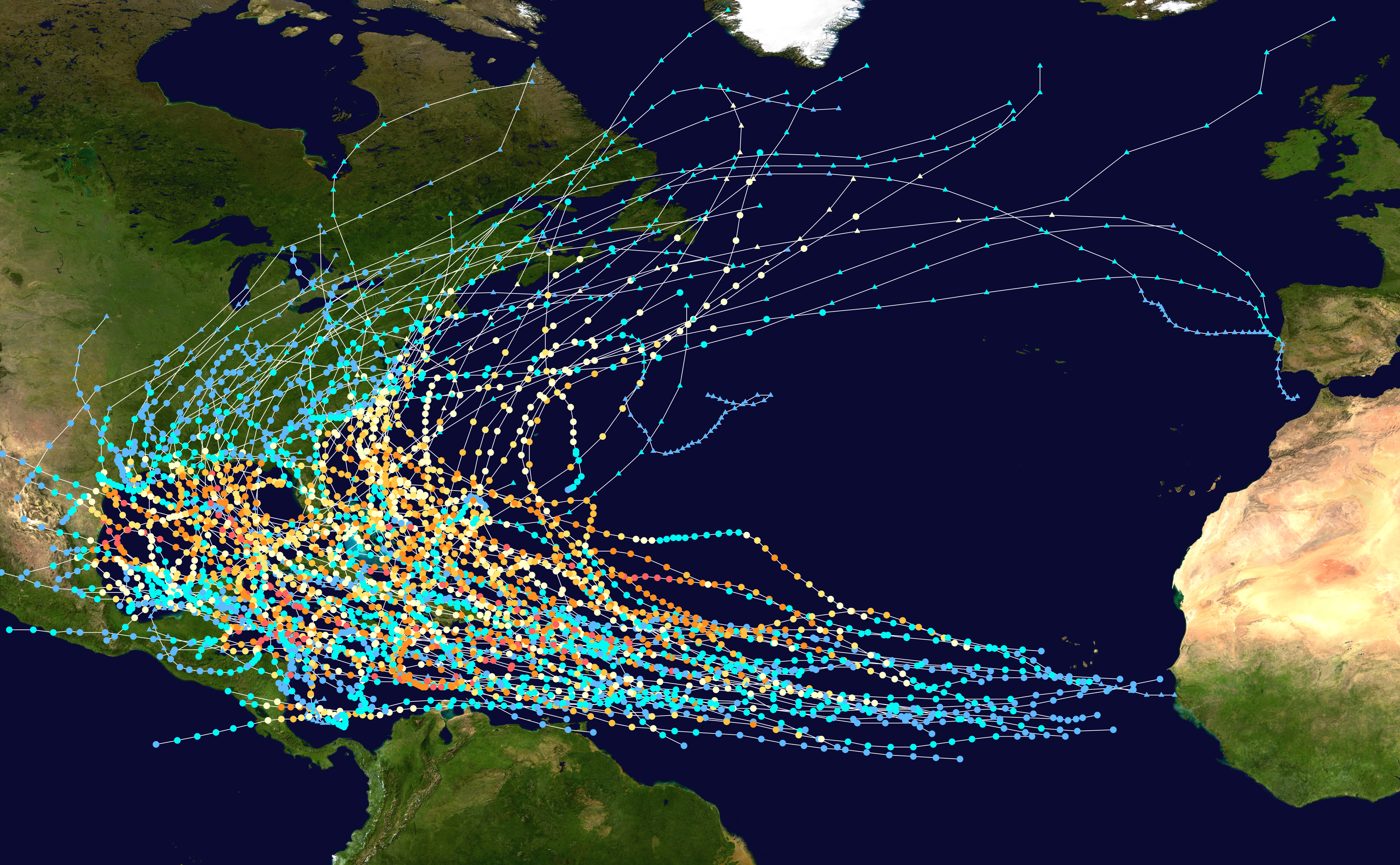
English: This map shows the tracks of all Tropical cyclones in the North Atlantic Ocean whose names were retired due to their impact. Uses the color scheme from the Saffir-Simpson Hurricane Scale. |
||
| Date | |||
| Source |
English: Created using the WPTC track map generator. Background image from Image:Whole_world_-_land_and_oceans.jpg (NASA). Tracking data from the National Hurricane Center. [1] |
||
| Author | Titoxd | ||
| Permission (Reusing this file) |
|
File history
Click on a date/time to view the file as it appeared at that time.
| Date/Time | Thumbnail | Dimensions | User | Comment | |
|---|---|---|---|---|---|
| current | 03:00, 13 October 2019 | | 4,000 × 2,472 (8.77 MB) | Cyclonebiskit | Florence, Michael |
| 02:10, 10 May 2018 |  | 4,000 × 2,472 (8.73 MB) | Cyclonebiskit | overdue update | |
| 16:58, 11 April 2013 |  | 4,000 × 2,472 (6.61 MB) | Cyclonebiskit | updated version | |
| 05:50, 7 June 2009 |  | 1,024 × 633 (760 KB) | Titoxd | {{Information |Description={{en|1=This map shows the tracks of all {{w|Tropical cyclones}} in the North Atlantic Ocean that were retired due to their impact. Uses the color scheme from the {{w|Saffir-Simpso |
File usage
The following pages on the English Wikipedia use this file (pages on other projects are not listed):
Global file usage
The following other wikis use this file:
- Usage on ast.wikipedia.org
- Usage on ca.wikipedia.org
- Usage on es.wikipedia.org
- Usage on fr.wikipedia.org
- Usage on pt.wikipedia.org
- Usage on th.wikipedia.org
- Usage on tr.wikipedia.org