Size of this preview: 737 × 600 pixels. Other resolutions: 295 × 240 pixels | 590 × 480 pixels | 944 × 768 pixels | 1,258 × 1,024 pixels | 1,918 × 1,561 pixels.
Original file (1,918 × 1,561 pixels, file size: 5.36 MB, MIME type: image/png)
| This is a file from the Wikimedia Commons. Information from its description page there is shown below. Commons is a freely licensed media file repository. You can help. |
Summary
| Description |
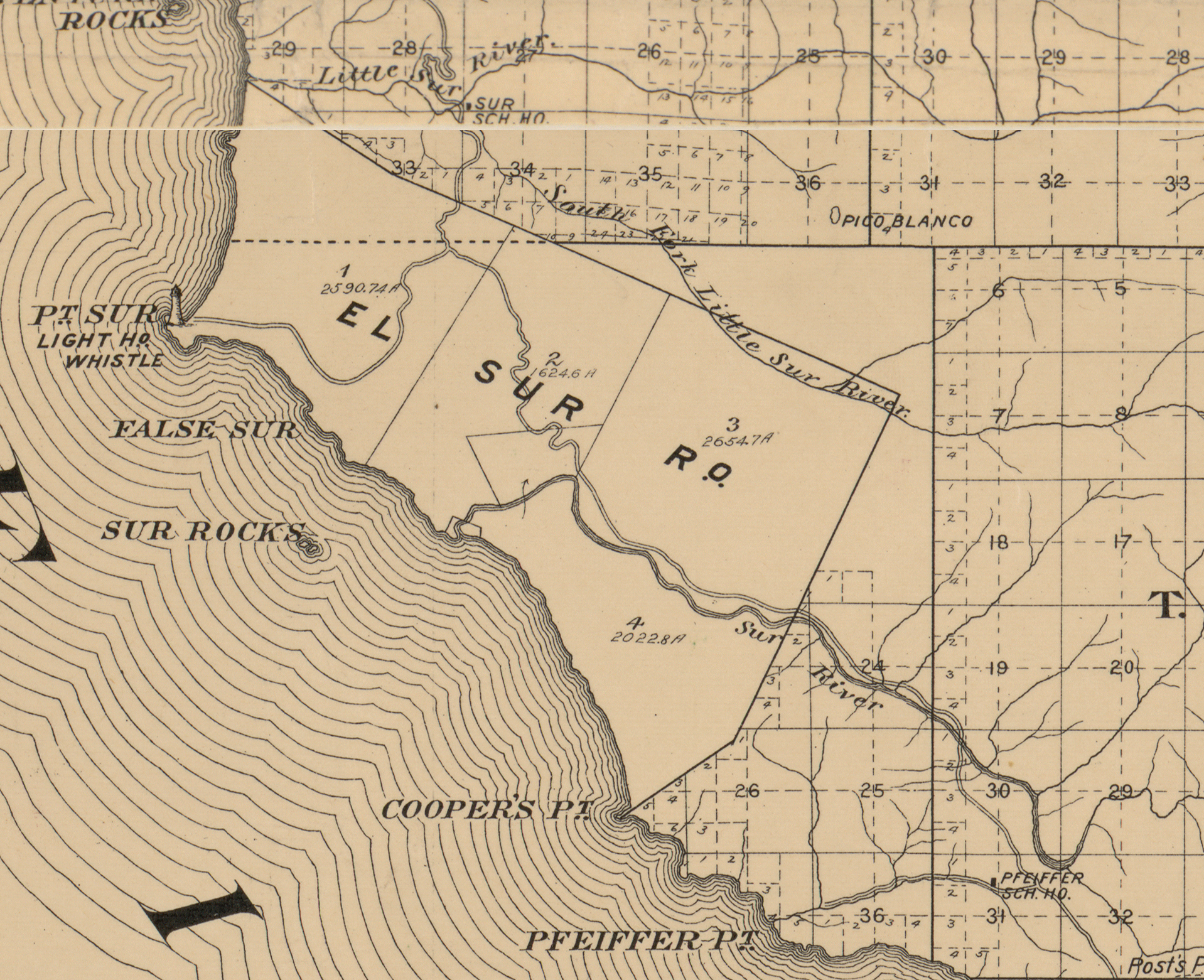
English: Excerpt from original map. Cadastral map showing drainage, ranchos, township & section lines, parcels, roads, railroads, canals, etc. LC land ownership maps, 28 "Approved and declared the official map of Monterey County, California, this 3rd day of May, 1898." LC copy rubber-stamped on lower left margin: 745B.
One map on 2 sheets : col., cloth backing ; 146 x 179 cm., sheets 77 x 186 cm. Library of Congress Geography and Map Division Washington, D.C. 20540-4650 USA dcu |
| Date | |
| Source | Official map of Monterey County, California, 1898 |
| Author | W.B. Walkup & Co. |
Licensing
This work is in the public domain in the United States because it was published (or registered with the U.S. Copyright Office) before January 1, 1929.
Public domain works must be out of copyright in both the United States and in the source country of the work in order to be hosted on the Commons. If the work is not a U.S. work, the file must have an additional copyright tag indicating the copyright status in the source country.
Note: This tag should not be used for sound recordings. |
File history
Click on a date/time to view the file as it appeared at that time.
| Date/Time | Thumbnail | Dimensions | User | Comment | |
|---|---|---|---|---|---|
| current | 16:39, 10 May 2018 | | 1,918 × 1,561 (5.36 MB) | Btphelps | User created page with UploadWizard |
File usage
The following pages on the English Wikipedia use this file (pages on other projects are not listed):