Original file (2,749 × 2,616 pixels, file size: 3.57 MB, MIME type: image/jpeg)
Summary edit
| Description |
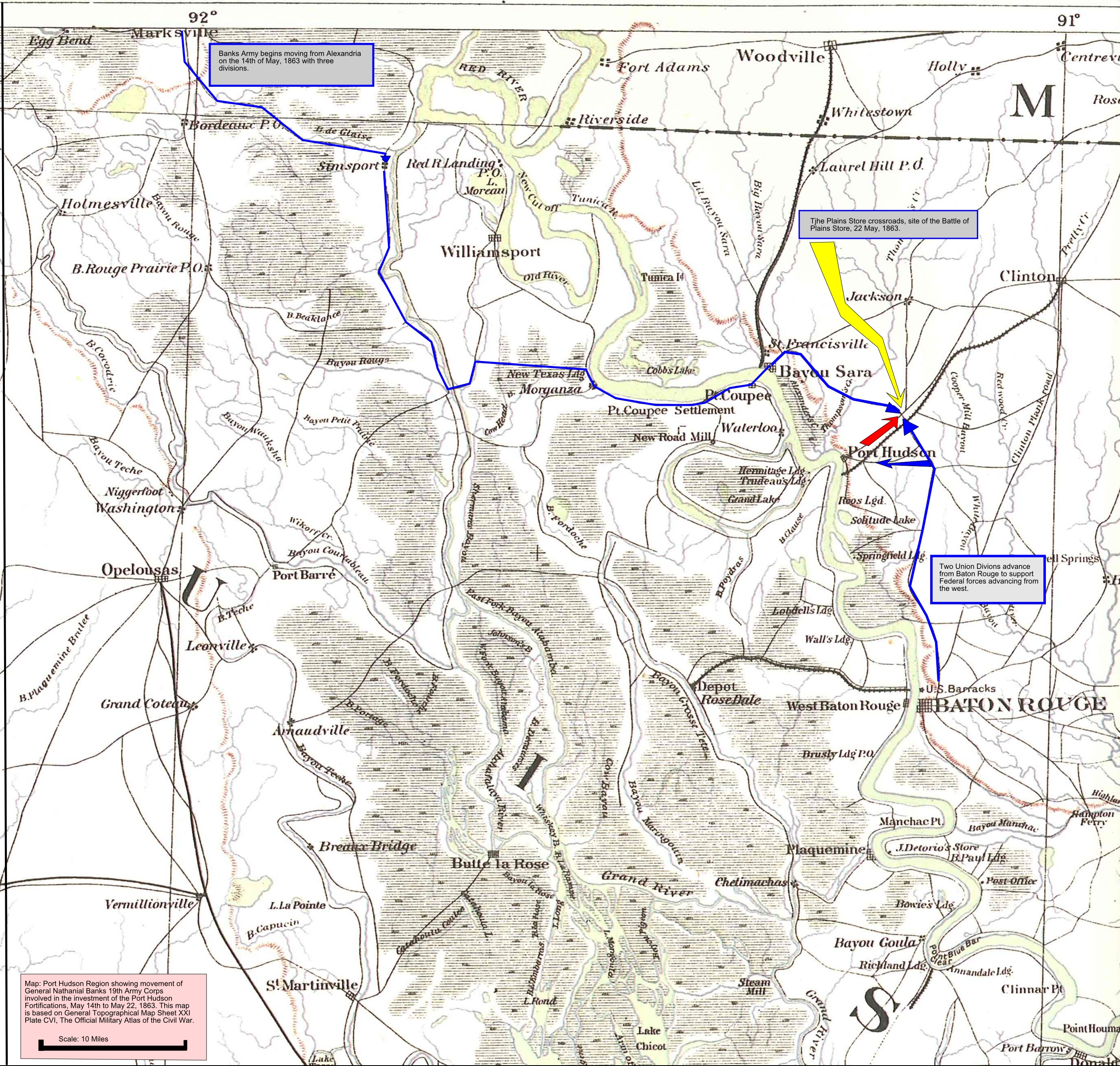
Port Hudson map showing the advance of Union forces on Confederate fortifications from 14-22 May, 1863 |
|---|---|
| Source |
Topographical Map Sheet XXI, Official Military Atlas of the Civil war, Plate CLVI, U.S. Army Military History Institute. |
| Date |
01:11, 26 February 2011 (UTC) |
| Author | |
| Permission (Reusing this file) |
U.S. Army Military History Institute, Federal Government of the United States of America
|
Licensing edit
| This image or file is a work of a U.S. Army employee, taken or made as part of that person's official duties. As a work of the U.S. federal government, the image is in the public domain in the United States. |  |
 | This file is a candidate to be copied to Wikimedia Commons.
Any user may perform this transfer; refer to Wikipedia:Moving files to Commons for details. If this file has problems with attribution, copyright, or is otherwise ineligible for Commons, then remove this tag and DO NOT transfer it; repeat violators may be blocked from editing. Other Instructions
| ||
| |||
File history
Click on a date/time to view the file as it appeared at that time.
| Date/Time | Thumbnail | Dimensions | User | Comment | |
|---|---|---|---|---|---|
| current | 01:11, 26 February 2011 | | 2,749 × 2,616 (3.57 MB) | Calendar5 (talk | contribs) | {{Information |Description = Port Hudson map showing the advance of Union forces on Confederate fortifications from 14-22 May, 1863 |Source = Topographical Map Sheet XXI, Official Military Atlas of the Civil war, Plate CLVI, U.S. Army Militar |
You cannot overwrite this file.