Size of this preview: 800 × 360 pixels. Other resolutions: 320 × 144 pixels | 640 × 288 pixels | 1,024 × 461 pixels | 1,280 × 576 pixels | 3,029 × 1,363 pixels.
Original file (3,029 × 1,363 pixels, file size: 900 KB, MIME type: image/jpeg)
| This is a file from the Wikimedia Commons. Information from its description page there is shown below. Commons is a freely licensed media file repository. You can help. |
| Description |
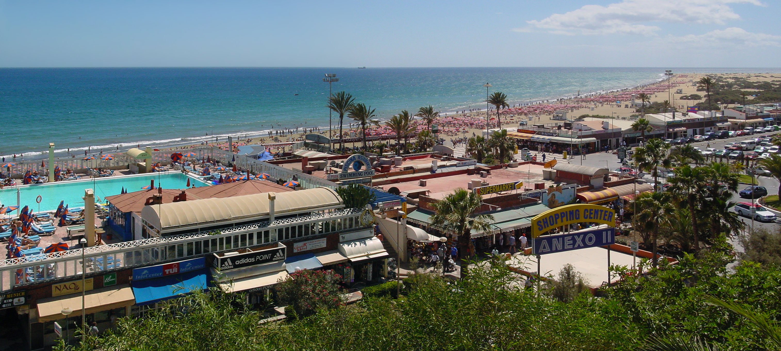
Gran Canaria, Playa del Inglés shopping centre and the beach, looking direction South.
|
||||
| Date | |||||
| Source | Own work | ||||
| Author | Wouter Hagens | ||||
| Permission (Reusing this file) |
|
File history
Click on a date/time to view the file as it appeared at that time.
| Date/Time | Thumbnail | Dimensions | User | Comment | |
|---|---|---|---|---|---|
| current | 11:36, 25 February 2007 | | 3,029 × 1,363 (900 KB) | Wouterhagens | {{Information |Description=Gran Canaria, Playa des Ingles shopping centre and the beach. Latitude 27°45'23.54"N, longitude 15°34'4.70"W looking direction south |Source=own work |Date=2002-03-16 |Author=Wouter Hagens |Permission={{P |
File usage
The following pages on the English Wikipedia use this file (pages on other projects are not listed):
Global file usage
The following other wikis use this file:
- Usage on arz.wikipedia.org
- Usage on az.wikipedia.org
- Usage on ceb.wikipedia.org
- Usage on cy.wikipedia.org
- Usage on de.wikivoyage.org
- Usage on eu.wikipedia.org
- Usage on fi.wikipedia.org
- Usage on fr.wikipedia.org
- Usage on fr.wikivoyage.org
- Usage on gl.wikipedia.org
- Usage on nl.wikipedia.org
- Usage on no.wikipedia.org
- Usage on pl.wikipedia.org
- Usage on pt.wikipedia.org
- Usage on ru.wikipedia.org
- Usage on sr.wikipedia.org
- Usage on sv.wikipedia.org
- Usage on www.wikidata.org